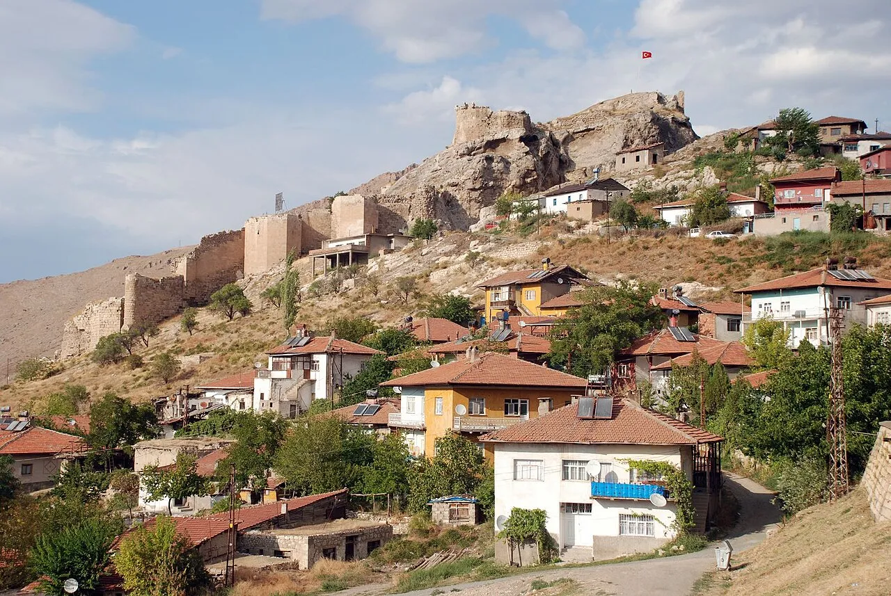
- Population
- 13,139
- 13.1K
- Elevation
- 1,039 m
- above sea level
- Local time
- UTC+03:00
- Europe/Istanbul · UTC+03:00
- Airports
- MLX Malatya Erhaç Airport104 km
- VAS Sivas Nuri Demirağ Airport115 km
About Divriği
Divriği is a city. Location: Divriği İlçesi, Sivas Province. Population: 13,139. Elevation: 1,039 m. The best months to visit are May–June, October. The nearest airport is Malatya Erhaç Airport (104 km). Nearby sights include Kızıldağ Tepesi and Fazlıoğlu Deresi.
Photos of Divriği
-

Engin Mutlu 58 · CC BY-SA 4.0 -

Engin Mutlu 58 · CC BY-SA 4.0 -

Panegyrics of Granovetter · CC BY-SA 2.0 -

Arif miletli · CC BY-SA 4.0 -

5544tk. at Turkish Wikipedia · CC BY-SA 3.0


Travel notes for Divriği
From Wikivoyage
Divriği is an iron-mining town in the mountainous northeast of Central Anatolia. In 2022 its population was 10,623 and stable, while the countryside around has become depopulated. The reason to visit is the Great Mosque and the adjoining medieval hospital (Darüşşifa), a UNESCO World Heritage Site for their superb carvings and architecture.
Understand+
The town is first documented in the Hittite era of 1500 BC, when it was called Apbrike; later the Byzantines called it Tephrike. From 843 AD it was settled by the Paulicians, an Armenian Christian sect. Almost nothing is known of their beliefs and practices, but they called themselves "Good Christians" implying that others weren't, a sure way to irk your neighbours. They were tolerated or persecuted by turns in other Byzantine territories, but in 843 Empress Theodora set about them in earnest. The survivors fled here, Tephrike, and for a time enjoyed a semi-autonomous realm protected by the Emir of Malatya. But they counter-attacked the Byzantines, so around 870 Basil I crushed them and made Tephrike a Byzantine possession. Thus it remained until the Byzantine defeat in 1071 at Manzikert by the Seljuk Turks, who called the town Divrik. Meanwhile the escaping Paulicians disappeared into Armenia to become the Tondrakians, with a credo somewhere between Karl Marx and Rasputin.
From the late 11th century Anatolia was a war zone between the Byzantines, Seljuks and Crusaders. However Divrik up in the mountains was not on any major route and lacked strategic value, so it was left in peace. From 1072 to 1277 it was the seat of the Mengücek, a Turkish principality under the Seljuks of Rum. In 1229 the Mengücek ruler called on the architect Hürrem Şah to build the Great Mosque - Şah had made his reputation at Ahlat near Tatvan with his fine stonework, and once again obliged.
Get in+
By air:
The nearest airport is in Sivas, 180 km or 3 hours away by road. Given its limited flights, you might prefer to fly to Ankara.
By bus:
A bus runs nightly from Istanbul (16 hr) via Ankara (8 hr) and Sivas to Divriği, arriving around 08:00 and returning west at 10:30. In 2022 the fare is 600 TL from Istanbul and 400 TL from Ankara. The bus company is Divriği Nazar Turizm - Metroturizm and Flixbus don't run here.
Divriği Özlem Turizm and Divriği Birlik run dolmuş services from Sivas otogar. There's no fixed timetable, they start whenever they have enough passengers. They also ferry customers of the Tourist Doğu Express around the sights.
By train:
Doğu Express leaves Ankara daily towards 18:00 and runs overnight via Kayseri and Sivas to Divriği, arriving towards 08:00. It continues east to Erzincan for 10:30 and Erzurum for 14:30 to reach Kars at 18:30. The eastbound train leaves Kars at 08:00, reaching Erzurum at 12:00, Erzincan at 16:00, Divriği at 18:30, Sivas at 22:00, Kayseri towards 02:00 and Ankara at 08.30. There are couchettes and a buffet.
A more expensive "tourist" version of this train runs in winter. It makes long stops for sightseeing eastbound at İliç (for Kemaliye), Erzincan and Erzurum; the westbound train makes long stops at Divriği and Bostankaya (for Sivas). Total travel time Ankara-Kars is 30 hours, and you're tied to the train schedule without flexibility of stopover. The accommodation is in standard sleeping cars, which have been purloined from the conventional train, so the travel experience on those has been degraded.
Regional trains run twice a day from Sivas and from Erzincan, both taking three hours to reach Divriği. So you could have six hours to explore here between those towns.
1 Divriği railway station is 500 m north of town along the main road. Water, snacks, tea and loos but no other facilities.
By car:
Source: Wikivoyage · CC BY-SA 4.0 · abridged
Climate of Divriği
Best months for sightseeingBest months for sightseeing: May–June, October.
This month · November
Outside the best season
Day 13° · Night 4° · Rain 53 mm
Better nearby cities in November
- Suruç · 268 km south20°
- Viranşehir · 278 km southeast18°
- Osmaniye · 303 km southwest21°
- Hottest month
- July (day 32°)
- Coldest month
- January (night -4°)
- Wettest month
- April (67 mm)
- Driest month
- August (6 mm)
Bars: average monthly low and high temperature. Below: precipitation. Monthly averages for 1970–2000 at about 18 km resolution, adjusted for elevation. Highlighted months are mild and relatively dry. Source: WorldClim 2.1 (CC BY 4.0).
Show values as a table
| Month | Jan | Feb | Mar | Apr | May | Jun | Jul | Aug | Sep | Oct | Nov | Dec |
|---|---|---|---|---|---|---|---|---|---|---|---|---|
| Average high (°C) | 3° | 5° | 11° | 18° | 23° | 28° | 32° | 32° | 28° | 21° | 13° | 6° |
| Average low (°C) | -4° | -2° | 2° | 7° | 11° | 14° | 18° | 17° | 14° | 9° | 4° | 0° |
| Precipitation (mm) | 54 | 47 | 57 | 67 | 63 | 32 | 7 | 6 | 12 | 41 | 53 | 61 |
How to get to Divriği
The nearest airport is Malatya Erhaç Airport (MLX), 104 km to the south as the crow flies. The nearest large city is Sivas, 103 km to the northwest.
Airports
- Malatya Erhaç Airport (MLX) Malatya 104 kmsouth
- Sivas Nuri Demirağ Airport (VAS) Sivas 115 kmnorthwest
- Erzincan Airport (ERC) Erzincan 127 kmeast
Nearby large cities
- Sivas Population: 264K 103 kmnorthwest
- Malatya Population: 750.5K 115 kmsouth
- Elâzığ Population: 443.4K 123 kmsoutheast
- Erzincan Population: 150.7K 125 kmeast
- Tokat Province Population: 129.7K 170 kmnorthwest
Straight-line distances; road distances are longer. Airport data: OurAirports.
Day trips from Divriği
Within 100 km: 4 historic and cultural sites, 202 natural sites, 268 lakes, rivers and coasts.
0–25 km34 places
- Ziyaret Tepesi Mountain 23 kmW
- Sivri Tepe Mountain 25 kmS
- Ulu Tepe Mountain 21 kmSW
- Göl Dağı Mountain 10 kmNE
25–60 km133 places
- Palat Gölü Lake 48 kmE
- Zorbehan Dağı Mountain 58 kmS
- Ziyarettepeleri | Çobanevliyası Mountain 49 kmN
- Büyük Yılanlı Dağı Mountain 55 kmW
60–100 km307 places
- Kuru Göl Lake 65 kmNW
- Tötürge Gölü Lake 72 kmNW
- Büyük Göl Lake 84 kmNW
- Kara Kaya Barajı Lake 98 kmS
Straight-line distances.
Nearby attractions & nature
Everything nearby-
Kızıldağ Tepesi Mountain, Divriği İlçesi7.4 km S
-
Fazlıoğlu Deresi River, Sivas Province5.6 km SE
-
Nih Çayı River, Sivas Province5.6 km SE
-
Dumluca Dağı Mountain, Divriği İlçesi8.5 km W
-
Efendi Deresi River, Sivas Province5.9 km N
-
Dumluca Deresi River, Sivas Province6.6 km SW
-
Göl Dağı Mountain, Divriği İlçesi10 km NE
-
Deliktaş Deresi River, Sivas Province7.7 km E
Sources & licences
Data last updated: