- Elevation
- 1,045 m
- above sea level
- Local time
- UTC+03:00
- Europe/Istanbul · UTC+03:00
- Airports
- VAS Sivas Nuri Demirağ Airport110 km
- MLX Malatya Erhaç Airport112 km
About Eskibeyli Deresi
Eskibeyli Deresi is a river. Location: Sivas Province, Turkey. The best months to visit are May–June, October. The nearest airport is Sivas Nuri Demirağ Airport (110 km). Nearby sights include Efendi Deresi and Akdağ.
Climate of Eskibeyli Deresi
Best months for sightseeingBest months for sightseeing: May–June, October.
This month · November
Outside the best season
Day 13° · Night 4° · Rain 53 mm
Better nearby cities in November
- Suruç · 276 km south20°
- Viranşehir · 287 km southeast18°
- Osmaniye · 309 km southwest21°
- Hottest month
- July (day 32°)
- Coldest month
- January (night -4°)
- Wettest month
- April (67 mm)
- Driest month
- August (6 mm)
Bars: average monthly low and high temperature. Below: precipitation. Monthly averages for 1970–2000 at about 18 km resolution, adjusted for elevation. Highlighted months are mild and relatively dry. Source: WorldClim 2.1 (CC BY 4.0).
Show values as a table
| Month | Jan | Feb | Mar | Apr | May | Jun | Jul | Aug | Sep | Oct | Nov | Dec |
|---|---|---|---|---|---|---|---|---|---|---|---|---|
| Average high (°C) | 3° | 5° | 11° | 18° | 23° | 28° | 32° | 32° | 28° | 21° | 13° | 6° |
| Average low (°C) | -4° | -2° | 2° | 7° | 11° | 14° | 18° | 17° | 14° | 9° | 4° | 0° |
| Precipitation (mm) | 54 | 47 | 57 | 67 | 63 | 32 | 7 | 6 | 12 | 41 | 53 | 61 |
How to get to Eskibeyli Deresi
The nearest airport is Sivas Nuri Demirağ Airport (VAS), 110 km to the west as the crow flies. The nearest large city is Sivas, 98 km to the west.
Airports
- Sivas Nuri Demirağ Airport (VAS) Sivas 110 kmwest
- Malatya Erhaç Airport (MLX) Malatya 112 kmsouth
- Erzincan Airport (ERC) Erzincan 127 kmeast
Nearby large cities
- Sivas Population: 264K 98 kmwest
- Malatya Population: 750.5K 123 kmsouth
- Erzincan Population: 150.7K 125 kmeast
- Elâzığ Population: 443.4K 130 kmsoutheast
- Tokat Province Population: 129.7K 163 kmnorthwest
Straight-line distances; road distances are longer. Airport data: OurAirports.
Day trips from Eskibeyli Deresi
Within 100 km: 10 historic and cultural sites, 202 natural sites, 262 lakes, rivers and coasts.
0–25 km29 places
- Ziyaret Tepesi Mountain 23 kmSW
- Piliç Dağı Mountain 24 kmE
- Göl Dağı Mountain 10 kmE
- Kızıldağ Tepesi Mountain 16 kmS
25–60 km142 places
- Kuru Göl Lake 58 kmNW
- Palat Gölü Lake 47 kmE
- Ziyarettepeleri | Çobanevliyası Mountain 40 kmN
- Büyük Yılanlı Dağı Mountain 52 kmW
60–100 km303 places
- Tötürge Gölü Lake 64 kmNW
- Büyük Göl Lake 77 kmNW
- Aşağıtepecik Gölü Lake 78 kmNE
- Kılıçkaya Barajı Lake 81 kmN
Straight-line distances.
Nearest towns and villages
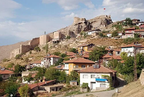
Nearby attractions & nature
Everything nearby-
Efendi Deresi River, Sivas Province3 km SE
-
Akdağ Mountain, Divriği İlçesi7.7 km NE
-
Dumluca Dağı Mountain, Divriği İlçesi9.5 km SW
-
Göl Dağı Mountain, Divriği İlçesi9.7 km E
-
Hanın Pınarı Natural site, Sivas Province12 km SW
-
Nih Çayı River, Sivas Province13 km SE
-
Kavak Deresi River, Sivas Province13 km W
-
Fazlıoğlu Deresi River, Sivas Province13 km SE
Sources & licences
Data last updated: