Çiçekli Bucağı
Located in Tunceli Province, Turkey Coordinates: 39°03′37″ N 39°25′39″ E
- Elevation
- 1,126 m
- above sea level
- Local time
- UTC+03:00
- Europe/Istanbul · UTC+03:00
- Airports
- EZS Elazığ Airport53 km
- ERC Erzincan Airport73 km
About Çiçekli Bucağı
Çiçekli Bucağı is a municipality. Location: Tunceli Province, Turkey. Elevation: 1,126 m. The best months to visit are May, October. The nearest airport is Elazığ Airport (53 km). Nearby sights include Daloli Tepe and Dalalı Tepesi.
Climate of Çiçekli Bucağı
Best months for sightseeingBest months for sightseeing: May, October.
This month · November
Outside the best season
Day 12° · Night 3° · Rain 99 mm
Better nearby cities in November
- Viranşehir · 206 km south18°
- Kızıltepe · 231 km southeast19°
- Suruç · 248 km south20°
- Hottest month
- July (day 34°)
- Coldest month
- January (night -5°)
- Wettest month
- December (119 mm)
- Driest month
- August (4 mm)
Bars: average monthly low and high temperature. Below: precipitation. Monthly averages for 1970–2000 at about 18 km resolution, adjusted for elevation. Highlighted months are mild and relatively dry. Source: WorldClim 2.1 (CC BY 4.0).
Show values as a table
| Month | Jan | Feb | Mar | Apr | May | Jun | Jul | Aug | Sep | Oct | Nov | Dec |
|---|---|---|---|---|---|---|---|---|---|---|---|---|
| Average high (°C) | 2° | 4° | 10° | 17° | 23° | 29° | 34° | 34° | 29° | 21° | 12° | 5° |
| Average low (°C) | -5° | -4° | 1° | 7° | 11° | 15° | 19° | 19° | 15° | 9° | 3° | -2° |
| Precipitation (mm) | 99 | 89 | 94 | 106 | 81 | 25 | 6 | 4 | 11 | 64 | 99 | 119 |
How to get to Çiçekli Bucağı
The nearest airport is Elazığ Airport (EZS), 53 km to the south as the crow flies. The nearest large city is Elâzığ, 46 km to the south.
Airports
- Elazığ Airport (EZS) Elazığ 53 kmsouth
- Erzincan Airport (ERC) Erzincan 73 kmnorth
- Bingöl Airport (BGG) Bingöl 104 kmeast
Nearby large cities
- Elâzığ Population: 443.4K 46 kmsouth
- Erzincan Population: 150.7K 76 kmnorth
- Bingoel Population: 128.9K 94 kmeast
- Malatya Population: 750.5K 125 kmsouthwest
- Diyarbakır Population: 1.8M 145 kmsoutheast
Straight-line distances; road distances are longer. Airport data: OurAirports.
Day trips from Çiçekli Bucağı
Within 100 km: 9 historic and cultural sites, 264 natural sites, 295 lakes, rivers and coasts.
0–25 km36 places
- Sincik Tepe Mountain 21 kmNW
- Sakaltutan Dağı Mountain 16 kmS
- Kölerik Tepesi Mountain 21 kmE
- Kırmızı Dağ Mountain 17 kmNE
25–60 km159 places
- Keban Barajı Gölü Lake 46 kmS
- Koç Gölü Lake 48 kmN
- Ziri Dağı Mountain 28 kmSE
- Yılan Dağı Mountain 49 kmNW
60–100 km373 places
- Lake Hazar Lake 63 kmS
- Dipni Barajı Lake 98 kmSE
- Özlüce Barajı Lake 66 kmE
- Cayit Barajı Lake 78 kmE
Straight-line distances.
Nearby attractions & nature
Everything nearby-
Daloli Tepe Mountain, Tunceli3.9 km N
-
Dalalı Tepesi Mountain, Tunceli4.9 km N
-
Kalvosan Deresi River, Tunceli Province9.2 km E
-
Topatan Tepe Mountain, Hozat İlçesi9.9 km W
-
Kızıl Dağ Mountain, Hozat İlçesi9.9 km W
-
Kırmızıdağ Tepesi Mountain, Hozat İlçesi10 km W
-
Büyük Dere River, Tunceli Province11 km N
-
Munzur Çayı River, Tunceli Province12 km NE
Other cities and towns in Tunceli Province
-
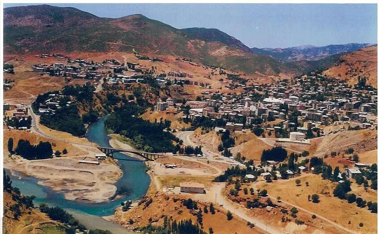 Tunceli City, Tunceli11 km NE
-
Mazgirt City, Mazgirt İlçesi16 km E
-
Dere Bucağı Municipality, Tunceli Province13 km SW
-
Mazgirt Bucağı Municipality, Tunceli Province16 km E
-
Hozat City, Hozat İlçesi20 km W
-
Sütlüce Bucağı Municipality, Tunceli Province16 km NE
Sources & licences
Data last updated: