- Elevation
- 2,883 m
- above sea level
- Local time
- UTC+01:00
- Europe/Madrid · UTC+01:00
- Airports
- LDE Tarbes-Lourdes-Pyrénées Airport64 km
- PUF Pau Pyrénées Airport74 km
About Peak of Collarada
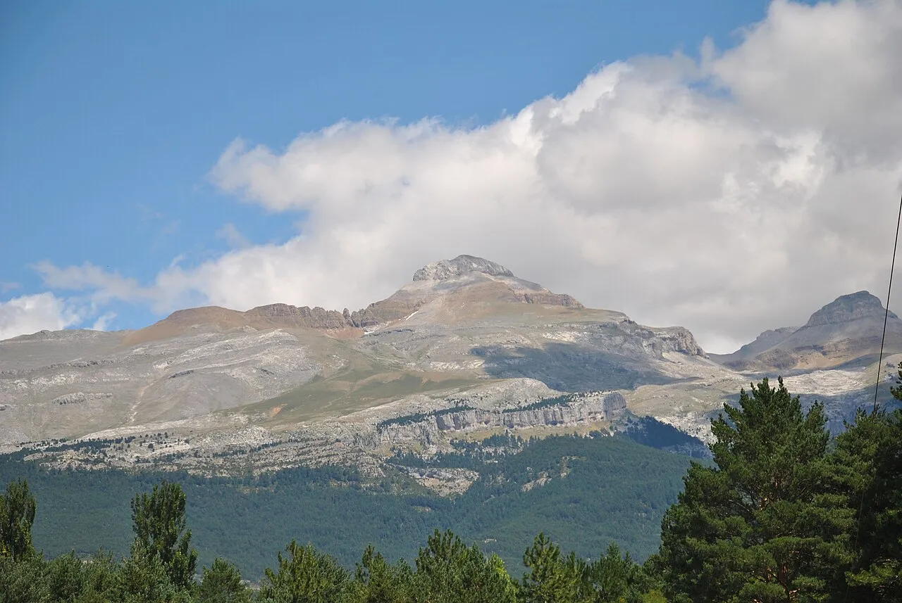
Peak of Collarada is a mountain. Location: Canfranc, Huesca. Elevation: 2,883 m.
Collarada peak is a mountain in the western Pyrenees of Huesca, situated on the northeastern Aragon near the towns of Villanúa (to the south) and Canfranc (to the west). The peak is 2,886 meters AMSL high, being the highest summit in the Jacetania comarca of Aragon. A great view of this mountain can be obtained from Larres, a village that gained life again after its castle dated 14th century got restored by the "Amigos del Serrablo".
Source: Wikipedia · CC BY-SA 4.0
At a glance
- Topographic prominence
- 800 m
Source: Wikidata
Photos of Peak of Collarada
-

Juan Emilio Prades Bel · CC BY 4.0 -

Footprint420 · CC BY-SA 4.0 -

Frabrupe · CC BY-SA 3.0 -

Frabrupe · CC BY-SA 3.0


Climate of Peak of Collarada
Best months for sightseeingBest months for sightseeing: July.
This month · November
A wet month
Day -1° · Night -9° · Rain 128 mm
- Hottest month
- August (day 15°)
- Coldest month
- January (night -13°)
- Wettest month
- May (132 mm)
- Driest month
- July (65 mm)
Bars: average monthly low and high temperature. Below: precipitation. Monthly averages for 1970–2000 at about 18 km resolution, adjusted for elevation. Highlighted months are mild and relatively dry. Source: WorldClim 2.1 (CC BY 4.0).
Show values as a table
| Month | Jan | Feb | Mar | Apr | May | Jun | Jul | Aug | Sep | Oct | Nov | Dec |
|---|---|---|---|---|---|---|---|---|---|---|---|---|
| Average high (°C) | -6° | -5° | -2° | 0° | 5° | 10° | 15° | 15° | 11° | 4° | -1° | -5° |
| Average low (°C) | -13° | -12° | -11° | -9° | -6° | -2° | 1° | 1° | -2° | -5° | -9° | -11° |
| Precipitation (mm) | 115 | 104 | 90 | 109 | 132 | 102 | 65 | 74 | 85 | 115 | 128 | 124 |
Other places to visit in this season: July
How to get to Peak of Collarada
The nearest airport is Tarbes-Lourdes-Pyrénées Airport (LDE), 64 km to the northeast as the crow flies. The nearest large city is Pamplona, 97 km to the west.
Airports
- Tarbes-Lourdes-Pyrénées Airport (LDE) Tarbes/Lourdes/Pyrénées 64 kmnortheast
- Pau Pyrénées Airport (PUF) Pau/Pyrénées (Uzein) 74 kmnorth
- Pamplona Airport (PNA) Pamplona 96 kmwest
Nearby large cities
- Pamplona Population: 208.2K 97 kmwest
- Zaragoza Population: 687K 122 kmsouth
- Donostia / San Sebastian Population: 185.4K 140 kmnorthwest
- Lleida Population: 140.8K 152 kmsoutheast
- Logroño Population: 151.2K 165 kmwest
Straight-line distances; road distances are longer. Airport data: OurAirports.
Day trips from Peak of Collarada
Within 100 km: 119 historic and cultural sites, 1,357 natural sites, 224 lakes, rivers and coasts.
0–25 km229 places
- Ibón de Tramacastilla Lake 9 kmE
- Ibón Superior de Brazato Lake 22 kmE
- Ibón Superior de Bramatuero Lake 24 kmE
- Ibón de Samán Lake 4 kmN
25–60 km742 places
- Fourmat Mountain 35 kmN
- Pantano de Yesa Lake 57 kmW
- Pantano de la Peña Lake 42 kmSW
- Pantano de la Nava Lake 50 kmS
60–100 km729 places
- Valle de Baztan Natural site 97 kmNW
- Yamaguchi Natural site 98 kmW
- Aubin River 94 kmN
- Lago de Urdiceto Lake 62 kmE
Straight-line distances.
Nearest towns and villages
-
Canfranc Village, Canfranc4.5 km W
-
Villanúa Municipality, Huesca4.5 km SW
-
Camino de Cabañeras Village, Canfranc4.6 km W
-
Villanúa Village, Villanúa6.7 km SW
-
Los Arañones Village, Canfranc5.5 km NW
-
Aisa Municipality, Huesca9.8 km W
Nearby attractions & nature
Everything nearby-
Colladareta Mountain, Canfranc1.3 km SE
-
Ibón de Ip Lake, Canfranc1.3 km NE
-
Peña Nevera Mountain, Canfranc1.8 km E
-
Punta de los Cuchillares Mountain, Sabiñánigo2 km E
-
Pico Bucuesa Mountain, Canfranc2.4 km E
-
Punta de la Tronquera Mountain, Canfranc2.4 km N
-
Pico Somola Alta Mountain, Villanúa2.6 km SE
-
Punta del Águila Mountain, Canfranc2.6 km E
Sources & licences
Data last updated: · 2 independent sources