- Elevation
- 750 m
- above sea level
- Local time
- UTC+01:00
- Europe/Madrid · UTC+01:00
- Airports
- PNA Pamplona Airport80 km
- ZAZ Zaragoza Airport81 km
About San Felices
San Felices is a village. Location: Biel Municipality, Saragossa. Elevation: 750 m. The best months to visit are June, September. The nearest airport is Pamplona Airport (80 km). Nearby sights include Punta Común and Punta de Barrio Estrecho.
Climate of San Felices
Best months for sightseeingBest months for sightseeing: June, September.
This month · November
Outside the best season
Day 12° · Night 5° · Rain 65 mm
- Hottest month
- July (day 28°)
- Coldest month
- January (night 1°)
- Wettest month
- May (70 mm)
- Driest month
- July (31 mm)
Bars: average monthly low and high temperature. Below: precipitation. Monthly averages for 1970–2000 at about 18 km resolution, adjusted for elevation. Highlighted months are mild and relatively dry. Source: WorldClim 2.1 (CC BY 4.0).
Show values as a table
| Month | Jan | Feb | Mar | Apr | May | Jun | Jul | Aug | Sep | Oct | Nov | Dec |
|---|---|---|---|---|---|---|---|---|---|---|---|---|
| Average high (°C) | 8° | 10° | 13° | 15° | 19° | 24° | 28° | 28° | 24° | 17° | 12° | 9° |
| Average low (°C) | 1° | 2° | 3° | 5° | 8° | 12° | 15° | 15° | 12° | 9° | 5° | 2° |
| Precipitation (mm) | 57 | 51 | 43 | 61 | 70 | 54 | 31 | 41 | 47 | 66 | 65 | 61 |
How to get to San Felices
The nearest airport is Pamplona Airport (PNA), 80 km to the northwest as the crow flies. For international flights: Zaragoza Airport (ZAZ) (81 km). The nearest large city is Zaragoza, 80 km to the south.
Airports
- Pamplona Airport (PNA) Pamplona 80 kmnorthwest
- Zaragoza Airport (ZAZ) Zaragoza 81 kmsouth
- Tarbes-Lourdes-Pyrénées Airport (LDE) Tarbes/Lourdes/Pyrénées 112 kmnortheast
Nearby large cities
- Zaragoza Population: 687K 80 kmsouth
- Pamplona Population: 208.2K 83 kmnorthwest
- Logroño Population: 151.2K 134 kmwest
- Donostia / San Sebastian Population: 185.4K 140 kmnorthwest
- Lleida Population: 140.8K 146 kmsoutheast
Straight-line distances; road distances are longer. Airport data: OurAirports.
Day trips from San Felices
Within 100 km: 198 historic and cultural sites, 986 natural sites, 185 lakes, rivers and coasts.
0–25 km54 places
- Pantano de la Peña Lake 9 kmE
- Pantano de la Nava Lake 18 kmSE
- Pantano de Ardisa Lake 22 kmS
- Santo Tomás Mountain 13 kmN
25–60 km310 places
- Pantano de Yesa Lake 37 kmNW
- Ibón de Tramacastilla Lake 54 kmNE
- Embalse de la Sotonera Lake 31 kmSE
- Ibón de Samán Lake 50 kmNE
60–100 km1,005 places
- Fourmat Mountain 81 kmNE
- Yamaguchi Natural site 84 kmNW
- Lago de Urdiceto Lake 96 kmE
- Ibón Superior de Brazato Lake 66 kmNE
Straight-line distances.
Nearby attractions & nature
Everything nearby-
Punta Común Mountain, Murillo de Gállego Municipality4.4 km E
-
Punta de Barrio Estrecho Mountain, Longás Municipality5 km NW
-
Peña Rueba Mountain, Murillo de Gállego Municipality5.5 km E
-
Barranco del Arlo River, Biel Municipality6.8 km N
-
Punta del Baste Mountain, Peñas de Riglos, Las9.1 km NE
-
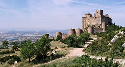 Loarre Castle Historic site, Loarre18 km E
Sources & licences
Data last updated: