Escó
Located in Nigüella Municipality, Saragossa Coordinates: 42°37′07″ N 1°03′26″ W
- Population
- 3
- 3
- Elevation
- 558 m
- above sea level
- Local time
- UTC+01:00
- Europe/Madrid · UTC+01:00
About Escó
Escó is a village. Location: Nigüella Municipality, Saragossa. Population: 3. Elevation: 558 m.
Escó, or in local Aragonese Esco, is an almost deserted village in the region of Jacetania, province of Zaragoza, Aragon, Spain, located next to the Yesa Reservoir. Esco, along with Sigüés, Ruesta, and Tiermas were largely abandoned in 1960 with the creation of the Yesa Dam, flooding much of the surrounding farmland.
Read more on Wikipedia Text: Wikipedia contributors · CC BY-SA 4.0 · shortened
At a glance
- Heritage designation
- part of UNESCO World Heritage Site
Source: Wikidata
In comparison
- No. 2 of 3 places in Nigüella Municipality by population
- Nearest larger town: Nigüella Municipality, 2 km E
- 10 sights and natural places within 10 km Río Esca, Ermita de San Juan Bautista de Ruesta
Climate of Escó
Best months for sightseeing: June, September.
| Month | Jan | Feb | Mar | Apr | May | Jun | Jul | Aug | Sep | Oct | Nov | Dec |
|---|---|---|---|---|---|---|---|---|---|---|---|---|
| Average high (°C) | 9° | 11° | 14° | 15° | 19° | 23° | 27° | 28° | 24° | 18° | 13° | 10° |
| Average low (°C) | 2° | 3° | 4° | 6° | 9° | 12° | 15° | 15° | 13° | 9° | 6° | 3° |
| Precipitation (mm) | 68 | 59 | 51 | 71 | 73 | 54 | 35 | 43 | 46 | 73 | 75 | 69 |
Monthly averages for 1970–2000 at about 18 km resolution, adjusted for elevation. Highlighted months are mild and relatively dry. Source: WorldClim 2.1 (CC BY 4.0).
Airports nearest to Escó
- Pamplona Airport (PNA) Pamplona 51 km
- Pau Pyrénées Airport (PUF) Pau/Pyrénées (Uzein) 99 km
- San Sebastián Airport (EAS) Hondarribia 101 km
Straight-line distance; airports with scheduled flights only. Source: OurAirports (public domain).
Nearby attractions & nature
Everything nearby-
Río Esca River, Spain2.1 km E
-
Ermita de San Juan Bautista de Ruesta Historic site, Los Pintanos Municipality3 km SW
-
Tiermas, baños termales Historic site, Nigüella Municipality4.3 km W
-
Sierra de Leire Mountain, Romanzado4.1 km NW
-
Sierra de Orba Mountain, Salvatierra de Esca Municipality6.6 km NE
-
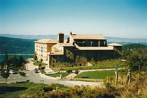 Monastery of Leyre Attraction, Yesa9.6 km W
Sources & licences
Data last updated: · 2 independent sources