Hoyo de Pinares, El
Located in Avila, Castille and León Coordinates: 40°30′25″ N 4°23′54″ W
- Population
- 2,449
- 2.4K
- Elevation
- 925 m
- above sea level
- Local time
- UTC+01:00
- Europe/Madrid · UTC+01:00
- Places inside
- 1
- listed under Hoyo de Pinares, El
- Airports
- MAD Adolfo Suárez Madrid–Barajas Airport70 km
- SLM Salamanca Airport106 km
About Hoyo de Pinares, El
Hoyo de Pinares, El is a municipality. Location: Avila, Castille and León. Population: 2,449. Elevation: 925 m. The best months to visit are June, September. The nearest airport is Adolfo Suárez Madrid–Barajas Airport (70 km). Nearby sights include Arroyo Retuerta and Río Becedas.
Climate of Hoyo de Pinares, El
Best months for sightseeingBest months for sightseeing: June, September.
This month · November
A cold month
Day 12° · Night 4° · Rain 57 mm
Better nearby cities in November
- Seville · 373 km south20°
- Dos Hermanas · 382 km south20°
- Murcia · 397 km southeast20°
- Hottest month
- July (day 29°)
- Coldest month
- January (night 1°)
- Wettest month
- May (57 mm)
- Driest month
- July (18 mm)
Bars: average monthly low and high temperature. Below: precipitation. Monthly averages for 1970–2000 at about 18 km resolution, adjusted for elevation. Highlighted months are mild and relatively dry. Source: WorldClim 2.1 (CC BY 4.0).
Show values as a table
| Month | Jan | Feb | Mar | Apr | May | Jun | Jul | Aug | Sep | Oct | Nov | Dec |
|---|---|---|---|---|---|---|---|---|---|---|---|---|
| Average high (°C) | 8° | 10° | 12° | 14° | 19° | 24° | 29° | 29° | 24° | 17° | 12° | 9° |
| Average low (°C) | 1° | 2° | 3° | 5° | 8° | 13° | 16° | 16° | 13° | 8° | 4° | 2° |
| Precipitation (mm) | 45 | 36 | 33 | 54 | 57 | 42 | 18 | 19 | 31 | 55 | 57 | 57 |
How to get to Hoyo de Pinares, El
The nearest airport is Adolfo Suárez Madrid–Barajas Airport (MAD), 70 km to the east as the crow flies. The nearest large city is Móstoles, 50 km to the southeast.
Airports
- Adolfo Suárez Madrid–Barajas Airport (MAD) Madrid 70 kmeast
- Salamanca Airport (SLM) Salamanca 106 kmnorthwest
- Valladolid Airport (VLL) Valladolid 139 kmnorth
Nearby large cities
- Móstoles Population: 207.1K 50 kmsoutheast
- Alcorcón Population: 172.4K 52 kmeast
- Fuenlabrada Population: 190.5K 57 kmsoutheast
- Leganés Population: 188.4K 57 kmeast
- Madrid Population: 3.3M 60 kmeast
Straight-line distances; road distances are longer. Airport data: OurAirports.
Day trips from Hoyo de Pinares, El
Within 100 km: 500 historic and cultural sites, 284 natural sites, 319 lakes, rivers and coasts.
0–25 km58 places
- Embalse del Burguillo Lake 18 kmSW
- Pantano de San Juan Lake 14 kmS
- Pantano de San Juan Lake 16 kmSE
- Embalse de la Aceña Lake 19 kmNE
25–60 km450 places
- San Millán Attraction 54 kmNE
- Laguna de Taeña Lake 30 kmNW
- Embalse de Santillana Lake 54 kmNE
- La Jarosa Lake 29 kmNE
60–100 km595 places
- Pantano del Torcón Lake 99 kmS
- Laguna Grande de Gredos Lake 80 kmW
- Pontón de la Oliva Lake 91 kmNE
- Embalse del Atazar Lake 90 kmNE
Straight-line distances.
Places in Hoyo de Pinares, El
1 placeBar: population relative to the most populous place in this list.
Nearby attractions & nature
Everything nearby-
Arroyo Retuerta River, San Bartolomé de Pinares5.8 km NE
-
Río Becedas River, Cebreros6.9 km SE
-
Arroyo de la Hoz River, Spain8.4 km SE
-
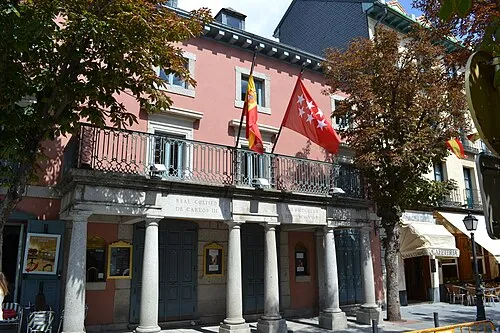 Teatro Real Coliseo de Carlos III Attraction, San Lorenzo de El Escorial23 km NE
-
Atalaya Mountain, Valdemaqueda10 km NE
-
Río Sotillo River, Cebreros9.1 km SE
-
Arroyo de la Puebla River, Robledo de Chavela9.2 km SE
-
Arroyo de Majatayegua River, San Bartolomé de Pinares7.8 km NW
Other cities and towns in Avila
-
Tiemblo, El Municipality, Avila14 km SW
-
Barraco, El Municipality, Avila17 km W
-
Herradón de Pinares Municipality, Avila15 km NW
-
Santa Cruz de Pinares Municipality, Avila16 km W
-
Ávila Municipality, Avila29 km NW
-
 Navaluenga Municipality, Avila29 km SW
Sources & licences
Data last updated: