- Elevation
- 905 m
- above sea level
- Local time
- UTC+01:00
- Europe/Madrid · UTC+01:00
- Airports
- SLM Salamanca Airport80 km
- VLL Valladolid Airport94 km
About Arroyo de la Magdalena
Arroyo de la Magdalena is a river. Location: Maello, Avila. The best months to visit are June, September. The nearest airport is Salamanca Airport (80 km). Nearby sights include Pinar Veinte Fuentes and Cruz de Hierro.
Climate of Arroyo de la Magdalena
Best months for sightseeingBest months for sightseeing: June, September.
This month · November
A cold month
Day 12° · Night 2° · Rain 41 mm
- Hottest month
- July (day 29°)
- Coldest month
- January (night -1°)
- Wettest month
- May (48 mm)
- Driest month
- August (15 mm)
Bars: average monthly low and high temperature. Below: precipitation. Monthly averages for 1970–2000 at about 18 km resolution, adjusted for elevation. Highlighted months are mild and relatively dry. Source: WorldClim 2.1 (CC BY 4.0).
Show values as a table
| Month | Jan | Feb | Mar | Apr | May | Jun | Jul | Aug | Sep | Oct | Nov | Dec |
|---|---|---|---|---|---|---|---|---|---|---|---|---|
| Average high (°C) | 7° | 10° | 13° | 15° | 19° | 24° | 29° | 28° | 24° | 17° | 12° | 8° |
| Average low (°C) | -1° | 0° | 2° | 4° | 7° | 11° | 14° | 13° | 10° | 6° | 2° | 0° |
| Precipitation (mm) | 33 | 26 | 22 | 40 | 48 | 36 | 17 | 15 | 30 | 40 | 41 | 41 |
How to get to Arroyo de la Magdalena
The nearest airport is Salamanca Airport (SLM), 80 km to the west as the crow flies. For international flights: Adolfo Suárez Madrid–Barajas Airport (MAD) (94 km). The nearest large city is Alcobendas, 86 km to the southeast.
Airports
- Salamanca Airport (SLM) Salamanca 80 kmwest
- Valladolid Airport (VLL) Valladolid 94 kmnorth
- Adolfo Suárez Madrid–Barajas Airport (MAD) Madrid 94 kmsoutheast
Nearby large cities
- Alcobendas Population: 116K 86 kmsoutheast
- Valladolid Population: 300.6K 86 kmnorth
- Móstoles Population: 207.1K 86 kmsoutheast
- Alcorcón Population: 172.4K 87 kmsoutheast
- Chamartin Population: 140K 88 kmsoutheast
Straight-line distances; road distances are longer. Airport data: OurAirports.
Day trips from Arroyo de la Magdalena
Within 100 km: 442 historic and cultural sites, 281 natural sites, 327 lakes, rivers and coasts.
0–25 km17 places
- Laguna de Taeña Lake 21 kmS
- Alto de las Peñas Mountain 24 kmS
- Pinar Veinte Fuentes Natural site 5 kmNW
- Río Chico River 20 kmE
25–60 km233 places
- San Millán Attraction 37 kmE
- Embalse del Burguillo Lake 52 kmS
- Pantano de San Juan Lake 59 kmS
- La Jarosa Lake 44 kmSE
60–100 km800 places
- Embalse de Santillana Lake 64 kmE
- Laguna Grande de Gredos Lake 94 kmSW
- Pantano de San Juan Lake 61 kmS
- Pontón de la Oliva Lake 94 kmE
Straight-line distances.
Nearest towns and villages
-
Sanchidrián Village, Sanchidrián2.2 km W
-
Sanchidrián Municipality, Avila2.6 km W
-
Peromingo Village, Muñopedro0.8 km E
-
Muñopedro Municipality, Segovia5.7 km E
-
 Velayos Municipality, Avila6.2 km SW
-
Labajos Municipality, Segovia5.7 km SE
Nearby attractions & nature
Everything nearby-
Pinar Veinte Fuentes Natural site, Adanero5.1 km NW
-
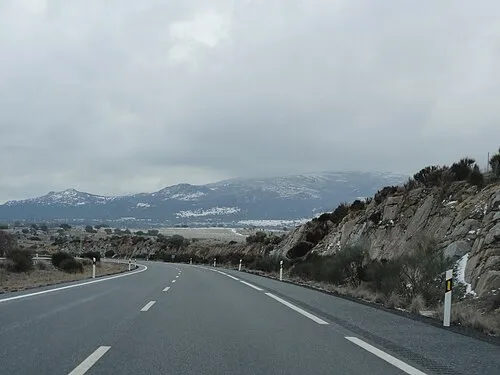 Cruz de Hierro Mountain, Santa María del Cubillo21 km SE
-
Arroyo de San Miguel River, San Pascual9.8 km W
-
Alto de las Peñas Mountain, Ávila24 km S
-
Laguna de Taeña Lake, Tolbaños21 km S
-
Arroyo de los Prados River, Muñopedro11 km E
-
Río Cardeña River, Tolbaños13 km S
-
Río de Mediana River, Tolbaños16 km S
Sources & licences
Data last updated: