- Elevation
- 774 m
- above sea level
- Local time
- UTC+01:00
- Europe/Madrid · UTC+01:00
- Airports
- VLL Valladolid Airport58 km
- LEN León Airport100 km
About Villafruela
Villafruela is a village. Location: Perales, Palencia. Elevation: 774 m. The best months to visit are June, September. The nearest airport is Valladolid Airport (58 km). Nearby sights include Arroyo del Val and Arroyo Geroa.
Climate of Villafruela
Best months for sightseeingBest months for sightseeing: June, September.
This month · November
Outside the best season
Day 12° · Night 3° · Rain 48 mm
- Hottest month
- July (day 29°)
- Coldest month
- January (night 0°)
- Wettest month
- May (53 mm)
- Driest month
- August (18 mm)
Bars: average monthly low and high temperature. Below: precipitation. Monthly averages for 1970–2000 at about 18 km resolution, adjusted for elevation. Highlighted months are mild and relatively dry. Source: WorldClim 2.1 (CC BY 4.0).
Show values as a table
| Month | Jan | Feb | Mar | Apr | May | Jun | Jul | Aug | Sep | Oct | Nov | Dec |
|---|---|---|---|---|---|---|---|---|---|---|---|---|
| Average high (°C) | 8° | 10° | 14° | 15° | 19° | 24° | 29° | 28° | 24° | 18° | 12° | 8° |
| Average low (°C) | 0° | 1° | 2° | 4° | 7° | 11° | 13° | 13° | 11° | 7° | 3° | 1° |
| Precipitation (mm) | 41 | 35 | 33 | 42 | 53 | 43 | 19 | 18 | 21 | 46 | 48 | 50 |
How to get to Villafruela
The nearest airport is Valladolid Airport (VLL), 58 km to the southwest as the crow flies. The nearest large city is Valladolid, 60 km to the south.
Airports
- Valladolid Airport (VLL) Valladolid 58 kmsouthwest
- León Airport (LEN) La Virgen del Camino 100 kmnorthwest
- Seve Ballesteros-Santander Airport (SDR) Santander 151 kmnortheast
Nearby large cities
- Valladolid Population: 300.6K 60 kmsouth
- Burgos Population: 176.4K 74 kmeast
- León Population: 124.8K 95 kmnorthwest
- Santander Population: 173.6K 156 kmnortheast
- Salamanca Population: 144.8K 163 kmsouthwest
Straight-line distances; road distances are longer. Airport data: OurAirports.
Day trips from Villafruela
Within 100 km: 153 historic and cultural sites, 80 natural sites, 256 lakes, rivers and coasts.
0–25 km45 places
- Arroyo de Laisa River 6 kmS
- Arroyo de la Huerga River 24 kmW
- Arroyo de la Gira River 13 kmNE
- Arroyo Geroa River 3 kmN
25–60 km118 places
- Montes de Torozos Natural site 46 kmSW
- Manantial de Fuentes Claras Natural site 53 kmNE
- Río Hormazuela River 54 kmE
- Arroyo de la Hormaza River 44 kmE
60–100 km326 places
- Playa fluvial Fuente del Prior Beach 77 kmE
- Pantano de Ruesga Lake 76 kmN
- Pantano Requejada Lake 82 kmN
- Pozo Obscuro Lake 88 kmN
Straight-line distances.
Nearby attractions & nature
Everything nearby-
Arroyo del Val River, San Cebrián de Campos2.1 km E
-
Arroyo Geroa River, Manquillos2.9 km N
-
Iglesia De San Esteban Attraction, Villoldo7.4 km N
-
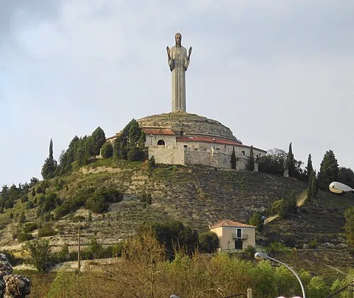 Cristo del Otero Landmark, Palencia17 km S
-
Arroyo de Laisa River, Becerril de Campos6.1 km S
-
Iglesia Museo Parroquial de Santa Eulalia de Paredes de Nava Attraction, Paredes de Nava11 km W
Sources & licences
Data last updated: