Iglesias
Located in Province of Burgos, Castille and León Coordinates: 42°17′53″ N 3°59′26″ W

- Population
- 143
- 143
- Elevation
- 851 m
- above sea level
- Local time
- UTC+01:00
- Europe/Madrid · UTC+01:00
- Places inside
- 1
- listed under Iglesias
- Airports
- VLL Valladolid Airport97 km
- VIT Vitoria Airport123 km
About Iglesias
Iglesias is a municipality. Location: Province of Burgos, Castille and León. Population: 143. Elevation: 851 m.
Iglesias (pronounced [iˈɡleːzjas]) is a municipality located in the province of Burgos, Castile and León, Spain.
Source: Wikipedia · CC BY-SA 4.0
Photos of Iglesias
-

Taurëendil · CC BY-SA 4.0 -

Rowanwindwhistler · CC BY-SA 3.0 -

Taurëendil · CC BY-SA 4.0 -

Rowanwindwhistler · CC BY-SA 3.0 -

Marathoni62 · CC BY-SA 3.0


Places bordering Iglesias
- Hornillos del Camino
- Hontanas
- Castellanos de Castro
- Isar
Population of Iglesias over time
| 2014 | 135 | |
|---|---|---|
| 2015 | 140 | |
| 2016 | 143 | |
| 2017 | 145 | |
| 2018 | 137 | |
| 2019 | 145 | |
| 2020 | 143 | |
| 2021 | 146 | |
| 2022 | 146 | |
| 2023 | 144 | |
| 2024 | 141 | |
| 2025 | 136 |
Censuses and official estimates; source: Wikidata.
Climate of Iglesias
Best months for sightseeingBest months for sightseeing: June, September.
This month · November
Outside the best season
Day 12° · Night 3° · Rain 48 mm
- Hottest month
- July (day 29°)
- Coldest month
- January (night -1°)
- Wettest month
- May (53 mm)
- Driest month
- August (19 mm)
Bars: average monthly low and high temperature. Below: precipitation. Monthly averages for 1970–2000 at about 18 km resolution, adjusted for elevation. Highlighted months are mild and relatively dry. Source: WorldClim 2.1 (CC BY 4.0).
Show values as a table
| Month | Jan | Feb | Mar | Apr | May | Jun | Jul | Aug | Sep | Oct | Nov | Dec |
|---|---|---|---|---|---|---|---|---|---|---|---|---|
| Average high (°C) | 8° | 10° | 14° | 15° | 19° | 24° | 29° | 28° | 24° | 18° | 12° | 8° |
| Average low (°C) | -1° | 0° | 2° | 3° | 7° | 10° | 13° | 13° | 10° | 6° | 3° | 1° |
| Precipitation (mm) | 45 | 37 | 28 | 46 | 53 | 40 | 22 | 19 | 30 | 45 | 48 | 50 |
How to get to Iglesias
The nearest airport is Valladolid Airport (VLL), 97 km to the southwest as the crow flies. The nearest large city is Burgos, 24 km to the east.
Airports
- Valladolid Airport (VLL) Valladolid 97 kmsouthwest
- Vitoria Airport (VIT) Alava 123 kmnortheast
- Seve Ballesteros-Santander Airport (SDR) Santander 126 kmnorth
Nearby large cities
- Burgos Population: 176.4K 24 kmeast
- Valladolid Population: 300.6K 94 kmsouthwest
- Vitoria-Gasteiz Population: 257.4K 124 kmnortheast
- Logroño Population: 151.2K 128 kmeast
- Santander Population: 173.6K 131 kmnorth
Straight-line distances; road distances are longer. Airport data: OurAirports.
Day trips from Iglesias
Within 100 km: 139 historic and cultural sites, 87 natural sites, 308 lakes, rivers and coasts.
0–25 km53 places
- Villas Del Arlanzon Molino Ramon Natural site 19 kmE
- Río Hormazuela River 7 kmSE
- Arroyo de la Hormaza River 14 kmS
- Río Santiago River 15 kmW
25–60 km140 places
- Playa fluvial Fuente del Prior Beach 28 kmE
- Pantano del Arlanzón Lake 54 kmE
- Lagunas de Carcedo Lake 31 kmE
- Medela Mountain 47 kmN
60–100 km341 places
- Playa de Arija Beach 78 kmN
- Pantano de Ruesga Lake 77 kmNW
- Pantano Requejada Lake 80 kmNW
- Pozo Obscuro Lake 92 kmNW
Straight-line distances.
Places in Iglesias
1 placeBar: population relative to the most populous place in this list.
Nearby attractions & nature
Everything nearby-
Arroyo Penillas River, Pampliega6.7 km S
-
Río Hormazuela River, Pampliega6.8 km SE
-
Arroyo de Rucabia River, Pampliega7.4 km S
-
Monasterio de San Antón Historic site, Castrojeriz9 km W
-
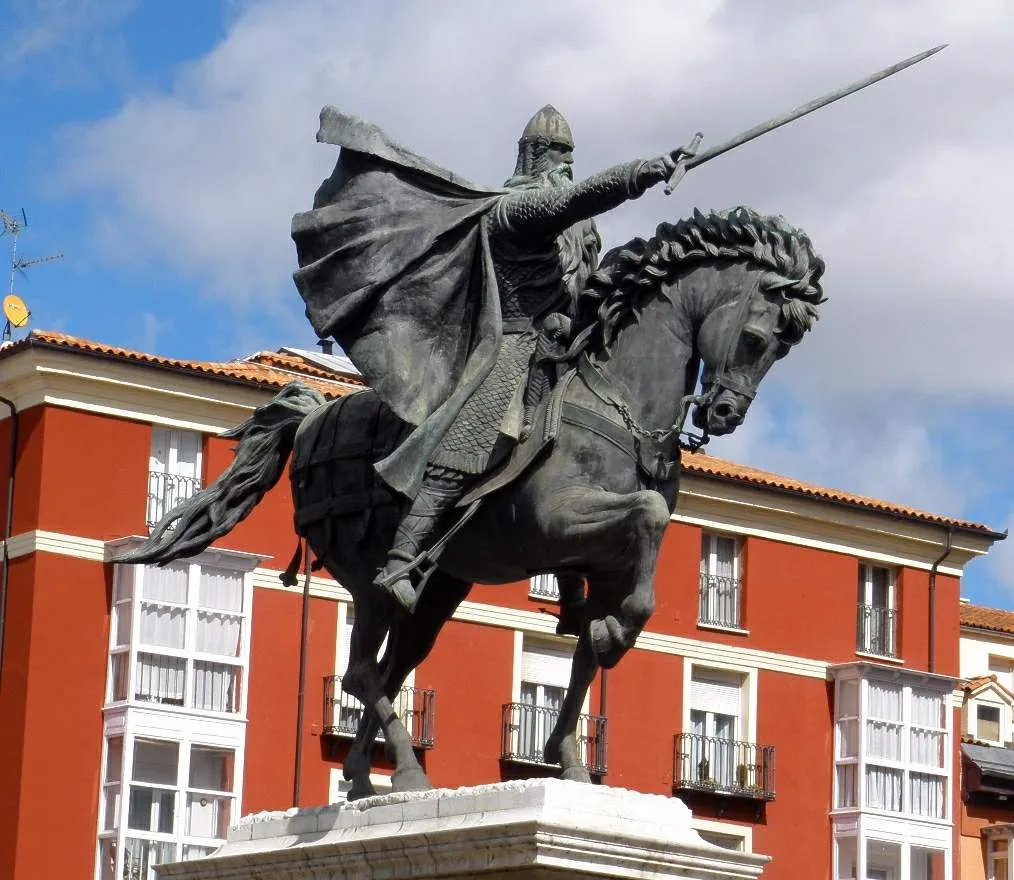 Estatua del Cid Landmark, Burgos24 km E
-
Arroyo de Mazuelo River, Estépar9.6 km E
-
Convento de Santa Clara Attraction, Castrojeriz11 km W
-
ex-Colegiata de Nuestra Señora del Manzano Attraction, Castrojeriz11 km W
Other cities and towns in Province of Burgos
-
 Castrojeriz Municipality, Province of Burgos12 km W
-
 Isar Municipality, Province of Burgos8.7 km NE
-
 Hornillos del Camino Municipality, Province of Burgos7 km NE
-
 Pampliega Municipality, Province of Burgos10 km S
-
 Cavia Municipality, Province of Burgos12 km E
-
 Villasandino Municipality, Province of Burgos13 km NW
Sources & licences
Data last updated: · 2 independent sources