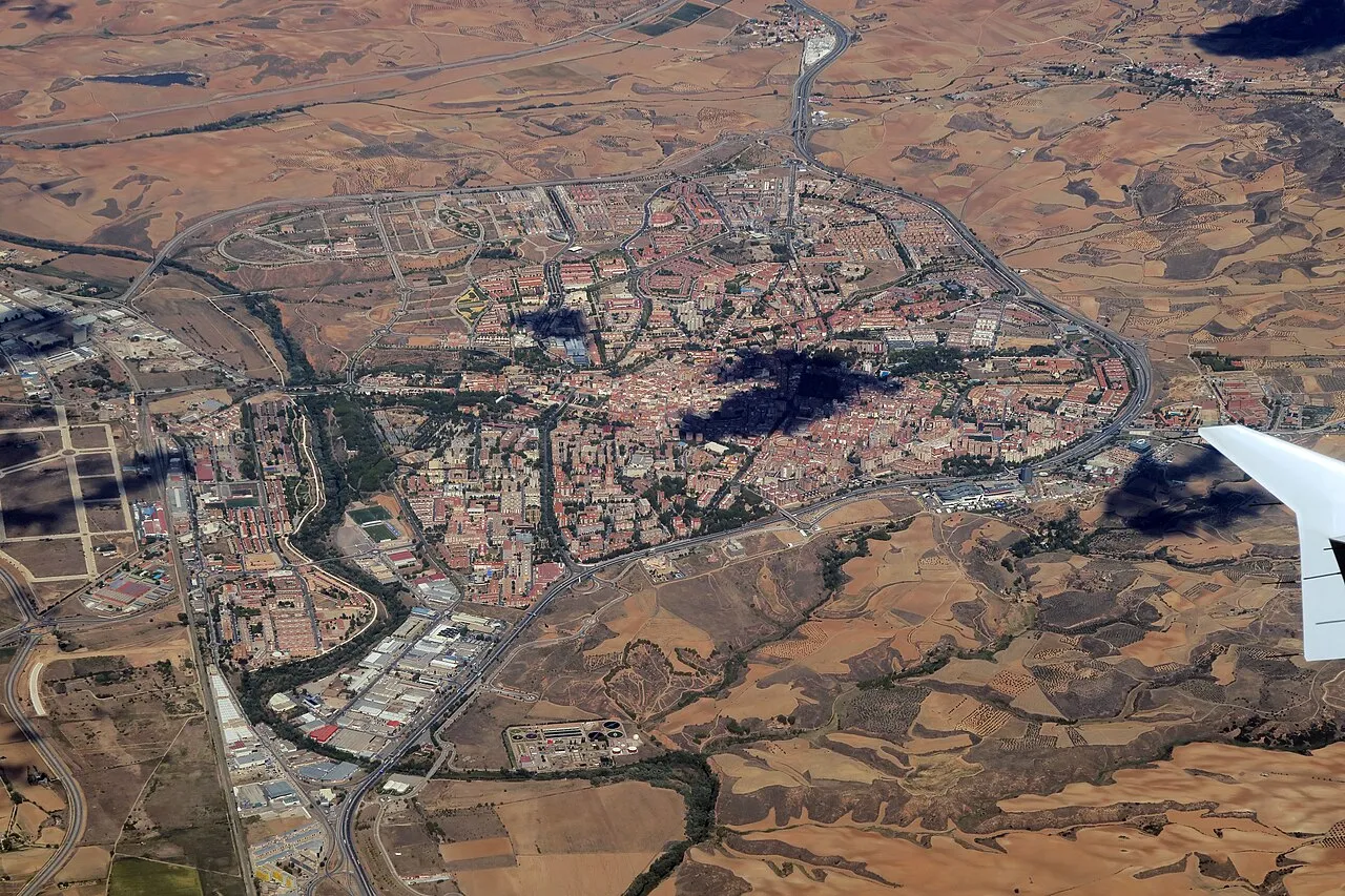
- Population
- 280,225
- 280.2K
- Elevation
- 1,152 m
- above sea level
- Local time
- UTC+01:00
- Europe/Madrid · UTC+01:00
- Places inside
- 288
- listed under Guadalajara
- Airports
- MAD Adolfo Suárez Madrid–Barajas Airport98 km
- ZAZ Zaragoza Airport153 km
About Guadalajara
Guadalajara is a district. Location: Castille-La Mancha, Spain. Population: 280,225. The best months to visit are June, September. The nearest airport is Adolfo Suárez Madrid–Barajas Airport (98 km).
Climate of Guadalajara
Best months for sightseeingBest months for sightseeing: June, September.
This month · November
A cold month
Day 11° · Night 1° · Rain 65 mm
Better nearby cities in November
- Elche · 325 km southeast20°
- Alicante · 326 km southeast20°
- Orihuela · 334 km southeast20°
- Hottest month
- July (day 29°)
- Coldest month
- January (night -2°)
- Wettest month
- November (65 mm)
- Driest month
- July (15 mm)
Bars: average monthly low and high temperature. Below: precipitation. Monthly averages for 1970–2000 at about 18 km resolution, adjusted for elevation. Highlighted months are mild and relatively dry. Source: WorldClim 2.1 (CC BY 4.0).
Show values as a table
| Month | Jan | Feb | Mar | Apr | May | Jun | Jul | Aug | Sep | Oct | Nov | Dec |
|---|---|---|---|---|---|---|---|---|---|---|---|---|
| Average high (°C) | 7° | 9° | 12° | 14° | 18° | 24° | 29° | 28° | 24° | 17° | 11° | 8° |
| Average low (°C) | -2° | -1° | 0° | 3° | 6° | 10° | 13° | 13° | 10° | 5° | 1° | -1° |
| Precipitation (mm) | 49 | 43 | 32 | 52 | 58 | 33 | 15 | 16 | 33 | 64 | 65 | 60 |
How to get to Guadalajara
The nearest airport is Adolfo Suárez Madrid–Barajas Airport (MAD), 98 km to the west as the crow flies. The nearest large city is Alcalá de Henares, 83 km to the southwest.
Airports
- Adolfo Suárez Madrid–Barajas Airport (MAD) Madrid 98 kmwest
- Zaragoza Airport (ZAZ) Zaragoza 153 kmnortheast
- Logroño-Agoncillo Airport (RJL) Logroño 181 kmnorth
Nearby large cities
- Alcalá de Henares Population: 193.8K 83 kmsouthwest
- Torrejón de Ardoz Population: 118.2K 92 kmsouthwest
- Alcobendas Population: 116K 102 kmwest
- Ciudad Lineal Population: 228.2K 107 kmsouthwest
- Chamartin Population: 140K 108 kmwest
Straight-line distances; road distances are longer. Airport data: OurAirports.
Places in Guadalajara
288 places- 61 Armuña de Tajuña 252
- 62 Orea 245
- 63 Torremocha del Campo 240
- 64 Torre del Burgo 239
- 65 Tortuera 226
- 66 Alustante 225
- 67 Peñalver 225
- 68 Budia 220
- 69 Villel de Mesa 217
- 70 Anguita 215
- 71 Auñón 206
- 72 Alhóndiga 205
- 73 Málaga del Fresno 204
- 74 Escariche 203
- 75 Mohernando 200
- 76 Valdepeñas de la Sierra 193
- 77 Campillo de Ranas 189
- 78 Salmerón 188
- 79 Villanueva de Alcorón 188
- 80 Arbancón 181
- 81 Tamajón 175
- 82 Alocén 173
- 83 Tartanedo 172
- 84 Cubillo de Uceda, El 171
- 85 Alcoroches 162
- 86 Cantalojas 159
- 87 Matillas 158
- 88 Zaorejas 158
- 89 Hiendelaencina 154
- 90 Millana 152
- 91 Peralejos de las Truchas 151
- 92 Condemios de Arriba 146
- 93 Malaguilla 145
- 94 Pobo de Dueñas, El 144
- 95 Hueva 140
- 96 Poveda de la Sierra 138
- 97 Moratilla de los Meleros 137
- 98 Fuencemillán 136
- 99 Robledillo de Mohernando 136
- 100 Romanones 130
- 101 Viñuelas 130
- 102 Fuentelahiguera de Albatages 129
- 103 Olivar, El 129
- 104 Casa de Uceda 128
- 105 Ciruelas 128
- 106 Alarilla 123
- 107 Cobeta 123
- 108 Riba de Saelices 123
- 109 Renera 122
- 110 Galve de Sorbe 121
- 111 Membrillera 119
- 112 Chillarón del Rey 118
- 113 Pozo de Almoguera 118
- 114 Tordesilos 118
- 115 Durón 117
- 116 Sayatón 117
- 117 Yunta, La 115
- 118 Caspueñas 114
- 119 Muduex 114
- 120 Ledanca 112
Bar: population relative to the most populous place in this list.
Nature and heritage in Guadalajara
Sources & licences
Data last updated: