Chillarón del Rey
Located in Guadalajara, Castille-La Mancha Coordinates: 40°35′36″ N 2°42′06″ W
- Population
- 118
- 118
- Elevation
- 788 m
- above sea level
- Local time
- UTC+01:00
- Europe/Madrid · UTC+01:00
- Places inside
- 1
- listed under Chillarón del Rey
- Airports
- MAD Adolfo Suárez Madrid–Barajas Airport75 km
- ZAZ Zaragoza Airport183 km
About Chillarón del Rey
Chillarón del Rey is a municipality. Location: Guadalajara, Castille-La Mancha. Population: 118. Elevation: 788 m. The best months to visit are May–June, September–October. The nearest airport is Adolfo Suárez Madrid–Barajas Airport (75 km). Nearby sights include Barranco de Durón and Arroyo de la Solana.
Climate of Chillarón del Rey
Best months for sightseeingBest months for sightseeing: May–June, September–October.
This month · November
Outside the best season
Day 13° · Night 4° · Rain 54 mm
Better nearby cities in November
- Elche · 311 km southeast20°
- Alicante · 314 km southeast20°
- Orihuela · 317 km southeast20°
- Hottest month
- July (day 31°)
- Coldest month
- January (night 0°)
- Wettest month
- October (56 mm)
- Driest month
- July (13 mm)
Bars: average monthly low and high temperature. Below: precipitation. Monthly averages for 1970–2000 at about 18 km resolution, adjusted for elevation. Highlighted months are mild and relatively dry. Source: WorldClim 2.1 (CC BY 4.0).
Show values as a table
| Month | Jan | Feb | Mar | Apr | May | Jun | Jul | Aug | Sep | Oct | Nov | Dec |
|---|---|---|---|---|---|---|---|---|---|---|---|---|
| Average high (°C) | 9° | 11° | 15° | 17° | 21° | 26° | 31° | 31° | 26° | 19° | 13° | 10° |
| Average low (°C) | 0° | 1° | 3° | 5° | 8° | 13° | 16° | 16° | 12° | 8° | 4° | 2° |
| Precipitation (mm) | 43 | 40 | 29 | 48 | 51 | 31 | 13 | 13 | 29 | 56 | 54 | 50 |
Other places to visit in this season: May June September October
How to get to Chillarón del Rey
The nearest airport is Adolfo Suárez Madrid–Barajas Airport (MAD), 75 km to the west as the crow flies. The nearest large city is Alcalá de Henares, 57 km to the west.
Airports
- Adolfo Suárez Madrid–Barajas Airport (MAD) Madrid 75 kmwest
- Zaragoza Airport (ZAZ) Zaragoza 183 kmnortheast
- Logroño-Agoncillo Airport (RJL) Logroño 210 kmnorth
Nearby large cities
- Alcalá de Henares Population: 193.8K 57 kmwest
- Torrejón de Ardoz Population: 118.2K 67 kmwest
- Alcobendas Population: 116K 80 kmwest
- Ciudad Lineal Population: 228.2K 82 kmwest
- Chamartin Population: 140K 84 kmwest
Straight-line distances; road distances are longer. Airport data: OurAirports.
Day trips from Chillarón del Rey
Within 100 km: 344 historic and cultural sites, 322 natural sites, 255 lakes, rivers and coasts.
0–25 km38 places
- Pantano de Entrepeñas Lake 4 kmS
- Pantano de Buendía Lake 20 kmS
- Sierra de San Cristóbal Mountain 16 kmS
- La Peña Parda Mountain 19 kmS
25–60 km178 places
- Laguna de Navahonda Lake 57 kmS
- Laguna Grande Lake 55 kmE
- Cerros de la Mudarra Mountain 44 kmS
- Cuesta Moratilla Mountain 57 kmE
60–100 km705 places
- Laguna de Uña Lake 74 kmSE
- Embalse de Santillana Lake 96 kmW
- Pantano de Monteagudo Lake 99 kmNE
- Pantano de La Toba Lake 80 kmSE
Straight-line distances.
Places in Chillarón del Rey
1 placeBar: population relative to the most populous place in this list.
Nearby attractions & nature
Everything nearby-
Barranco de Durón River, Pareja4.2 km NW
-
Arroyo de la Solana River, Pareja4.2 km NE
-
Pantano de Entrepeñas Lake, Pareja4.2 km S
-
Arroyo de la Solana River, Pareja6.5 km SE
-
Berninches Mountain, Berninches8.4 km W
-
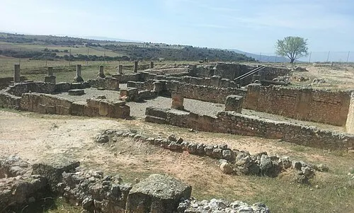 Ercavica Historic site, Cañaveruelas18 km S
-
Río de la Vega River, Trillo9.2 km NE
-
Fuente Fría Natural site, Pareja11 km SE
Sources & licences
Data last updated: