Bargota
Local name: Ibargoiti
Located in Navarre, Navarre Coordinates: 42°32′20″ N 2°18′26″ W

- Population
- 312
- 312
- Elevation
- 552 m
- above sea level
- Local time
- UTC+01:00
- Europe/Madrid · UTC+01:00
- Places inside
- 1
- listed under Bargota
- Airports
- RJL Logroño-Agoncillo Airport9 km
- VIT Vitoria Airport51 km
About Bargota
Bargota is a municipality. Location: Navarre, Navarre. Population: 312. Elevation: 552 m.
Bargota is a town and municipality located in the province and autonomous community of Navarra, northern Spain.
Source: Wikipedia · CC BY-SA 4.0
Places bordering Bargota
- Aras
- Azuelo
- Espronceda
- Mendavia
Population of Bargota over time
| 2014 | 295 | |
|---|---|---|
| 2015 | 292 | |
| 2016 | 284 | |
| 2017 | 276 | |
| 2018 | 262 | |
| 2019 | 257 | |
| 2020 | 255 | |
| 2021 | 254 | |
| 2022 | 256 | |
| 2023 | 257 | |
| 2024 | 247 | |
| 2025 | 237 |
Censuses and official estimates; source: Wikidata.
Climate of Bargota
Best months for sightseeingBest months for sightseeing: June, September.
This month · November
Outside the best season
Day 13° · Night 4° · Rain 58 mm
- Hottest month
- August (day 28°)
- Coldest month
- January (night 1°)
- Wettest month
- April (64 mm)
- Driest month
- August (33 mm)
Bars: average monthly low and high temperature. Below: precipitation. Monthly averages for 1970–2000 at about 18 km resolution, adjusted for elevation. Highlighted months are mild and relatively dry. Source: WorldClim 2.1 (CC BY 4.0).
Show values as a table
| Month | Jan | Feb | Mar | Apr | May | Jun | Jul | Aug | Sep | Oct | Nov | Dec |
|---|---|---|---|---|---|---|---|---|---|---|---|---|
| Average high (°C) | 8° | 10° | 13° | 15° | 19° | 23° | 27° | 28° | 24° | 18° | 13° | 9° |
| Average low (°C) | 1° | 2° | 3° | 5° | 8° | 11° | 14° | 14° | 11° | 8° | 4° | 3° |
| Precipitation (mm) | 50 | 42 | 39 | 64 | 64 | 51 | 35 | 33 | 35 | 51 | 58 | 56 |
How to get to Bargota
The nearest airport is Logroño-Agoncillo Airport (RJL), 9 km to the south as the crow flies. The nearest large city is Logroño, 14 km to the southwest.
Airports
- Logroño-Agoncillo Airport (RJL) Logroño 9 kmsouth
- Vitoria Airport (VIT) Alava 51 kmnorthwest
- Pamplona Airport (PNA) Pamplona 60 kmnortheast
Nearby large cities
- Logroño Population: 151.2K 14 kmsouthwest
- Vitoria-Gasteiz Population: 257.4K 46 kmnorthwest
- Pamplona Population: 208.2K 63 kmnortheast
- Donostia / San Sebastian Population: 185.4K 90 kmnorth
- Bilbao Population: 347.3K 95 kmnorthwest
Straight-line distances; road distances are longer. Airport data: OurAirports.
Day trips from Bargota
Within 100 km: 323 historic and cultural sites, 258 natural sites, 203 lakes, rivers and coasts.
0–25 km44 places
- Pantano de la Grajera Lake 19 kmSW
- Iermanda Mountain 23 kmNW
- Peñas de Ulibarri Mountain 25 kmN
- Sierra de Santiago de Loquiz Mountain 25 kmNE
25–60 km183 places
- Pantano de Valbornedo Lake 26 kmSW
- Pantano de González de Lacasa Lake 50 kmSW
- El Lago Lake 57 kmW
- Pantano de Cuadra Lake 38 kmSE
60–100 km557 places
- Valle de Baztan Natural site 96 kmNE
- Iglesia San Juan Bautista Attraction 87 kmNE
- Yamaguchi Natural site 61 kmNE
- Kontxa / La Concha Beach 90 kmN
Straight-line distances.
Places in Bargota
1 placeBar: population relative to the most populous place in this list.
Nearby attractions & nature
Everything nearby-
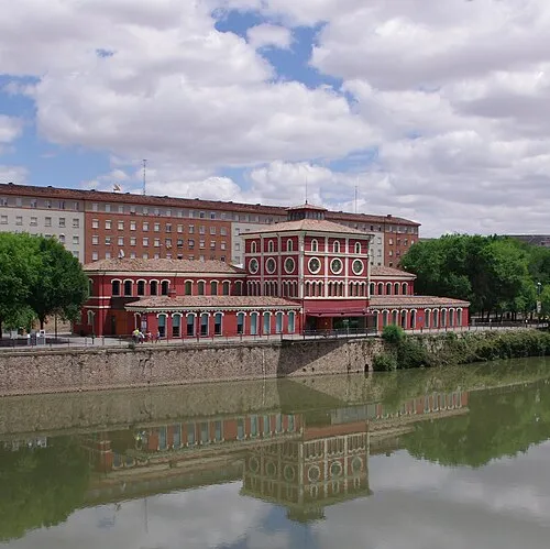 Casa de las Ciencias Museum, Logroño14 km SW
-
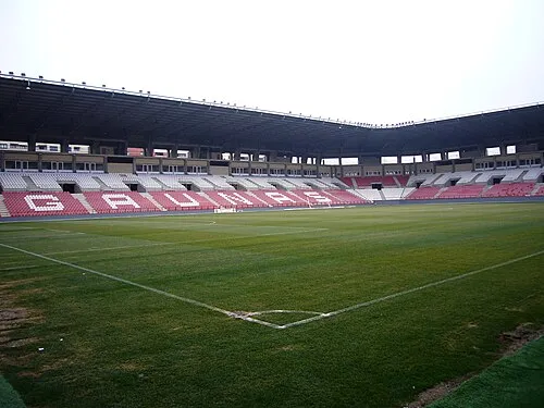 Estadio Las Gaunas Landmark, Logroño15 km SW
-
Castillo de Aguas Mansas Historic site, Agoncillo10 km S
-
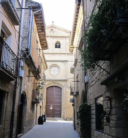 Church of Santa María de los Reyes Attraction, Laguardia23 km W
-
Puente Romano sobre el río Leza Historic site, Agoncillo12 km S
-
Museo del Aceite de Oliva Museum, Oion / Oyón11 km W
-
Museo Würth La Rioja Museum, Agoncillo13 km S
-
La Ribera Park Natural site, Logroño13 km SW
Other cities and towns in Navarre
-
 Mendavia Municipality, Navarre13 km SE
-
 Espronceda Municipality, Navarre6.2 km N
-
 Desojo Municipality, Navarre6.4 km NE
-
 Azuelo Municipality, Navarre8.5 km NW
-
Lazagurría Municipality, Navarre8 km SE
-
 Mirafuentes Municipality, Navarre9.7 km N
Sources & licences
Data last updated: · 2 independent sources