Mola de Xert
Located in Chert/Xert, Castellon Coordinates: 40°32′18″ N 0°10′03″ E
- Elevation
- 807 m
- above sea level
- Local time
- UTC+01:00
- Europe/Madrid · UTC+01:00
About Mola de Xert
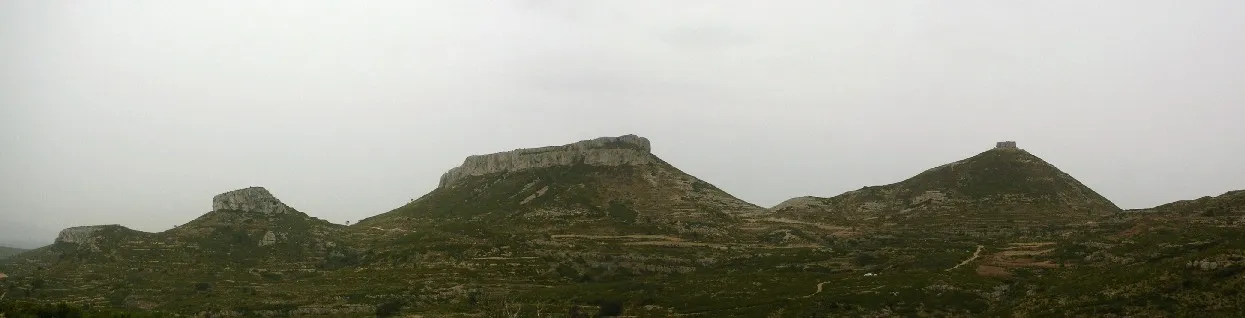
Mola de Xert is a mountain. Location: Chert/Xert, Castellon. Elevation: 807 m.
Moles de Xert (Valencian pronunciation: [ˈmɔlez ðe ˈtʃɛɾt], Spanish: Muelas de Chert) is a 4.2 km (3 mi) long mountain range in the Baix Maestrat comarca, Valencian Country, Spain. Its highest point is Mola Gran (806 m). The other main summits are Mola Murada, a breast-shaped hill, Moleta Redona and Mola Llarga. These mountains have very original shapes, topped by regular rocky outcrops resembling castles or fortifications. They are frequently covered in snow in the winter.
Read more on Wikipedia Text: Wikipedia contributors · CC BY-SA 4.0 · shortened
At a glance
- Length
- 3.2 km
Source: Wikidata
In comparison
- No. 2325 of 3603 mountains in Spain by elevation
Airports nearest to Mola de Xert
- Castellón-Costa Azahar Airport (CDT) Castellón de la Plana 37 km
- Reus Airport (REU) Reus 108 km
- Valencia Airport (VLC) Valencia 129 km
Straight-line distance; airports with scheduled flights only. Source: OurAirports (public domain).
Nearest towns and villages
-
Chert/Xert Village, Chert/Xert2.2 km S
-
Canet lo Roig Municipality, Castellon6.2 km NE
-
La Jana Municipality, Castellon6.5 km SE
-
Sant Mateu Municipality, Castellon6.6 km S
-
Canet lo Roig Village, Canet lo Roig6.6 km E
-
Anroig Village, Chert/Xert5.1 km SW
Nearby attractions & nature
Everything nearby-
Muela Peña Blanca Mountain, Chert/Xert5.3 km NW
-
Tossal de la Nevera Mountain, Morella18 km SW
-
Balneario de l'Avellà Natural site, Catí14 km SW
-
Sierra Encanes Mountain, La Salzadella17 km S
-
Montes de Vallivana Mountain, Catí17 km W
-
Encanadé Mountain, Peñarroya de Tastavins Municipality21 km N
-
Moleta Alta Mountain, Peñarroya de Tastavins Municipality22 km N
-
Tossal del Rei Mountain, Valderrobres Municipality22 km N
Sources & licences
Data last updated: · 2 independent sources