Gammalsätersfjället
Located in Malung-Sälen Municipality, Dalarna County Coordinates: 61°06′00″ N 13°11′00″ E
- Elevation
- 853 m
- above sea level
- Local time
- UTC+01:00
- Europe/Stockholm · UTC+01:00
- Airports
- SCR Scandinavian Mountains Airport20 km
- MXX Mora Airport74 km
About Gammalsätersfjället
Gammalsätersfjället is a mountain. Location: Malung-Sälen Municipality, Dalarna County. Elevation: 853 m. The best months to visit are June–July. The nearest airport is Scandinavian Mountains Airport (20 km). Nearby sights include Bredvallsfjäll and Mosskalen.
Climate of Gammalsätersfjället
Best months for sightseeingBest months for sightseeing: June–July.
This month · November
A cold month
Day -3° · Night -9° · Rain 75 mm
- Hottest month
- July (day 18°)
- Coldest month
- February (night -16°)
- Wettest month
- July (94 mm)
- Driest month
- February (38 mm)
Bars: average monthly low and high temperature. Below: precipitation. Monthly averages for 1970–2000 at about 18 km resolution, adjusted for elevation. Highlighted months are mild and relatively dry. Source: WorldClim 2.1 (CC BY 4.0).
Show values as a table
| Month | Jan | Feb | Mar | Apr | May | Jun | Jul | Aug | Sep | Oct | Nov | Dec |
|---|---|---|---|---|---|---|---|---|---|---|---|---|
| Average high (°C) | -7° | -5° | -1° | 3° | 11° | 16° | 18° | 15° | 10° | 4° | -3° | -6° |
| Average low (°C) | -15° | -16° | -11° | -7° | -2° | 3° | 5° | 4° | 0° | -4° | -9° | -14° |
| Precipitation (mm) | 53 | 38 | 46 | 55 | 66 | 86 | 94 | 90 | 94 | 85 | 75 | 59 |
How to get to Gammalsätersfjället
The nearest airport is Scandinavian Mountains Airport (SCR), 20 km to the west as the crow flies. The nearest large city is Oslo, 188 km to the southwest.
Airports
- Scandinavian Mountains Airport (SCR) Malung-Sälen 20 kmwest
- Mora Airport (MXX) Mora 74 kmeast
- Torsby Airport (TYF) Torsby 106 kmsouth
Nearby large cities
- Oslo Population: 1.1M 188 kmsouthwest
- Drammen Population: 106K 223 kmsouthwest
- Örebro Population: 156K 232 kmsoutheast
- Västerås Population: 127.8K 249 kmsoutheast
- Trondheim Population: 216.5K 297 kmnorthwest
Straight-line distances; road distances are longer. Airport data: OurAirports.
Day trips from Gammalsätersfjället
Within 100 km: 1 historic or cultural site, 60 natural sites, 18 lakes, rivers and coasts.
0–25 km18 places
- Grämsön Island 25 kmSW
- Fiskön Island 24 kmSW
- Transtrandsfjällen Mountain 9 kmNW
- Synddalskläppen Mountain 19 kmNW
25–60 km18 places
- Jönna Island 50 kmSE
- Svansåsknattarna Mountain 39 kmSW
- Storhöa Mountain 56 kmNW
- Skäråsen Mountain 48 kmN
60–100 km43 places
- Håberget Mountain 88 kmSE
- Djurmus Island 72 kmE
- Myckelön Island 78 kmE
- Lerön Island 78 kmE
Straight-line distances.
Nearest towns and villages
-
 Sälen Village, Malung-Sälen Municipality7.2 km NE
-
Lima-Transtrand Municipality, Malung-Sälen Municipality21 km SE
-
 Lima Village, Malung-Sälen Municipality21 km SE
-
 Limedsforsen Village, Malung-Sälen Municipality25 km SE
-
Transtrand socken Village, Lima-Transtrand15 km N
-
Lima socken Village, Lima-Transtrand15 km S
Nearby attractions & nature
Everything nearby-
Bredvallsfjäll Mountain, Malung-Sälen Municipality2.6 km SW
-
Mosskalen Mountain, Malung-Sälen Municipality4 km NW
-
Storfjället Mountain, Malung-Sälen Municipality4.6 km NW
-
Sälfjället Mountain, Malung-Sälen Municipality5.6 km N
-
Skogfjället Mountain, Malung-Sälen Municipality6.5 km NW
-
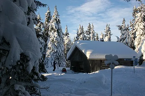 Transtrandsfjällen Mountain, Dalarna County8.7 km NW
-
Köarskärsfjäll Mountain, Malung-Sälen Municipality9.7 km N
-
Östra Kalven Mountain, Malung-Sälen Municipality9.7 km NW
Sources & licences
Data last updated: · 2 independent sources