- Elevation
- 561 m
- above sea level
- Local time
- UTC+01:00
- Europe/Stockholm · UTC+01:00
- Airports
- OSD Åre Östersund Airport97 km
- TRD Trondheim Airport, Værnes109 km
About Kall socken
Kall socken is a village. Location: Kall, Åre Municipality. Elevation: 561 m. The best months to visit are July. The nearest airport is Åre Östersund Airport (97 km). Nearby sights include Daletjahke and Edefjället.
Climate of Kall socken
Best months for sightseeingBest months for sightseeing: July.
This month · November
A cold month
Day -1° · Night -6° · Rain 66 mm
- Hottest month
- July (day 16°)
- Coldest month
- January (night -12°)
- Wettest month
- July (86 mm)
- Driest month
- May (38 mm)
Bars: average monthly low and high temperature. Below: precipitation. Monthly averages for 1970–2000 at about 18 km resolution, adjusted for elevation. Highlighted months are mild and relatively dry. Source: WorldClim 2.1 (CC BY 4.0).
Show values as a table
| Month | Jan | Feb | Mar | Apr | May | Jun | Jul | Aug | Sep | Oct | Nov | Dec |
|---|---|---|---|---|---|---|---|---|---|---|---|---|
| Average high (°C) | -5° | -4° | -1° | 3° | 10° | 14° | 16° | 14° | 10° | 4° | -1° | -3° |
| Average low (°C) | -12° | -11° | -8° | -5° | 1° | 5° | 7° | 7° | 3° | -1° | -6° | -9° |
| Precipitation (mm) | 75 | 57 | 52 | 45 | 38 | 62 | 86 | 71 | 86 | 82 | 66 | 78 |
Other places to visit in this season: July
How to get to Kall socken
The nearest airport is Åre Östersund Airport (OSD), 97 km to the southeast as the crow flies. For international flights: Trondheim Airport, Værnes (TRD) (109 km). The nearest large city is Trondheim, 135 km to the west.
Airports
- Åre Östersund Airport (OSD) Östersund 97 kmsoutheast
- Trondheim Airport, Værnes (TRD) Trondheim 109 kmwest
- Rørvik Airport, Ryum (RVK) Rørvik 151 kmnorthwest
Nearby large cities
- Trondheim Population: 216.5K 135 kmwest
- Umeå Population: 130.2K 357 kmeast
Straight-line distances; road distances are longer. Airport data: OurAirports.
Day trips from Kall socken
Within 100 km: 2 historic and cultural sites, 98 natural sites, 4 lakes, rivers and coasts.
0–25 km22 places
- Skildake Mountain 20 kmNW
- Tempelhögen Mountain 23 kmS
- Skurebakte Mountain 15 kmNE
- Stuore Tjallinge Mountain 22 kmN
25–60 km31 places
- Järpön Island 56 kmS
- Godön Island 27 kmSW
- Årsön Island 56 kmSW
- Västra Middagsfjället Mountain 50 kmSW
60–100 km51 places
- Hästön Island 67 kmSE
- Västra Endalshöjden Mountain 83 kmSW
- Västra Duatjärro Mountain 83 kmNE
- Tväråklumpen Mountain 71 kmSW
Straight-line distances.
Nearby attractions & nature
Everything nearby-
Daletjahke Mountain, Åre Municipality11 km E
-
Edefjället Mountain, Åre Municipality12 km NE
-
Skurebakte Mountain, Åre Municipality15 km NE
-
Grönfjället Mountain, Åre Municipality17 km N
-
Sösjöfjällen Mountain, Jämtland County18 km NE
-
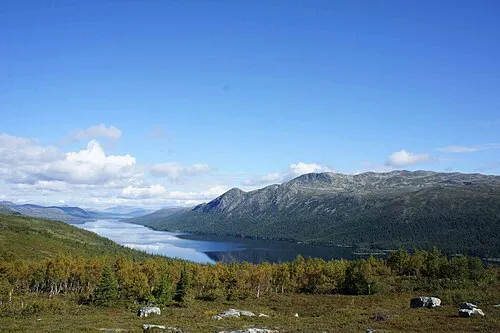 Himmelsraften Mountain, Krokoms Kommun24 km NE
Sources & licences
Data last updated: