Kaarinasvaara
Located in Kiruna Municipality, Norrbotten County Coordinates: 68°54′52″ N 20°49′31″ E
- Elevation
- 550 m
- above sea level
- Local time
- UTC+01:00
- Europe/Stockholm · UTC+01:00
- Airports
- BDU Bardufoss Airport93 km
- SOJ Sørkjosen Airport97 km
About Kaarinasvaara
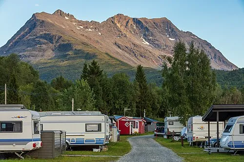
Kaarinasvaara is a mountain. Location: Kiruna Municipality, Norrbotten County. Elevation: 550 m. The best months to visit are July. The nearest airport is Bardufoss Airport (93 km). Nearby sights include Ristinasvaara and Njaŋggot.
Climate of Kaarinasvaara
Best months for sightseeingBest months for sightseeing: July.
This month · November
A cold month
Day -4° · Night -12° · Rain 35 mm
- Hottest month
- July (day 16°)
- Coldest month
- January (night -18°)
- Wettest month
- July (82 mm)
- Driest month
- April (23 mm)
Bars: average monthly low and high temperature. Below: precipitation. Monthly averages for 1970–2000 at about 18 km resolution, adjusted for elevation. Highlighted months are mild and relatively dry. Source: WorldClim 2.1 (CC BY 4.0).
Show values as a table
| Month | Jan | Feb | Mar | Apr | May | Jun | Jul | Aug | Sep | Oct | Nov | Dec |
|---|---|---|---|---|---|---|---|---|---|---|---|---|
| Average high (°C) | -8° | -8° | -4° | 0° | 6° | 13° | 16° | 14° | 8° | 1° | -4° | -7° |
| Average low (°C) | -18° | -17° | -14° | -9° | -2° | 4° | 7° | 6° | 1° | -4° | -12° | -17° |
| Precipitation (mm) | 36 | 27 | 26 | 23 | 29 | 48 | 82 | 63 | 44 | 43 | 35 | 35 |
Other places to visit in this season: July
How to get to Kaarinasvaara
The nearest airport is Bardufoss Airport (BDU), 93 km to the west as the crow flies. For international flights: Tromsø Airport (TOS) (114 km).
Airports
- Bardufoss Airport (BDU) Målselv 93 kmwest
- Sørkjosen Airport (SOJ) Sørkjosen 97 kmnorth
- Tromsø Airport (TOS) Tromsø 114 kmnorthwest
Straight-line distances; road distances are longer. Airport data: OurAirports.
Day trips from Kaarinasvaara
Within 100 km: 52 natural sites, 1 lake, river or coast.
0–25 km25 places
- Njaŋggot Mountain 3 kmSW
- Vutnošgielas Mountain 19 kmS
- Vahtsaoive Mountain 16 kmSE
- Váhccaoaivi Mountain 16 kmSE
25–60 km15 places
- Árjjatoaivi Mountain 28 kmS
- Čávskkasvárri Mountain 29 kmSE
- Cokcu Mountain 51 kmS
- Covrooaivi Mountain 26 kmS
60–100 km13 places
- Jebrensuolo Island 96 kmSW
- Ráhpes Vuoskkoaivi Mountain 66 kmSW
- Siuru Mountain 95 kmS
- Čovra Mountain 70 kmS
Straight-line distances.
Nearest towns and villages
Nearby attractions & nature
Everything nearby-
Ristinasvaara Mountain, Kiruna Municipality2.7 km N
-
Njaŋggot Mountain, Kiruna Municipality3.2 km SW
-
Roavvevárri Mountain, Kiruna Municipality3.9 km N
-
Boaldovárri Mountain, Kiruna Municipality5.3 km SW
-
Tadtjapahta Mountain, Kiruna Municipality5.4 km S
-
Čáhcebealvárri Mountain, Kiruna Municipality5.5 km N
-
Vuolit Derpmošvárri Mountain, Kiruna Municipality5.9 km S
-
Latnjavárri Mountain, Kiruna Municipality8.4 km W
Sources & licences
Data last updated: · 2 independent sources