Schwarzhorn
Located in Grindelwald, Interlaken-Oberhasli District Coordinates: 46°41′10″ N 8°04′32″ E
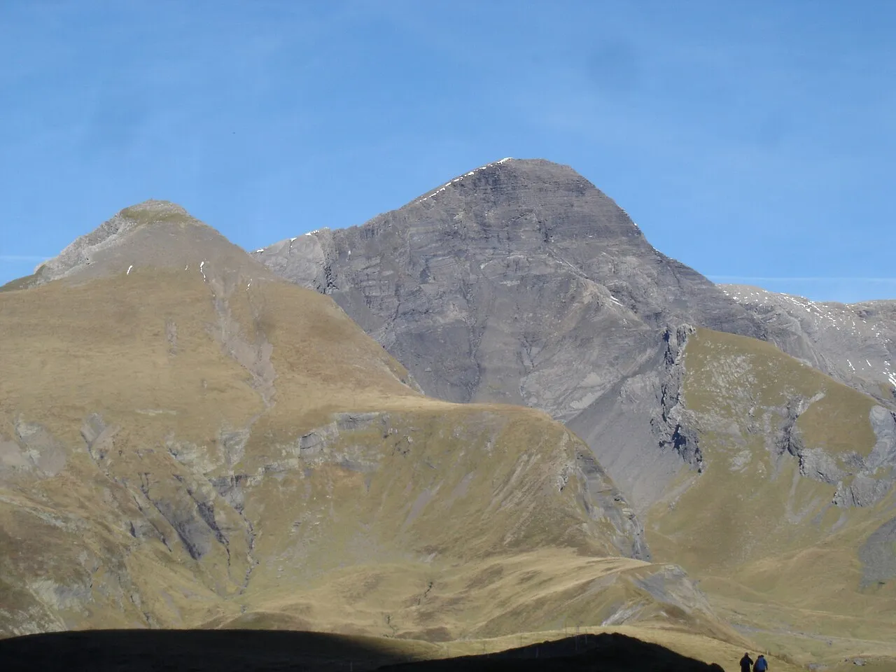
- Elevation
- 2,927 m
- above sea level
- Local time
- UTC+01:00
- Europe/Zurich · UTC+01:00
- Airports
- BRN Bern Airport51 km
- ZRH Zürich Airport93 km
About Schwarzhorn
Schwarzhorn is a mountain. Location: Grindelwald, Interlaken-Oberhasli District. Elevation: 2,927 m.
The Schwarzhorn is a mountain of the Bernese Alps, located between Brienz and Grindelwald in the Bernese Oberland. With a height of 2,928 metres above sea level, it is the highest summit of the group north of the Grosse Scheidegg Pass. The Schwarzhorn is also the highest point in the municipality of Brienz. A small glacier named Blau Gletscherli lies on the north side of the mountain. The Schwarzhorn is regarded as one of the most stunning look-out peaks in the Bernese Oberland.
Source: Wikipedia · CC BY-SA 4.0
At a glance
- Topographic prominence
- 966 m
Source: Wikidata
Photos of Schwarzhorn
-

Paradise Chronicle · CC BY-SA 4.0 -

Pmau · CC BY-SA 4.0 -

Björn S · CC BY-SA 2.0 -

M M from Switzerland · CC BY-SA 2.0 -

Earth Science and Remote Sensing Unit , Lyndon B. Johnson Space Center · Public domain


Climate of Schwarzhorn
This month · November
A wet month
Day -5° · Night -12° · Rain 111 mm
- Hottest month
- July (day 8°)
- Coldest month
- January (night -15°)
- Wettest month
- June (138 mm)
- Driest month
- January (93 mm)
Bars: average monthly low and high temperature. Below: precipitation. Monthly averages for 1970–2000 at about 18 km resolution, adjusted for elevation. Highlighted months are mild and relatively dry. Source: WorldClim 2.1 (CC BY 4.0).
Show values as a table
| Month | Jan | Feb | Mar | Apr | May | Jun | Jul | Aug | Sep | Oct | Nov | Dec |
|---|---|---|---|---|---|---|---|---|---|---|---|---|
| Average high (°C) | -9° | -8° | -6° | -4° | 2° | 5° | 8° | 8° | 4° | 0° | -5° | -8° |
| Average low (°C) | -15° | -15° | -13° | -11° | -6° | -4° | -1° | -1° | -4° | -7° | -12° | -14° |
| Precipitation (mm) | 93 | 96 | 97 | 106 | 117 | 138 | 134 | 133 | 101 | 109 | 111 | 104 |
How to get to Schwarzhorn
The nearest airport is Bern Airport (BRN), 51 km to the northwest as the crow flies. For international flights: Zürich Airport (ZRH) (93 km). The nearest large city is Bern, 56 km to the northwest.
Airports
- Bern Airport (BRN) Bern 51 kmnorthwest
- Zürich Airport (ZRH) Zurich 93 kmnorth
- Lugano Airport (LUG) Agno 99 kmsoutheast
Nearby large cities
- Bern Population: 121.6K 56 kmnorthwest
- Zurich Population: 415.4K 84 kmnortheast
- Winterthur Population: 111.8K 104 kmnortheast
- Basel Population: 177.6K 104 kmnorth
- Lausanne Population: 139.1K 112 kmwest
Straight-line distances; road distances are longer. Airport data: OurAirports.
Day trips from Schwarzhorn
Within 100 km: 231 historic and cultural sites, 6,609 natural sites, 916 lakes, rivers and coasts.
0–25 km883 places
- Strandbad Neuhaus Beach 20 kmW
- Strandbad Manor Farm Beach 20 kmW
- Strandbad Leissigen Beach 24 kmW
- Strandbad Iseltwald Beach 8 kmW
25–60 km3,021 places
- Kleiner Bremgartenwald Mountain 58 kmNW
- Lago Nero Lake 44 kmSE
- Insel Schwanau Island 55 kmNE
- Sankt-Niklausen-Insle Island 44 kmNE
60–100 km3,852 places
- Fahr Abbey Attraction 85 kmN
- Arbeiterstrandbad Tennwil Beach 70 kmN
- Ufenau Island 80 kmNE
- Sankt Petersinsel Island 83 kmNW
Straight-line distances.
Nearest towns and villages
-
Brienzwiler Municipality, Interlaken-Oberhasli District2.9 km NE
-
Oberläger Village, Grindelwald2.4 km S
-
Brienz (BE) Municipality, Interlaken-Oberhasli District5.8 km NW
-
Oberfeld Village, Brienzwiler2.6 km N
-
Grindelwald Village, Grindelwald7.5 km SW
-
Gidisdorf Village, Brienz (BE)3.6 km NW
Nearby attractions & nature
Everything nearby-
Blau Gletscherli Natural site, Grindelwald0.2 km NE
-
Grossi Chrinne Mountain, Grindelwald0.8 km SW
-
Wildgärst Mountain, Brienzwiler0.8 km N
-
Schrybershiri Mountain, Grindelwald0.8 km E
-
Gemschberg Mountain, Grindelwald1 km S
-
Gandig Mountain, Brienz (BE)1.2 km W
-
Chlyni Chrinne Mountain, Brienz (BE)1.3 km SW
-
Gärstenhoren Mountain, Brienz (BE)1.4 km NW
More nature in Switzerland
-
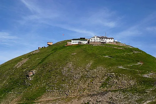 Faulhorn Mountain, Grindelwald6 km W
-
Bandspitz Mountain, Grindelwald1.5 km E
-
Schilt Mountain, Grindelwald1.6 km SW
-
Widderfeldgrätli Mountain, Grindelwald1.9 km SW
-
Hohbiel Mountain, Grindelwald2.1 km S
-
Cheerhubel Mountain, Grindelwald2.6 km E
Sources & licences
Data last updated: · 2 independent sources