Finsteraarhorn
Located in Guttannen, Interlaken-Oberhasli District Coordinates: 46°32′14″ N 8°07′34″ E
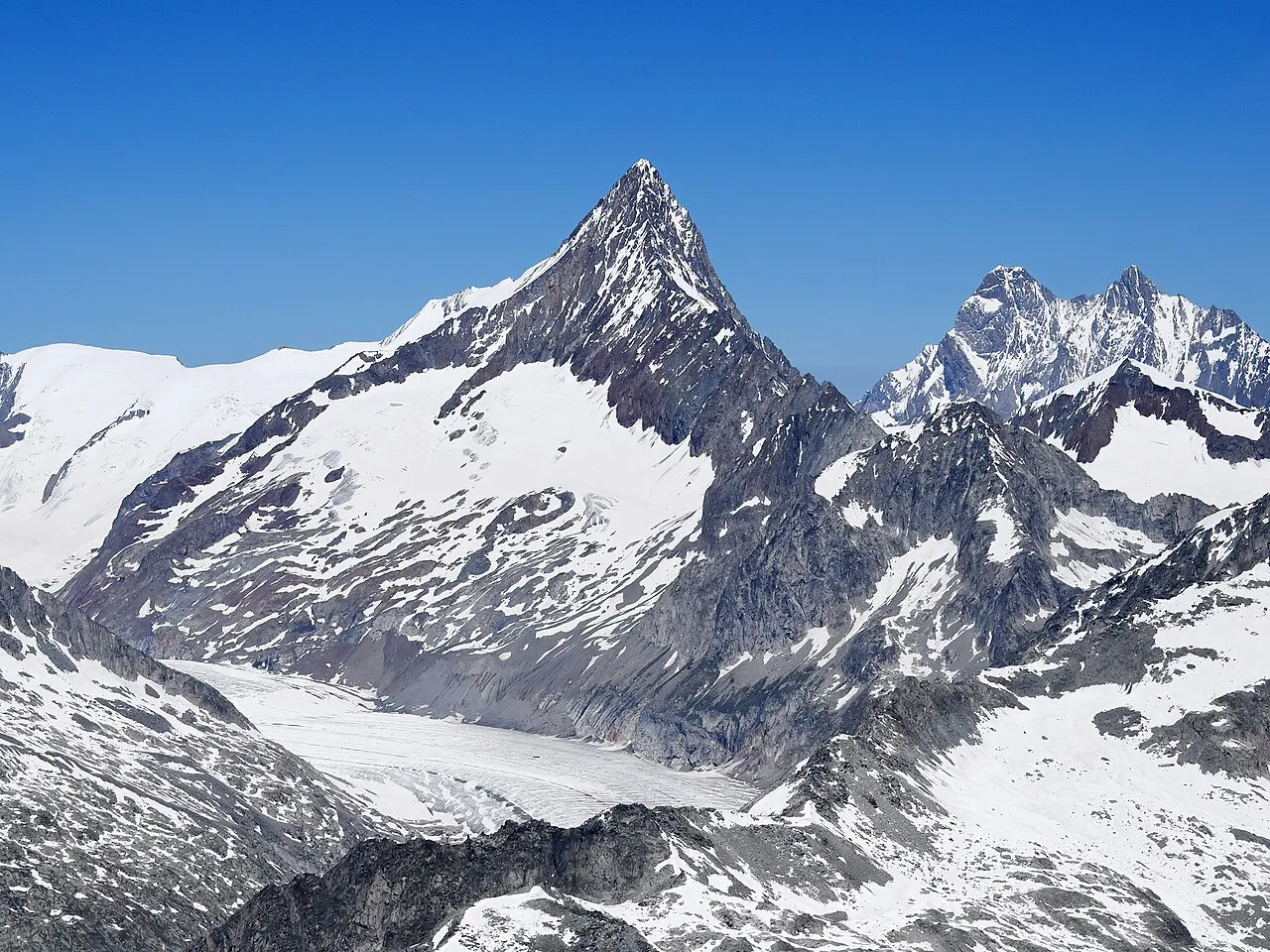
- Elevation
- 4,273 m
- above sea level
- Local time
- UTC+01:00
- Europe/Zurich · UTC+01:00
- Airports
- BRN Bern Airport64 km
- LUG Lugano Airport85 km
About Finsteraarhorn
Finsteraarhorn is a mountain. Location: Guttannen, Interlaken-Oberhasli District. Elevation: 4,273 m.
The Finsteraarhorn (4,274 m; 14,022 ft) is a mountain lying on the border between the cantons of Bern and Valais. It is the highest mountain of the Bernese Alps and the most prominent peak of Switzerland. The Finsteraarhorn is the ninth-highest mountain and third-most prominent peak in the Alps. In 2001 the whole massif and surrounding glaciers were designated as part of the Jungfrau-Aletsch World Heritage Site.
Source: Wikipedia · CC BY-SA 4.0
At a glance
- Topographic prominence
- 2,278 m
Source: Wikidata
Photos of Finsteraarhorn
-

Andrew Bossi · CC BY-SA 2.5 -

FkMohr · CC BY-SA 3.0 de -

Paradise Chronicle · CC BY-SA 4.0 -

Paradise Chronicle · CC BY-SA 4.0 -

Hp.Baumeler · CC BY-SA 4.0


Climate of Finsteraarhorn
This month · November
A cold month
Day -13° · Night -18° · Rain 82 mm
- Hottest month
- August (day -3°)
- Coldest month
- February (night -22°)
- Wettest month
- August (86 mm)
- Driest month
- February (72 mm)
Bars: average monthly low and high temperature. Below: precipitation. Monthly averages for 1970–2000 at about 18 km resolution, adjusted for elevation. Highlighted months are mild and relatively dry. Source: WorldClim 2.1 (CC BY 4.0).
Show values as a table
| Month | Jan | Feb | Mar | Apr | May | Jun | Jul | Aug | Sep | Oct | Nov | Dec |
|---|---|---|---|---|---|---|---|---|---|---|---|---|
| Average high (°C) | -16° | -17° | -16° | -14° | -9° | -6° | -3° | -3° | -5° | -9° | -13° | -15° |
| Average low (°C) | -22° | -22° | -21° | -19° | -15° | -11° | -8° | -8° | -10° | -13° | -18° | -20° |
| Precipitation (mm) | 76 | 72 | 80 | 75 | 75 | 83 | 85 | 86 | 74 | 75 | 82 | 76 |
How to get to Finsteraarhorn
The nearest airport is Bern Airport (BRN), 64 km to the northwest as the crow flies. For international flights: Zürich Airport (ZRH) (107 km). The nearest large city is Bern, 69 km to the northwest.
Airports
- Bern Airport (BRN) Bern 64 kmnorthwest
- Lugano Airport (LUG) Agno 85 kmsoutheast
- Zürich Airport (ZRH) Zurich 107 kmnorth
Nearby large cities
- Bern Population: 121.6K 69 kmnorthwest
- Zurich Population: 415.4K 98 kmnorth
- Lausanne Population: 139.1K 115 kmwest
- Winterthur Population: 111.8K 117 kmnortheast
- Basel Population: 177.6K 121 kmnorth
Straight-line distances; road distances are longer. Airport data: OurAirports.
Day trips from Finsteraarhorn
Within 100 km: 206 historic and cultural sites, 6,756 natural sites, 892 lakes, rivers and coasts.
0–25 km959 places
- Strandbad Iseltwald Beach 23 kmNW
- Strandbad Brienz Beach 25 kmN
- Schnäggeninseli Island 23 kmNW
- Grimselsee Lake 14 kmE
25–60 km3,241 places
- Strandbad Neuhaus Beach 28 kmNW
- Strandbad Manor Farm Beach 29 kmNW
- Strandbad Leissigen Beach 30 kmNW
- Lago Nero Lake 33 kmE
60–100 km3,654 places
- Kleiner Bremgartenwald Mountain 72 kmNW
- Fahr Abbey Attraction 100 kmN
- Arbeiterstrandbad Tennwil Beach 86 kmN
- Ufenau Island 90 kmNE
Straight-line distances.
Nearest towns and villages
-
Fieschertal Municipality, Goms District6.2 km SW
-
Grindelwald Municipality, Interlaken-Oberhasli District11 km NW
-
Bellwald Municipality, Goms District11 km S
-
Grindelwald Village, Grindelwald12 km NW
-
Goms Municipality, Goms District12 km SE
-
Bellwald Village, Bellwald12 km S
Nearby attractions & nature
Everything nearby-
Agassizhorn Mountain, Grindelwald1.4 km NW
-
Studerhorn Mountain, Fieschertal1.7 km E
-
Nasse Strahlegg Mountain, Guttannen1.9 km N
-
Walliser Fiescherfirn Natural site, Fieschertal2.5 km W
-
Finsteraargletscher Natural site, Guttannen2.6 km NE
-
Finsteraarrothorn Mountain, Fieschertal2.8 km SE
-
Studergletscher Natural site, Fieschertal2.7 km SE
-
Alte Strahlegg Mountain, Guttannen2.8 km N
More nature in Switzerland
-
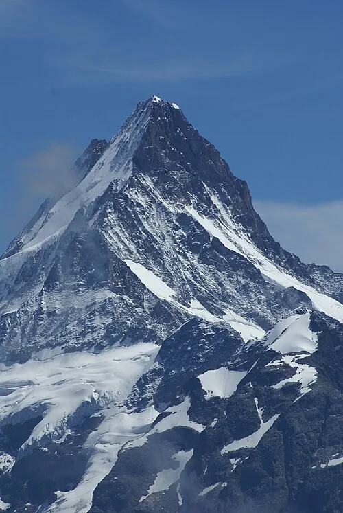 Schreckhorn Mountain, Guttannen5.9 km N
-
Strahlegggletscher Natural site, Guttannen2.9 km N
-
Oberaarhorn Mountain, Guttannen3.8 km E
-
Lauteraar Rothörner Mountain, Guttannen3.9 km NE
-
Grunerhorn Mountain, Guttannen4.3 km E
-
Hugihorn Mountain, Guttannen4.3 km N
Sources & licences
Data last updated: · 2 independent sources