Eiger
Located in Lauterbrunnen, Interlaken-Oberhasli District Coordinates: 46°34′39″ N 8°00′19″ E
- Elevation
- 3,967 m
- above sea level
- Local time
- UTC+01:00
- Europe/Zurich · UTC+01:00
- Airports
- BRN Bern Airport54 km
- LUG Lugano Airport94 km
About Eiger
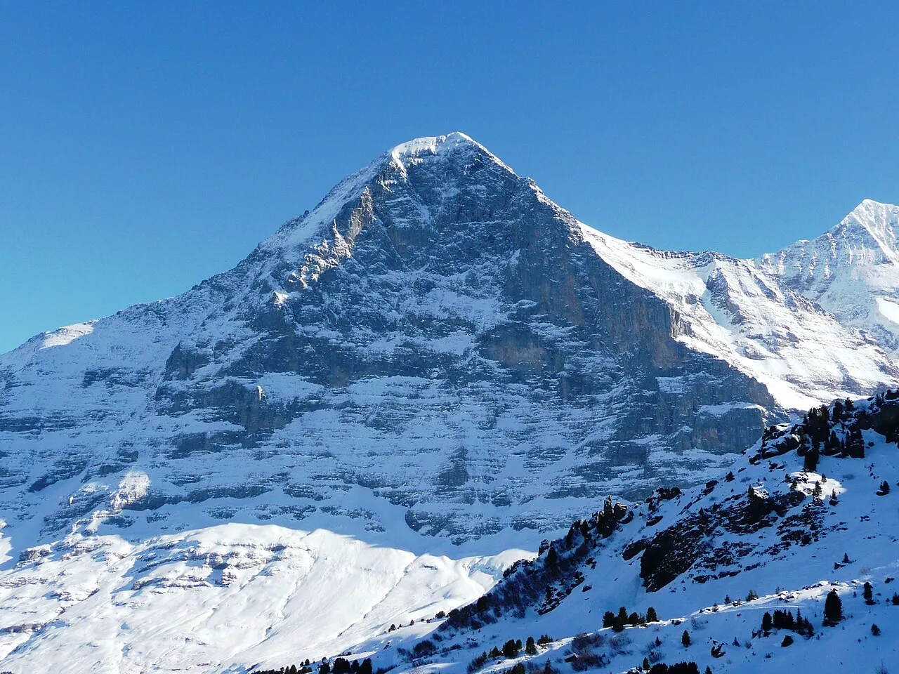
Eiger is a mountain. Location: Lauterbrunnen, Interlaken-Oberhasli District. Elevation: 3,967 m.
The Eiger (Swiss Standard German pronunciation: [ˈaɪɡər] ) is a 3,967-metre (13,015 ft) mountain of the Bernese Alps, overlooking Grindelwald and Lauterbrunnen in the Bernese Oberland of Switzerland, just north of the main watershed and border with Valais. It is the easternmost peak of a ridge crest that extends across the Mönch to the Jungfrau at 4,158 m (13,642 ft), constituting one of the most emblematic sights of the Swiss Alps.
Source: Wikipedia · CC BY-SA 4.0
At a glance
- Topographic prominence
- 361 m
Source: Wikidata
Photos of Eiger
-

Andrew Bossi · CC BY-SA 2.5 -

Giles Laurent · CC BY-SA 4.0 -

Giles Laurent · CC BY-SA 4.0 -

Andrew Bossi · CC BY-SA 2.5 -
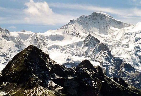
Jungfrau Roland Zumbühl, Arlesheim · CC BY-SA 3.0


Climate of Eiger
This month · November
A cold month
Day -11° · Night -16° · Rain 82 mm
- Hottest month
- August (day -1°)
- Coldest month
- February (night -20°)
- Wettest month
- August (86 mm)
- Driest month
- February (72 mm)
Bars: average monthly low and high temperature. Below: precipitation. Monthly averages for 1970–2000 at about 18 km resolution, adjusted for elevation. Highlighted months are mild and relatively dry. Source: WorldClim 2.1 (CC BY 4.0).
Show values as a table
| Month | Jan | Feb | Mar | Apr | May | Jun | Jul | Aug | Sep | Oct | Nov | Dec |
|---|---|---|---|---|---|---|---|---|---|---|---|---|
| Average high (°C) | -14° | -15° | -14° | -12° | -7° | -4° | -1° | -1° | -3° | -7° | -11° | -13° |
| Average low (°C) | -20° | -20° | -19° | -17° | -13° | -9° | -6° | -6° | -8° | -11° | -16° | -18° |
| Precipitation (mm) | 76 | 72 | 80 | 75 | 75 | 83 | 85 | 86 | 74 | 75 | 82 | 76 |
How to get to Eiger
The nearest airport is Bern Airport (BRN), 54 km to the northwest as the crow flies. For international flights: Zürich Airport (ZRH) (106 km). The nearest large city is Bern, 59 km to the northwest.
Airports
- Bern Airport (BRN) Bern 54 kmnorthwest
- Lugano Airport (LUG) Agno 94 kmsoutheast
- Zürich Airport (ZRH) Zurich 106 kmnortheast
Nearby large cities
- Bern Population: 121.6K 59 kmnorthwest
- Zurich Population: 415.4K 97 kmnortheast
- Lausanne Population: 139.1K 105 kmwest
- Basel Population: 177.6K 114 kmnorth
- Winterthur Population: 111.8K 117 kmnortheast
Straight-line distances; road distances are longer. Airport data: OurAirports.
Day trips from Eiger
Within 100 km: 217 historic and cultural sites, 6,692 natural sites, 870 lakes, rivers and coasts.
0–25 km873 places
- Strandbad Neuhaus Beach 18 kmNW
- Strandbad Manor Farm Beach 19 kmNW
- Strandbad Leissigen Beach 20 kmNW
- Strandbad Iseltwald Beach 15 kmN
25–60 km3,172 places
- Lago Nero Lake 43 kmE
- Sankt-Niklausen-Insle Island 57 kmNE
- Neptun-Inseln Island 58 kmNE
- Lorelei-Inseln Island 58 kmNE
60–100 km3,734 places
- Kleiner Bremgartenwald Mountain 62 kmNW
- Fahr Abbey Attraction 98 kmN
- Arbeiterstrandbad Tennwil Beach 82 kmN
- Ufenau Island 92 kmNE
Straight-line distances.
Nearest towns and villages
-
Grindelwald Municipality, Interlaken-Oberhasli District5.8 km NE
-
Grindelwald Village, Grindelwald5.7 km NE
-
Mettla Village, Grindelwald2.4 km NW
-
Alpiglen Village, Grindelwald2.5 km N
-
Bustiglen Village, Grindelwald3.1 km NW
-
Bidem Village, Grindelwald3.5 km N
Nearby attractions & nature
Everything nearby-
Grosser Turm Mountain, Grindelwald0.6 km NE
-
Chlyne Eiger Mountain, Lauterbrunnen1 km SW
-
Obers Ischmeer Natural site, Grindelwald1.4 km S
-
Rotstock Mountain, Grindelwald1.7 km W
-
Eigergletscher Natural site, Lauterbrunnen1.6 km SW
-
Challifirn Natural site, Grindelwald1.9 km E
-
Mönch Mountain, Lauterbrunnen2.2 km S
-
Rots Brätt Mountain, Grindelwald2.2 km NE
More nature in Switzerland
-
Jungfrau Mountain, Lauterbrunnen5.6 km SW
-
Nollengletscher Natural site, Lauterbrunnen2.5 km SW
-
Kleine Scheidegg Mountain, Lauterbrunnen3.5 km W
-
Guggigletscher Natural site, Lauterbrunnen3.5 km SW
-
Mathildespitze Mountain, Lauterbrunnen4.1 km SW
-
Wyssi Flue Mountain, Lauterbrunnen4.3 km W
Sources & licences
Data last updated: · 2 independent sources