- Elevation
- 3,238 m
- above sea level
- Local time
- UTC+01:00
- Europe/Zurich · UTC+01:00
- Airports
- BRN Bern Airport73 km
- ZRH Zürich Airport77 km
About Titlis
Titlis is a mountain. Location: Engelberg, Obwalden. Elevation: 3,238 m.
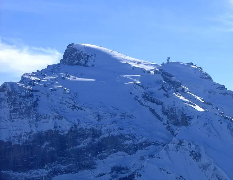
Titlis is a mountain of the Uri Alps, located on the border between the cantons of Obwalden and Bern. At 3,238 metres (10,623 ft) above sea level, it is the highest summit of the range north of the Susten Pass, between the Bernese Oberland and Central Switzerland. It is mainly accessed from Engelberg (OW) on the north side and is famous as the site of the world's first rotating cable car.
Source: Wikipedia · CC BY-SA 4.0
Photos of Titlis
-

MatthiasKabel · CC BY-SA 3.0 -

Miscellaneous Items in High Demand, PPOC, Library of Congress · Public domain -

W. Bulach · CC BY-SA 4.0 -

Wikimedia Commons · CC BY 4.0 -
Gross Spannort Mussklprozz · CC BY-SA 3.0


Climate of Titlis
This month · November
A wet month
Day -7° · Night -12° · Rain 121 mm
- Hottest month
- August (day 5°)
- Coldest month
- February (night -16°)
- Wettest month
- July (144 mm)
- Driest month
- February (96 mm)
Bars: average monthly low and high temperature. Below: precipitation. Monthly averages for 1970–2000 at about 18 km resolution, adjusted for elevation. Highlighted months are mild and relatively dry. Source: WorldClim 2.1 (CC BY 4.0).
Show values as a table
| Month | Jan | Feb | Mar | Apr | May | Jun | Jul | Aug | Sep | Oct | Nov | Dec |
|---|---|---|---|---|---|---|---|---|---|---|---|---|
| Average high (°C) | -10° | -10° | -9° | -7° | -3° | 1° | 4° | 5° | 2° | -2° | -7° | -9° |
| Average low (°C) | -16° | -16° | -15° | -13° | -8° | -5° | -3° | -2° | -5° | -8° | -12° | -15° |
| Precipitation (mm) | 103 | 96 | 109 | 121 | 124 | 141 | 144 | 138 | 119 | 119 | 121 | 111 |
How to get to Titlis
The nearest airport is Bern Airport (BRN), 73 km to the west as the crow flies. For international flights: Zürich Airport (ZRH) (77 km). The nearest large city is Zurich, 67 km to the north.
Airports
- Bern Airport (BRN) Bern 73 kmwest
- Zürich Airport (ZRH) Zurich 77 kmnorth
- Lugano Airport (LUG) Agno 93 kmsoutheast
Nearby large cities
- Zurich Population: 415.4K 67 kmnorth
- Bern Population: 121.6K 78 kmwest
- Winterthur Population: 111.8K 84 kmnorth
- Basel Population: 177.6K 109 kmnorthwest
- Mulhouse Population: 111.4K 138 kmnorthwest
Straight-line distances; road distances are longer. Airport data: OurAirports.
Day trips from Titlis
Within 100 km: 258 historic and cultural sites, 6,720 natural sites, 988 lakes, rivers and coasts.
0–25 km1,118 places
- Neptun-Inseln Island 18 kmNE
- Lorelei-Inseln Island 19 kmNE
- Sarnersee Lake 20 kmNW
- Oberalpsee Lake 21 kmSE
25–60 km3,011 places
- Strandbad Neuhaus Beach 49 kmW
- Strandbad Manor Farm Beach 49 kmW
- Strandbad Leissigen Beach 53 kmW
- Strandbad Iseltwald Beach 36 kmW
60–100 km3,837 places
- Kleiner Bremgartenwald Mountain 80 kmW
- Fahr Abbey Attraction 71 kmN
- Arbeiterstrandbad Tennwil Beach 61 kmN
- Isole di Brissago Island 75 kmS
Straight-line distances.
Nearest towns and villages
-
Engelberg Village, Engelberg6.1 km NW
-
Holzhostatt Village, Engelberg3.1 km N
-
Nieder Surenen Alp Village, Engelberg3.7 km E
-
Fürenalp Village, Engelberg4 km NE
-
Gerschnialp Village, Engelberg5.2 km N
-
Steingletscher Village, Innertkirchen4.7 km S
Nearby attractions & nature
Everything nearby-
Tierberg Mountain, Engelberg0.7 km E
-
Stotzig-Egg Natural site, Engelberg0.7 km NW
-
Firnalpeligletscher Natural site, Engelberg0.8 km E
-
Klein Titlis Mountain, Innertkirchen1 km W
-
Rotstöckli Mountain, Engelberg1.1 km NW
-
Galtiberggletscher Natural site, Engelberg1 km NW
-
Wendengletscher Natural site, Innertkirchen1 km S
-
Titlisgletscher Natural site, Engelberg1.1 km W
Sources & licences
Data last updated: · 2 independent sources