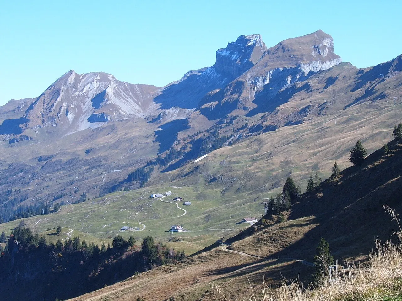
- Elevation
- 2,282 m
- above sea level
- Local time
- UTC+01:00
- Europe/Zurich · UTC+01:00
- Airports
- ZRH Zürich Airport55 km
- ACH Sankt Gallen Altenrhein Airport77 km
About Druesberg
Druesberg is a mountain. Location: Muotathal, Schwyz District. Elevation: 2,282 m.
The Druesberg, or Drusberg, is a mountain located north of Pragel Pass in the Schwyzer Alps and the canton of Schwyz, Switzerland. It lies on the range between Unteriberg and Muotathal. The skiing and hiking area Hoch-Ybrig lies to the north-west of the mountain summit, on the slopes into the valleys of the Minster and Waag rivers. To the north-east, the mountain is drained by the upper reaches of the Sihl, which eventually flows to the centre of the city of Zurich.
Source: Wikipedia · CC BY-SA 4.0
At a glance
- Topographic prominence
- 722 m
Source: Wikidata
Photos of Druesberg
-

Chris.urs-o · CC BY-SA 3.0 -

Chris.urs-o · CC BY-SA 4.0 -

Patrick Nouhailler's… · CC BY-SA 3.0 -

Dietrich Michael Weidmann · CC BY-SA 3.0 -

Patrick Nouhailler's… · CC BY-SA 3.0


Climate of Druesberg
This month · November
A wet month
Day -2° · Night -8° · Rain 135 mm
- Hottest month
- July (day 11°)
- Coldest month
- January (night -11°)
- Wettest month
- July (198 mm)
- Driest month
- January (105 mm)
Bars: average monthly low and high temperature. Below: precipitation. Monthly averages for 1970–2000 at about 18 km resolution, adjusted for elevation. Highlighted months are mild and relatively dry. Source: WorldClim 2.1 (CC BY 4.0).
Show values as a table
| Month | Jan | Feb | Mar | Apr | May | Jun | Jul | Aug | Sep | Oct | Nov | Dec |
|---|---|---|---|---|---|---|---|---|---|---|---|---|
| Average high (°C) | -5° | -5° | -2° | 1° | 6° | 9° | 11° | 11° | 8° | 3° | -2° | -4° |
| Average low (°C) | -11° | -11° | -9° | -7° | -2° | 1° | 3° | 3° | 0° | -3° | -8° | -10° |
| Precipitation (mm) | 105 | 105 | 113 | 139 | 151 | 188 | 198 | 185 | 150 | 130 | 135 | 120 |
How to get to Druesberg
The nearest airport is Zürich Airport (ZRH), 55 km to the northwest as the crow flies. The nearest large city is Zurich, 46 km to the northwest.
Airports
- Zürich Airport (ZRH) Zurich 55 kmnorthwest
- Sankt Gallen Altenrhein Airport (ACH) St. Gallen 77 kmnortheast
- Bodensee Airport Friedrichshafen (FDH) Friedrichshafen 90 kmnortheast
Nearby large cities
- Zurich Population: 415.4K 46 kmnorthwest
- Winterthur Population: 111.8K 56 kmnorth
- Bern Population: 121.6K 106 kmwest
- Basel Population: 177.6K 114 kmnorthwest
- Freiburg im Breisgau Population: 237.5K 133 kmnorthwest
Straight-line distances; road distances are longer. Airport data: OurAirports.
Day trips from Druesberg
Within 100 km: 400 historic and cultural sites, 6,743 natural sites, 1,123 lakes, rivers and coasts.
0–25 km831 places
- Ufenau Island 24 kmN
- Insel Lützelau Island 24 kmN
- Schönenwerd Island 24 kmN
- Insel Schwanau Island 18 kmW
25–60 km2,691 places
- Fahr Abbey Attraction 54 kmNW
- Arbeiterstrandbad Tennwil Beach 57 kmNW
- Saffa Insel Island 45 kmNW
- Sankt-Niklausen-Insle Island 36 kmW
60–100 km4,744 places
- Mainau Island 83 kmN
- Dominikanerinsel Konstanz Island 78 kmN
- Strandbad Steckborn Beach 74 kmN
- Strandbad Neuhaus Beach 86 kmSW
Straight-line distances.
Nearest towns and villages
-
Unteriberg Municipality, Schwyz District4.9 km N
-
Muotathal Village, Muotathal6.1 km SW
-
Oberiberg Municipality, Schwyz District4.9 km NW
-
Riedmattli Village, Muotathal3.1 km SW
-
Hoch-Ybrig Village, Unteriberg2.5 km NW
-
Seebli LWS Village, Oberiberg3.4 km W
Nearby attractions & nature
Everything nearby-
Rot Grind Mountain, Muotathal0.6 km S
-
Chläbdächer Mountain, Muotathal0.7 km E
-
Teuf Hund Mountain, Muotathal0.8 km E
-
Forstberg Mountain, Muotathal0.8 km SW
-
Gämsstafelchopf Mountain, Muotathal0.9 km SE
-
Twäriberg Mountain, Oberiberg0.9 km N
-
Höch Hund Mountain, Unteriberg1 km E
-
Rütistein Mountain, Unteriberg1.1 km NE
Sources & licences
Data last updated: · 2 independent sources