- Population
- 3,145
- 3.1K
- Elevation
- 2,003 m
- above sea level
- Local time
- UTC+01:00
- Europe/Zurich · UTC+01:00
- Places inside
- 83
- listed under Arosa
- Airports
- ACH Sankt Gallen Altenrhein Airport80 km
- FDH Bodensee Airport Friedrichshafen101 km
About Arosa
Arosa is a municipality. Location: Region Plessur, Grisons. Population: 3,145. Elevation: 2,003 m. The nearest airport is Sankt Gallen Altenrhein Airport (80 km). Nearby sights include Schaftällihorn and Gamschtällihorn.
Climate of Arosa
This month · November
A cold month
Day 2° · Night -6° · Rain 98 mm
- Hottest month
- July (day 15°)
- Coldest month
- February (night -10°)
- Wettest month
- July (149 mm)
- Driest month
- February (72 mm)
Bars: average monthly low and high temperature. Below: precipitation. Monthly averages for 1970–2000 at about 18 km resolution, adjusted for elevation. Highlighted months are mild and relatively dry. Source: WorldClim 2.1 (CC BY 4.0).
Show values as a table
| Month | Jan | Feb | Mar | Apr | May | Jun | Jul | Aug | Sep | Oct | Nov | Dec |
|---|---|---|---|---|---|---|---|---|---|---|---|---|
| Average high (°C) | -2° | -1° | 1° | 3° | 8° | 12° | 15° | 14° | 11° | 7° | 2° | -1° |
| Average low (°C) | -10° | -10° | -8° | -5° | 0° | 3° | 5° | 5° | 2° | -1° | -6° | -9° |
| Precipitation (mm) | 85 | 72 | 84 | 93 | 109 | 139 | 149 | 144 | 120 | 99 | 98 | 88 |
How to get to Arosa
The nearest airport is Sankt Gallen Altenrhein Airport (ACH), 80 km to the north as the crow flies. For international flights: Bodensee Airport Friedrichshafen (FDH) (101 km). The nearest large city is Zurich, 108 km to the northwest.
Airports
- Sankt Gallen Altenrhein Airport (ACH) St. Gallen 80 kmnorth
- Bodensee Airport Friedrichshafen (FDH) Friedrichshafen 101 kmnorth
- Lugano Airport (LUG) Agno 103 kmsouthwest
Nearby large cities
- Zurich Population: 415.4K 108 kmnorthwest
- Winterthur Population: 111.8K 109 kmnorthwest
- Innsbruck Population: 132.5K 142 kmnortheast
- Bern Population: 121.6K 170 kmwest
- Basel Population: 177.6K 182 kmnorthwest
Straight-line distances; road distances are longer. Airport data: OurAirports.
Day trips from Arosa
Within 100 km: 213 historic and cultural sites, 6,959 natural sites, 986 lakes, rivers and coasts.
0–25 km597 places
- Lake Davos Lake 15 kmNE
- Lai Alv Lake 24 kmSE
- Gotschnaseeli Lake 17 kmNE
- Lai Plang Bi Lake 6 kmSW
25–60 km3,294 places
- Chaviolas Island 39 kmS
- Lajets Lake 31 kmS
- Walensee Lake 53 kmNW
- Silvaplanersee Lake 36 kmS
60–100 km4,267 places
- Lago Nero Lake 93 kmW
- Ufenau Island 84 kmNW
- Insel Lützelau Island 83 kmNW
- Schönenwerd Island 87 kmNW
Straight-line distances.
Places in Arosa
83 placesCities & villages1
- Strassberg · Village
Mountains & nature18
- Seta · Mountain
- Siliadür · Mountain
- Spitzenbüel · Mountain
- Spitzig Gretli · Mountain
- Stelli · Mountain
- Strel · Mountain
- Tamial · Mountain
- Tiejer Flue · Mountain
- Tiejer Hauptji · Mountain
- Tschirpen · Mountain
- Valbellahorn · Mountain
- Wangegg · Mountain
- Wangegg · Mountain
- Weissfluh · Mountain
- Weissfluh Nordgipfel · Mountain
- Zalüenja · Mountain
- Zenji · Mountain
- Zenjiflue · Mountain
Lakes, rivers & coasts4
- Stausee Isel · Lake
- Totseeli · Lake
- Unter Prätschsee · Lake
- Untersee · Lake
Nearby attractions & nature
Everything nearby-
Schaftällihorn Mountain, Albula/Alvra1.7 km SW
-
Gamschtällihorn Mountain, Albula/Alvra3.3 km SW
-
Plattenhorn Mountain, Chur3.4 km W
-
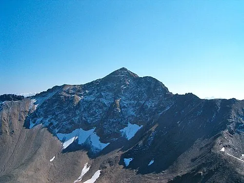 Aroser Rothorn Mountain, Albula/Alvra5.2 km SW
-
Hülli Mountain, Chur3.7 km NW
-
Erzhorn Mountain, Albula/Alvra3.9 km SW
-
Wallagrind Mountain, Chur3.9 km NW
-
Piz Culmet Mountain, Albula/Alvra4.1 km SW
Sources & licences
Data last updated: