Mottabühel
Located in Seewis im Prättigau, Region Prättigau / Davos Coordinates: 47°02′07″ N 9°40′46″ E
- Elevation
- 1,841 m
- above sea level
- Local time
- UTC+01:00
- Europe/Zurich · UTC+01:00
- Airports
- ACH Sankt Gallen Altenrhein Airport51 km
- FDH Bodensee Airport Friedrichshafen72 km
About Mottabühel
Mottabühel is a mountain. Location: Seewis im Prättigau, Region Prättigau / Davos. Elevation: 1,841 m. The nearest airport is Sankt Gallen Altenrhein Airport (51 km). Nearby sights include Ronenbühel and Rätikon.
Photos of Mottabühel
-
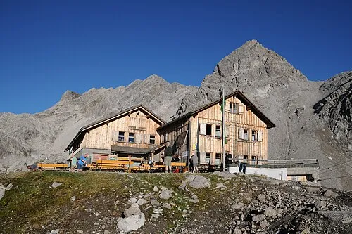
Zirmenkopf böhringer friedrich · CC BY-SA 2.5 -
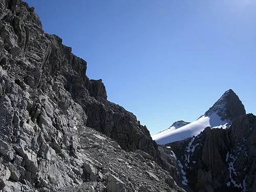
Rätikon Giac01 · Public domain -
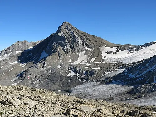
Schesaplana Jörg Braukmann · CC BY-SA 4.0


Climate of Mottabühel
This month · November
A wet month
Day 2° · Night -5° · Rain 117 mm
- Hottest month
- July (day 15°)
- Coldest month
- February (night -9°)
- Wettest month
- July (183 mm)
- Driest month
- February (97 mm)
Bars: average monthly low and high temperature. Below: precipitation. Monthly averages for 1970–2000 at about 18 km resolution, adjusted for elevation. Highlighted months are mild and relatively dry. Source: WorldClim 2.1 (CC BY 4.0).
Show values as a table
| Month | Jan | Feb | Mar | Apr | May | Jun | Jul | Aug | Sep | Oct | Nov | Dec |
|---|---|---|---|---|---|---|---|---|---|---|---|---|
| Average high (°C) | -1° | -1° | 2° | 4° | 9° | 12° | 15° | 15° | 12° | 8° | 2° | 0° |
| Average low (°C) | -8° | -9° | -6° | -4° | 1° | 4° | 6° | 6° | 4° | 0° | -5° | -7° |
| Precipitation (mm) | 104 | 97 | 102 | 110 | 126 | 165 | 183 | 171 | 134 | 104 | 117 | 112 |
How to get to Mottabühel
The nearest airport is Sankt Gallen Altenrhein Airport (ACH), 51 km to the north as the crow flies. For international flights: Bodensee Airport Friedrichshafen (FDH) (72 km). The nearest large city is Winterthur, 89 km to the northwest.
Airports
- Sankt Gallen Altenrhein Airport (ACH) St. Gallen 51 kmnorth
- Bodensee Airport Friedrichshafen (FDH) Friedrichshafen 72 kmnorth
- Zürich Airport (ZRH) Zurich 98 kmnorthwest
Nearby large cities
- Winterthur Population: 111.8K 89 kmnorthwest
- Zurich Population: 415.4K 93 kmnorthwest
- Innsbruck Population: 132.5K 133 kmeast
- Ulm Population: 120.5K 153 kmnorth
- Reutlingen Population: 112.6K 166 kmnorth
Straight-line distances; road distances are longer. Airport data: OurAirports.
Day trips from Mottabühel
Within 100 km: 358 historic and cultural sites, 6,746 natural sites, 1,195 lakes, rivers and coasts.
0–25 km604 places
- Gotschnaseeli Lake 23 kmSE
- Saysersee Lake 18 kmS
- Chapfensee Lake 23 kmW
- Malpraggsee Lake 18 kmSW
25–60 km3,019 places
- Walensee Lake 38 kmW
- Wägitalersee Lake 58 kmW
- Lake Davos Lake 27 kmSE
- Obersee Lake 51 kmW
60–100 km4,676 places
- Mainau Island 83 kmNW
- Dominikanerinsel Konstanz Island 80 kmNW
- Strandbad Steckborn Beach 88 kmNW
- Ufenau Island 71 kmW
Straight-line distances.
Nearest towns and villages
-
Valarsäge Village, Seewis im Prättigau0.3 km E
-
Vordersäss Village, Seewis im Prättigau1.8 km E
-
Hintersäss Village, Seewis im Prättigau3.5 km E
-
Fanas Village, Grüsch5.7 km S
-
Schiers Municipality, Region Prättigau / Davos7 km SE
-
Grüsch Village, Grüsch6.7 km S
Nearby attractions & nature
Everything nearby-
Ronenbühel Mountain, Seewis im Prättigau0.6 km W
-
Rätikon Mountain, Austria2.9 km NE
-
Schesaplana Mountain, Switzerland3 km NE
-
Picardichopf Mountain, Grüsch1.7 km SE
-
Alpstein Mountain, Switzerland2 km NE
-
Schafköpfe Mountain, Vorarlberg2.4 km NE
-
Rothorn Mountain, Seewis im Prättigau2.5 km N
-
Pfäwi Mountain, Grüsch2.6 km SE
Sources & licences
Data last updated: