Vorab
Located in Laax, Region Surselva Coordinates: 46°52′26″ N 9°09′24″ E
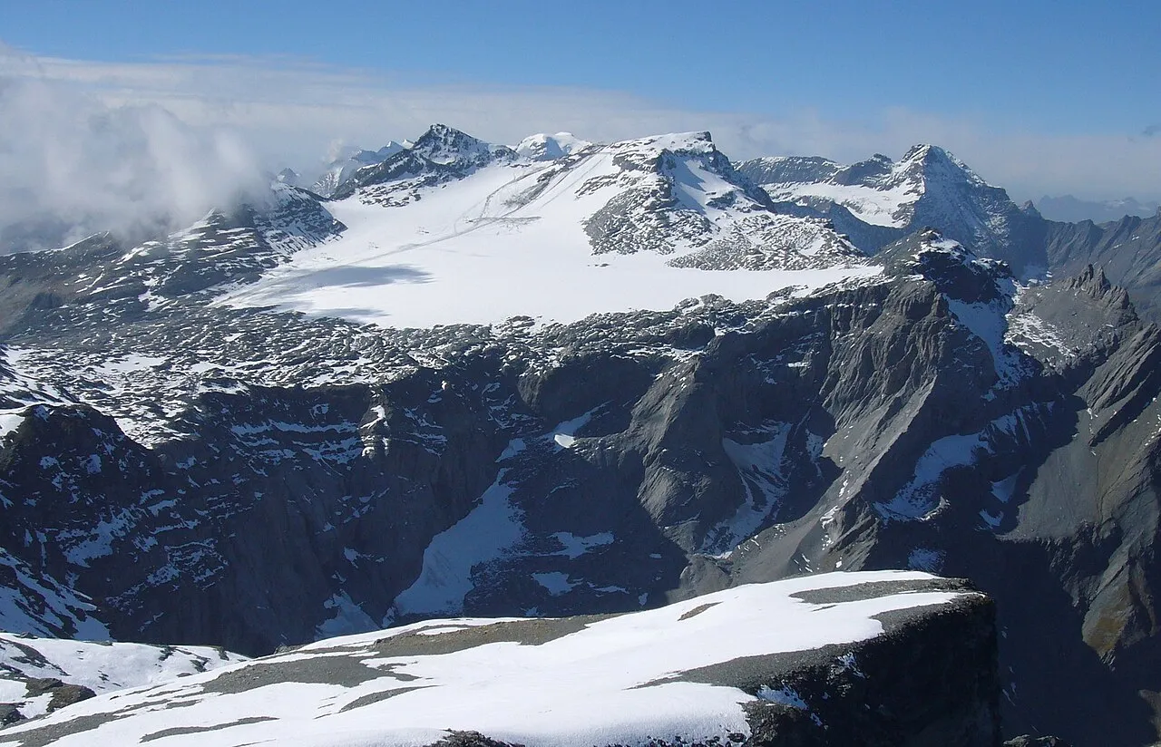
- Elevation
- 3,026 m
- above sea level
- Local time
- UTC+01:00
- Europe/Zurich · UTC+01:00
About Vorab
Vorab is a mountain. Location: Laax, Region Surselva. Elevation: 3,026 m.
The Vorab is a double summit mountain of the Glarus Alps, located on the border between the cantons of Glarus (GL) and Grisons (Graubünden, GR), Switzerland. The summit (3,028 m [9,934 ft]) is also named Bündner Vorab (lit. 'League's Vorab', referring to Graubünden) to distinguish it from a lower summit (3,018 m [9,902 ft]) named Glarner Vorab (lit. 'Vorab of Glarus').
Read more on Wikipedia Text: Wikipedia contributors · CC BY-SA 4.0 · shortened
At a glance
- Topographic prominence
- 408 m
Source: Wikidata
In comparison
- No. 1092 of 7660 mountains in Switzerland by elevation
- 117 sights and natural places within 10 km Vorab Pign, Glarner Vorab
Nearest towns and villages
-
Elm Village, Glarus Süd5.2 km N
-
Falera Municipality, Region Surselva6.5 km SE
-
Glarus Süd Municipality, Glarus8.4 km NW
-
Steinibach Village, Glarus Süd3.9 km N
-
Flims Municipality, Region Imboden9.3 km E
-
Niedern Village, Glarus Süd4.4 km NE
Nearby attractions & nature
Everything nearby-
Vorab Pign Mountain, Ilanz/Glion0.7 km E
-
Glarner Vorab Mountain, Glarus Süd0.7 km NW
-
Vorabfirn Natural site, Laax1 km NE
-
Glatscher dil Vorab Natural site, Switzerland1 km NE
-
Spienggenstöckli Mountain, Glarus Süd1.5 km NW
-
Gletscherhorn Mountain, Glarus Süd1.8 km NE
-
Zwölfihorn Mountain, Glarus Süd2 km NE
-
Chli Mittetaghorn Mountain, Glarus Süd2.2 km N
Sources & licences
Data last updated: · 2 independent sources