- Population
- 9,453
- 9.5K
- Elevation
- 2,121 m
- above sea level
- Local time
- UTC+01:00
- Europe/Zurich · UTC+01:00
- Places inside
- 229
- listed under Glarus Süd
- Airports
- ZRH Zürich Airport71 km
- ACH Sankt Gallen Altenrhein Airport72 km
About Glarus Süd
Glarus Süd is a municipality. Location: Glarus, Canton of Glarus. Population: 9,453. Elevation: 2,121 m. The nearest airport is Zürich Airport (71 km). Nearby sights include Grosstal and Hausstock.
Climate of Glarus Süd
This month · November
A wet month
Day 0° · Night -6° · Rain 145 mm
- Hottest month
- August (day 12°)
- Coldest month
- February (night -10°)
- Wettest month
- July (200 mm)
- Driest month
- February (110 mm)
Bars: average monthly low and high temperature. Below: precipitation. Monthly averages for 1970–2000 at about 18 km resolution, adjusted for elevation. Highlighted months are mild and relatively dry. Source: WorldClim 2.1 (CC BY 4.0).
Show values as a table
| Month | Jan | Feb | Mar | Apr | May | Jun | Jul | Aug | Sep | Oct | Nov | Dec |
|---|---|---|---|---|---|---|---|---|---|---|---|---|
| Average high (°C) | -3° | -3° | -1° | 1° | 6° | 9° | 12° | 12° | 9° | 5° | 0° | -2° |
| Average low (°C) | -10° | -10° | -8° | -6° | -1° | 2° | 4° | 5° | 2° | -2° | -6° | -9° |
| Precipitation (mm) | 120 | 110 | 124 | 149 | 155 | 186 | 200 | 187 | 162 | 144 | 145 | 131 |
How to get to Glarus Süd
The nearest airport is Zürich Airport (ZRH), 71 km to the northwest as the crow flies. The nearest large city is Zurich, 63 km to the northwest.
Airports
- Zürich Airport (ZRH) Zurich 71 kmnorthwest
- Sankt Gallen Altenrhein Airport (ACH) St. Gallen 72 kmnortheast
- Bodensee Airport Friedrichshafen (FDH) Friedrichshafen 89 kmnorth
Nearby large cities
- Zurich Population: 415.4K 63 kmnorthwest
- Winterthur Population: 111.8K 70 kmnorth
- Bern Population: 121.6K 124 kmwest
- Basel Population: 177.6K 134 kmnorthwest
- Freiburg im Breisgau Population: 237.5K 151 kmnorthwest
Straight-line distances; road distances are longer. Airport data: OurAirports.
Day trips from Glarus Süd
Within 100 km: 361 historic and cultural sites, 7,219 natural sites, 1,136 lakes, rivers and coasts.
0–25 km868 places
- Walensee Lake 24 kmN
- Wägitalersee Lake 22 kmNW
- Obersee Lake 18 kmN
- Klöntalersee Lake 13 kmNW
25–60 km2,974 places
- Ufenau Island 39 kmNW
- Insel Lützelau Island 39 kmNW
- Schönenwerd Island 41 kmNW
- Insel Schwanau Island 38 kmW
60–100 km4,874 places
- Mainau Island 87 kmN
- Fahr Abbey Attraction 72 kmNW
- Dominikanerinsel Konstanz Island 82 kmN
- Strandbad Steckborn Beach 82 kmN
Straight-line distances.
Places in Glarus Süd
229 places- 1 Schwanden 2.5K
- 2 Luchsingen 1.1K
- 3 Linthal 1.1K
- 4 Elm 729
- 5 Engi 662
- 6 Braunwald 421
- 7 Hätzingen 403
- 8 Rüti 347
- 9 Matt 344
- 10 Sool 301
- 11 Nidfurn 227
- 12 Diesbach 194
- 13 Betschwanden 171
- 14 Leuggelbach 164
Bar: population relative to the most populous place in this list.
Cities & villages2
- Dornhaus · Village
- Ennetlinth · Village
Mountains & nature40
- Alplifirn · Natural site
- Altenorenstock · Mountain
- Bächiegg · Mountain
- Bächifirn · Natural site
- Bächistock · Mountain
- Beggistock · Mountain
- Berglihorn · Mountain
- Bifertenfirn · Natural site
- Bifertengrätli · Mountain
- Bifertenstock · Mountain
- Biflenhorn · Mountain
- Breitchamm · Mountain
- Büchel · Mountain
- Bützistock · Mountain
- Bützistock · Mountain
- Chalchstöckli · Mountain
- Chamerstock · Mountain
- Chamm · Mountain
- Chämmler · Mountain
- Chämmli · Mountain
- Chanzle · Mountain
- Charenstock · Mountain
- Chilchli · Mountain
- Chilchli · Mountain
- Chlaggchopf · Mountain
- Chli Chalchhorn · Mountain
- Chli Höch · Mountain
- Chli Mittetaghorn · Mountain
- Chrämer · Mountain
- Claridenfirn · Natural site
- Dürenbüel · Mountain
- Erbser Stock · Mountain
- Etzelstock · Mountain
- Fanenstock · Mountain
- Färispitz · Mountain
- Fätschenhorn · Mountain
- Fessisstock · Mountain
- First · Mountain
- Franzenhorn · Mountain
- Füdle · Mountain
Lakes, rivers & coasts4
- Bergetenseeli · Lake
- Chammseeli · Lake
- Chüebodensee · Lake
- Engisee · Lake
Nearby attractions & nature
Everything nearby-
Grosstal Natural site, Canton of Glarus3.6 km W
-
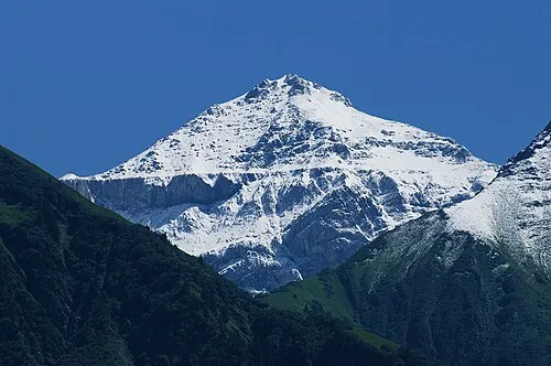 Hausstock Mountain, Ilanz/Glion5.9 km S
-
Freiberge Mountain, Canton of Glarus4.4 km N
-
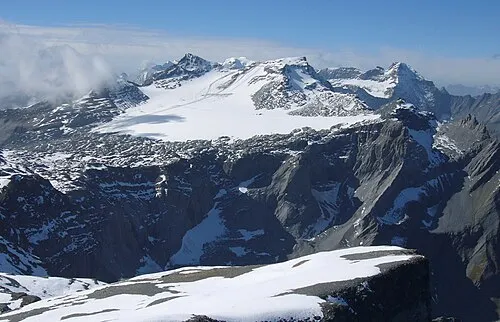 Vorab Mountain, Laax8.4 km SE
-
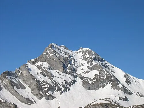 Ortstock Mountain, Muotathal9.9 km W
-
Glatscher da Mer Natural site, Ilanz/Glion6.4 km S
-
Ruchi Mountain, Breil/Brigels7.3 km S
-
Glatscher da Fluaz Natural site, Breil/Brigels7.4 km S
Sources & licences
Data last updated: