Wigoltingen
Located in Weinfelden District, Thurgau Coordinates: 47°36′02″ N 9°02′44″ E
- Population
- 2,464
- 2.5K
- Elevation
- 429 m
- above sea level
- Local time
- UTC+01:00
- Europe/Zurich · UTC+01:00
- Places inside
- 33
- listed under Wigoltingen
About Wigoltingen
Wigoltingen is a municipality. Location: Weinfelden District, Thurgau. Population: 2,464. Elevation: 429 m.
In comparison
- No. 10 of 18 places in Weinfelden District by population
- Nearest larger town: Märstetten-Dorf, 2 km SE
- 17 sights and natural places within 10 km Connyland, Ergolfweiher
- Listed here: Village: 32, Historic site: 1
Places in Wigoltingen
33 places-
Wigoltingen Village2K
-
Altenklingen Village
-
Bonau Village
-
Brunenäcker Village
-
Cholwis Village
-
Dangwang Village
-
Ebenau Village
-
Egelshofen Village
-
Engwang Village
-
Gehrau Village
-
Hangetloo Village
-
Hasli Village
-
Häusern Village
-
Hessenwiese Village
-
Hof Village
-
Horüti Village
-
Illhart Village
-
Jopenhaus Village
-
Königsgut Village
-
Lamperswil Village
-
Mösli Village
-
Mühle Village
-
Neugrüt Village
-
Rütiholz Village
-
Rüüteli Village
-
Schloss Altenklingen Historic site
-
Schürli Village
-
Schürlimühle Village
-
Storenberg Village
-
Suurugge Village
-
Uetwilen Village
-
Wagerswil Village
-
Ziegelhütte Village
Nearby attractions & nature
Everything nearby-
Connyland Natural site, Thurgau1.8 km NE
-
Ergolfweiher Lake, Märstetten2.2 km S
-
Schloss Klingenberg Historic site, Homburg4 km NW
-
Anderbach Lake, Homburg3.7 km NW
-
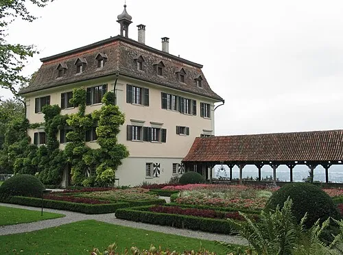 Schloss Wolfsberg Historic site, Ermatingen6.9 km N
-
Honegg Mountain, Thurgau6.1 km SW
-
Ottenberg Mountain, Weinfelden7.2 km E
-
Friedrichshöhe Mountain, Baden-Wurttemberg9.3 km N
Sources & licences
Data last updated: