Tête Blanche
Located in Evolène, Hérens District Coordinates: 45°59′12″ N 7°34′31″ E
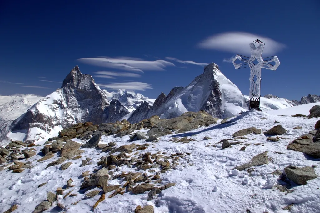
- Elevation
- 3,710 m
- above sea level
- Local time
- UTC+01:00
- Europe/Zurich · UTC+01:00
About Tête Blanche
Tête Blanche is a mountain. Location: Evolène, Hérens District. Elevation: 3,710 m.
Tête Blanche (French pronunciation: [tɛt blɑ̃ʃ], lit. 'White Head') is a mountain of the Pennine Alps on the Swiss-Italian border. Its summit (3,710 metres) is the tripoint between the valleys of Hérens, Mattertal (both in Valais) and Valpelline (in the Aosta Valley), thus forming the linguistic tri-point between French (Val d'Hérens and Aosta Valley), German (Mattertal), and Italian (bilingual Aosta Valley) -speaking areas.
Read more on Wikipedia Text: Wikipedia contributors · CC BY-SA 4.0 · shortened
At a glance
- Topographic prominence
- 159 m
Source: Wikidata
In comparison
- No. 129 of 7660 mountains in Switzerland by elevation
- 128 sights and natural places within 10 km Tête de Chavannes, Stockjigletscher
Climate of Tête Blanche
| Month | Jan | Feb | Mar | Apr | May | Jun | Jul | Aug | Sep | Oct | Nov | Dec |
|---|---|---|---|---|---|---|---|---|---|---|---|---|
| Average high (°C) | -12° | -12° | -11° | -9° | -5° | -1° | 3° | 3° | 0° | -4° | -8° | -11° |
| Average low (°C) | -18° | -18° | -17° | -15° | -11° | -7° | -4° | -3° | -6° | -9° | -14° | -16° |
| Precipitation (mm) | 80 | 77 | 85 | 85 | 84 | 70 | 61 | 70 | 66 | 85 | 90 | 80 |
Monthly averages for 1970–2000 at about 18 km resolution, adjusted for elevation. Highlighted months are mild and relatively dry. Source: WorldClim 2.1 (CC BY 4.0).
Airports nearest to Tête Blanche
- Turin Airport (TRN) Caselle Torinese (TO) 88 km
- Milan Malpensa International Airport (MXP) Ferno (VA) 98 km
- Bern Airport (BRN) Bern 103 km
Straight-line distance; airports with scheduled flights only. Source: OurAirports (public domain).
Nearest towns and villages
-
Breuil-Cervinia Village, Valtournenche7.3 km SE
-
Lago Bleu Village, Valtournenche7.8 km SE
-
Arolla Village, Evolène8.3 km NW
-
Valtournenche Municipality, Province of Aosta13 km S
-
Les Perreres Centrale Village, Valtournenche9.3 km S
-
La Monta Village, Evolène8.5 km NW
Nearby attractions & nature
Everything nearby-
Tête de Chavannes Mountain, Evolène0.8 km W
-
Stockjigletscher Natural site, Zermatt1.5 km E
-
Dents des Bouquetins Central Mountain, Evolène2.4 km W
-
Petit Bouquetin Mountain, Bionaz2.8 km W
-
Dents des Bouquetins Sud Mountain, Aosta Valley2.8 km W
-
Mota Rota Mountain, Evolène2.2 km N
-
Pointe Barnes Mountain, Aosta Valley2.9 km SW
-
Grand Bouquetin Mountain, Valais2.3 km W
Sources & licences
Data last updated: · 2 independent sources