Champéry
Located in Monthey District, Valais Coordinates: 46°09′32″ N 6°50′45″ E
- Population
- 1,338
- 1.3K
- Elevation
- 1,291 m
- above sea level
- Local time
- UTC+01:00
- Europe/Zurich · UTC+01:00
- Places inside
- 23
- listed under Champéry
About Champéry
Champéry is a municipality. Location: Monthey District, Valais. Population: 1,338. Elevation: 1,291 m.
In comparison
- No. 8 of 9 places in Monthey District by population
- Nearest larger town: Val-d'Illiez, 6 km NE
- 144 sights and natural places within 10 km Torrent de Barme, Signal de Bonavau
- Listed here: Mountain: 20, Village: 2, Lake: 1
Places in Champéry
23 places-
Champéry Village1.2K
-
Barme Village
-
Chaux d'Antème Mountain
-
Croix de Culet Mountain
-
Croix d'Increne Mountain
-
Dent de Bonavau Mountain
-
Dent de la Chaux Mountain
-
Dent de Rossétan Mountain
-
Dent des Chis Vernas Mountain
-
Dent du Signal Mountain
-
Lac d'Antème Lake
-
La Chaire Mountain
-
La Patenaille Mountain
-
Le Vanet Mountain
-
Pointe Bourdillon Mountain
-
Pointe de Fornets Mountain
-
Pointe de la Léchère Mountain
-
Pointe de Ripaille Mountain
-
Première Dent Mountain
-
Savoune Mountain
-
Signal de Bonavau Mountain
-
Tête à Vincent Mountain
-
Tour d'Antème Mountain
Nearby attractions & nature
Everything nearby-
Torrent de Barme River, Switzerland0.6 km E
-
Corne à Tournier Mountain, Valais2.9 km S
-
Dent de Barme Mountain, Valais3 km S
-
Mont Sagerou Mountain, Evionnaz3.5 km S
-
Sur Grande Conche Mountain, Val-d'Illiez3.8 km NW
-
Collines des Crosets Mountain, Val-d'Illiez3.8 km N
-
Tête des Ottans Mountain, Saint-Maurice District4.2 km SE
-
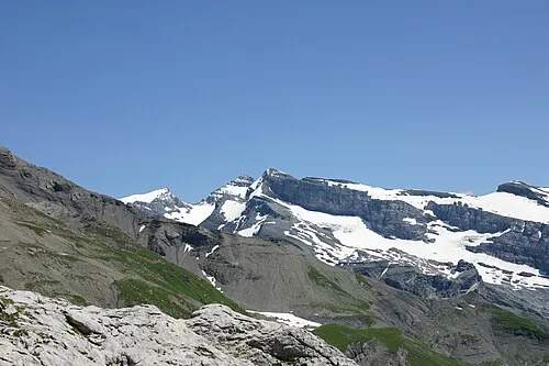 Mont Ruan Mountain, Upper Savoy5.8 km SE
Sources & licences
Data last updated: