Drijber
Located in Gemeente Midden-Drenthe, Drenthe Coordinates: 52°47′33″ N 6°32′20″ E
- Population
- 115
- 115
- Elevation
- 14 m
- above sea level
- Local time
- UTC+01:00
- Europe/Amsterdam · UTC+01:00
About Drijber
Drijber is a village. Location: Gemeente Midden-Drenthe, Drenthe. Population: 115. Elevation: 14 m.
Drijber is a village in the Dutch province of Drenthe. It is a part of the municipality of Midden-Drenthe, and lies about 9 km north of Hoogeveen. The village was first mentioned in 1217 as Triburd, and means "three neighbourhoods". The area around Drijber was first settled around 300 BC, however it was abandoned around 425. Drijber was home to 68 people in 1840. In 1928, a little church was built in the village.
Read more on Wikipedia Text: Wikipedia contributors · CC BY-SA 4.0 · shortened
In comparison
- No. 15 of 22 places in Gemeente Midden-Drenthe by population
- Nearest larger town: Wijster, 3 km NW
- 2 sights and natural places within 10 km Police Custody Camp Westerbork, Bendersche Berg
Airports nearest to Drijber
- Groningen Airport Eelde (GRQ) Groningen 36 km
- Münster Osnabrück Airport (FMO) Greven 107 km
- Amsterdam Airport Schiphol (AMS) Amsterdam 132 km
Straight-line distance; airports with scheduled flights only. Source: OurAirports (public domain).
Nearby attractions & nature
Everything nearby-
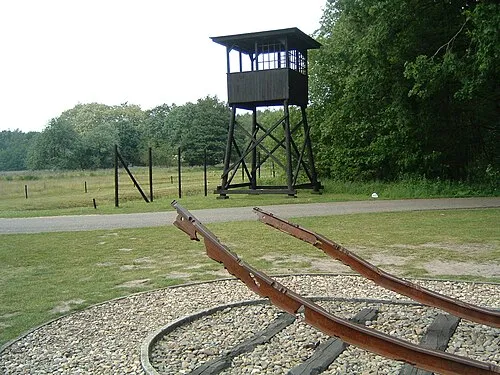 Police Custody Camp Westerbork Historic site, Gemeente Midden-Drenthe7.9 km NE
-
Bendersche Berg Mountain, Gemeente Westerveld9.7 km W
-
Hunnenkloosterberg Mountain, Gemeente De Wolden13 km SW
-
Breiberg Mountain, Coevorden16 km SE
-
Havelterberg Mountain, Gemeente Westerveld21 km W
-
Boschberg Mountain, Ooststellingwerf Municipality22 km NW
Sources & licences
Data last updated: · 2 independent sources