Witteveen
Located in Gemeente Westerveld, Drenthe Coordinates: 52°47′00″ N 6°21′25″ E
- Elevation
- 7 m
- above sea level
- Local time
- UTC+01:00
- Europe/Amsterdam · UTC+01:00
About Witteveen
Witteveen is a village. Location: Gemeente Westerveld, Drenthe. Elevation: 7 m.
Witteveen is a hamlet in the Drenthe municipality of De Wolden, the Netherlands. Witteveen lies north of Ruinen on the edge of the Dwingelderveld National Park. It is considered a part of Ruinen, and has about 15 houses and 2 bungalow parks.
Read more on Wikipedia Text: Wikipedia contributors · CC BY-SA 4.0 · shortened
In comparison
- Nearest larger town: Ansen, 1 km W
- 3 sights and natural places within 10 km Bendersche Berg, Hunnenkloosterberg
Nearby attractions & nature
Everything nearby-
Bendersche Berg Mountain, Gemeente Westerveld2.8 km NE
-
Hunnenkloosterberg Mountain, Gemeente De Wolden5.2 km S
-
Havelterberg Mountain, Gemeente Westerveld9 km W
-
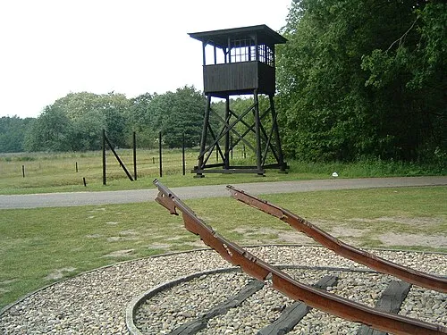 Police Custody Camp Westerbork Historic site, Gemeente Midden-Drenthe18 km NE
-
Boschberg Mountain, Ooststellingwerf Municipality18 km N
-
Breiberg Mountain, Coevorden24 km SE
Sources & licences
Data last updated: · 2 independent sources