Venray Municipality
Located in Limburg, The Netherlands Coordinates: 51°30′51″ N 5°57′33″ E
- Population
- 43,326
- 43.3K
- Elevation
- 30 m
- above sea level
- Local time
- UTC+01:00
- Europe/Amsterdam · UTC+01:00
- Places inside
- 19
- listed under Venray Municipality
About Venray Municipality
Venray Municipality is a district. Location: Limburg, The Netherlands. Population: 43,326.
In comparison
- 5 sights and natural places within 10 km Hansenberg, Sint Martinsberg
- Listed here: Village: 15, Neighbourhood: 2, Mountain: 1, Town: 1
Places in Venray Municipality
19 places-
Venray Town39K
-
Brukske Neighbourhood5K
-
Veltum Neighbourhood3.8K
-
Oostrum Village2.4K
-
Leunen Village2.3K
-
Ysselsteyn Village2.3K
-
Wanssum Village1.9K
-
Brabander Village1.7K
-
Oirlo Village1.2K
-
Merselo Village1.1K
-
Blitterswijck Village1.1K
-
Castenray Village775
-
Veulen Village520
-
Heide Village455
-
Geysteren Village425
-
Vredepeel Village240
-
Smakt Village220
-
Hansenberg Mountain
-
Zandhoek Village
Nearby attractions & nature
Everything nearby-
Sint Martinsberg Mountain, Horst aan de Maas Municipality6.2 km SE
-
Vliegenberg Mountain, Land van Cuijk8.3 km NE
-
Hondsberg Mountain, Land van Cuijk8.3 km N
-
Vossenheuvel Mountain, Horst aan de Maas Municipality9.6 km S
-
Dikkenberg Mountain, Bergen Municipality14 km E
-
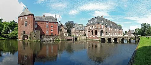 Schloß Wissen Historic site, Weeze18 km NE
Sources & licences
Data last updated: