Steensel
Located in Eersel Municipality, North Brabant Coordinates: 51°22′36″ N 5°21′10″ E
- Population
- 1,280
- 1.3K
- Elevation
- 28 m
- above sea level
- Local time
- UTC+01:00
- Europe/Amsterdam · UTC+01:00
About Steensel
Steensel is a village. Location: Eersel Municipality, North Brabant. Population: 1,280. Elevation: 28 m.
Steensel is a village on the Gender stream in the municipality of Eersel, North Brabant, the Netherlands. Steensel is part of the Acht Zaligheden (Eight Beatitudes), along with Eersel, Knegsel, Duizel, Wintelre, Netersel, Hulsel en Reusel. The name Steensel appeared first in a document from 1224, in which a certain Henricus and Marcelis were mentioned as knights of Steensel. In 1688, Steensel was plundered and destroyed by French soldiers. In 1810, Steensel became part of the municipality of Duizel and Steensel.
Read more on Wikipedia Text: Wikipedia contributors · CC BY-SA 4.0 · shortened
In comparison
- No. 6 of 6 places in Eersel Municipality by population
- Nearest larger town: Knegsel, 3 km N
Climate of Steensel
Best months for sightseeing: June–August.
| Month | Jan | Feb | Mar | Apr | May | Jun | Jul | Aug | Sep | Oct | Nov | Dec |
|---|---|---|---|---|---|---|---|---|---|---|---|---|
| Average high (°C) | 6° | 6° | 10° | 14° | 18° | 21° | 23° | 23° | 19° | 15° | 9° | 7° |
| Average low (°C) | 0° | 0° | 2° | 4° | 8° | 11° | 12° | 12° | 10° | 6° | 3° | 1° |
| Precipitation (mm) | 69 | 53 | 66 | 46 | 61 | 72 | 68 | 58 | 67 | 66 | 73 | 74 |
Monthly averages for 1970–2000 at about 18 km resolution, adjusted for elevation. Highlighted months are mild and relatively dry. Source: WorldClim 2.1 (CC BY 4.0).
Airports nearest to Steensel
- Eindhoven Airport (EIN) Eindhoven 8 km
- Maastricht Aachen Airport (MST) Maastricht 59 km
- Weeze (Niederrhein) Airport (NRN) Weeze 60 km
Straight-line distance; airports with scheduled flights only. Source: OurAirports (public domain).
Nearby attractions & nature
Everything nearby-
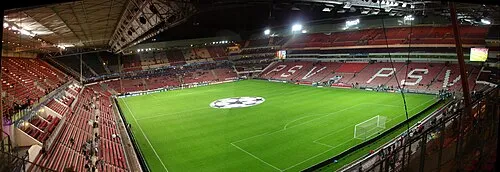 Philips Stadium Landmark, Eindhoven Municipality11 km NE
-
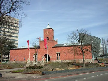 Van Abbe museum Museum, Eindhoven Municipality11 km NE
-
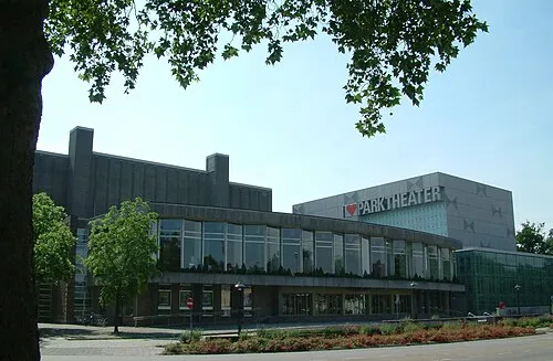 Parktheater Eindhoven Attraction, Eindhoven Municipality11 km NE
-
Eindhoven Concentration Camp Historic site, Eindhoven Municipality11 km NE
-
Appelenberg Mountain, Gemeente Reusel-De Mierden18 km W
-
Klagloop River, Belgium10 km S
Sources & licences
Data last updated: · 2 independent sources