- Population
- 1,435
- 1.4K
- Elevation
- 26 m
- above sea level
- Local time
- UTC+01:00
- Europe/Amsterdam · UTC+01:00
- Airports
- EIN Eindhoven Airport6 km
- NRN Weeze (Niederrhein) Airport60 km
About Knegsel
Knegsel is a village. Location: Eersel Municipality, North Brabant. Population: 1,435. Elevation: 26 m.
Knegsel is a village in the south of the Netherlands. It is located in the municipality of Eersel, North Brabant. Knegsel is part of the Acht Zaligheden (Eight Beatitudes), alongside Eersel, Duizel, Steensel, Wintelre, Netersel, Hulsel en Reusel. The village was first mentioned in 1281 as Cneczele, and means "single room house belonging to the servant". Knegsel was home to 238 people in 1840. The Catholic Monulphus and Gondulphus was built in 1926, and was a low wide tower.
Source: Wikipedia · CC BY-SA 4.0
Climate of Knegsel
Best months for sightseeingBest months for sightseeing: June–August.
This month · November
A cold month
Day 9° · Night 3° · Rain 73 mm
- Hottest month
- August (day 23°)
- Coldest month
- February (night 0°)
- Wettest month
- December (74 mm)
- Driest month
- April (46 mm)
Bars: average monthly low and high temperature. Below: precipitation. Monthly averages for 1970–2000 at about 18 km resolution, adjusted for elevation. Highlighted months are mild and relatively dry. Source: WorldClim 2.1 (CC BY 4.0).
Show values as a table
| Month | Jan | Feb | Mar | Apr | May | Jun | Jul | Aug | Sep | Oct | Nov | Dec |
|---|---|---|---|---|---|---|---|---|---|---|---|---|
| Average high (°C) | 6° | 6° | 10° | 14° | 18° | 21° | 23° | 23° | 19° | 15° | 9° | 7° |
| Average low (°C) | 0° | 0° | 2° | 4° | 8° | 11° | 12° | 12° | 10° | 6° | 3° | 1° |
| Precipitation (mm) | 69 | 53 | 66 | 46 | 61 | 72 | 68 | 58 | 67 | 66 | 73 | 74 |
How to get to Knegsel
The nearest airport is Eindhoven Airport (EIN), 6 km to the north as the crow flies. The nearest large city is Eindhoven, 10 km to the northeast.
Airports
- Eindhoven Airport (EIN) Eindhoven 6 kmnorth
- Weeze (Niederrhein) Airport (NRN) Weeze 60 kmnortheast
- Maastricht Aachen Airport (MST) Maastricht 62 kmsoutheast
Nearby large cities
- Eindhoven Population: 235.7K 10 kmnortheast
- Tilburg Population: 221.9K 25 kmnorthwest
- 's-Hertogenbosch Population: 160.8K 34 kmnorth
- Breda Population: 184.1K 45 kmnorthwest
- Venlo Population: 102K 57 kmeast
Straight-line distances; road distances are longer. Airport data: OurAirports.
Nearby attractions & nature
Everything nearby-
 Philips Stadium Landmark, Eindhoven Municipality9.7 km NE
-
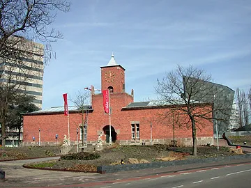 Van Abbe museum Museum, Eindhoven Municipality10 km NE
-
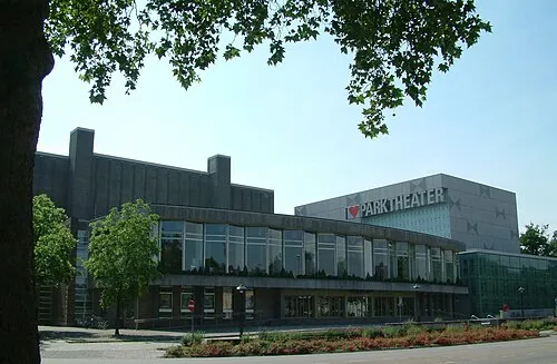 Parktheater Eindhoven Attraction, Eindhoven Municipality10 km E
-
Eindhoven Concentration Camp Historic site, Eindhoven Municipality9.8 km NE
-
Appelenberg Mountain, Gemeente Reusel-De Mierden17 km W
-
Riebosserheide Natural site, Limburg Province17 km S
Sources & licences
Data last updated: · 2 independent sources