De Rips
Located in Gemeente Gemert-Bakel, North Brabant Coordinates: 51°33′00″ N 5°48′35″ E
- Population
- 875
- 875
- Elevation
- 29 m
- above sea level
- Local time
- UTC+01:00
- Europe/Amsterdam · UTC+01:00
About De Rips
De Rips is a village. Location: Gemeente Gemert-Bakel, North Brabant. Population: 875. Elevation: 29 m.
De Rips is a village east of Helmond and Eindhoven in southern part of the Netherlands. Until the late 1990s it formed the municipality of Bakel and Milheeze alongside Milheeze and Bakel, but in 1997 it was forced to merge with the larger Gemert municipality. The village was first mentioned in 1544 as Ripse Paal, and refers to a border pole close to the stream Rips. De Rips was located in the Peel, a large heath area.
Read more on Wikipedia Text: Wikipedia contributors · CC BY-SA 4.0 · shortened
In comparison
- No. 7 of 8 places in Gemeente Gemert-Bakel by population
- Nearest larger town: Milheeze, 6 km S
- 2 sights and natural places within 10 km Hondsberg, Hansenberg
Nearby attractions & nature
Everything nearby-
Hondsberg Mountain, Land van Cuijk8.1 km NE
-
Hansenberg Mountain, Venray Municipality9.2 km E
-
Vliegenberg Mountain, Land van Cuijk14 km E
-
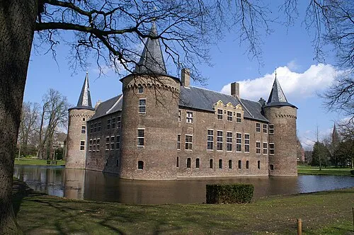 Kasteel Helmond Historic site, Gemeente Helmond14 km SW
-
Vossenheuvel Mountain, Horst aan de Maas Municipality15 km SE
-
Sint Jansberg Mountain, Mook en Middelaar Municipality23 km N
Sources & licences
Data last updated: · 2 independent sources