Kula Pınarı
Located in Ağrı Province, Turkey Coordinates: 39°31′27″ N 44°08′44″ E
- Elevation
- 2,327 m
- above sea level
- Local time
- UTC+03:00
- Europe/Istanbul · UTC+03:00
About Kula Pınarı
Kula Pınarı is a natural site. Location: Ağrı Province, Turkey.
In comparison
- 7 sights and natural places within 10 km Ishak Pacha, T’ezharruyg
Nearest towns and villages
-
Sarıgül Neighbourhood, Doğubayazıt District4.2 km W
-
Doğubeyazıt City, Doğubayazıt District5.9 km NW
-
Ahmedihani Neighbourhood, Doğubayazıt District6 km NW
-
Çiftepınar Neighbourhood, Doğubayazıt District6.1 km NW
-
Yukarıtavla Village, Doğubayazıt District4.6 km S
-
Hasankeyf Neighbourhood, Doğubayazıt District6.4 km NW
Nearby attractions & nature
Everything nearby-
T’ezharruyg Mountain, Ağrı Province3.1 km S
-
T’ezharruyg Mountain, Doğubayazıt District3.1 km S
-
Ishak Pacha Historic site, Doğubayazıt District1.4 km W
-
Akyayla Tepe Mountain, Doğubayazıt District8.8 km W
-
Akyayla Tepesi Mountain, Doğubayazıt District7.4 km S
-
Akyayla Dağı Mountain, Ağrı Province10 km S
-
Büyükkurt Tepe Mountain, Doğubayazıt District12 km S
-
Gölyüzü Gölü Lake, Ağrı Province9 km N
More nature in Turkey
-
Yalıntaşdağı Tepesi Mountain, Doğubayazıt District15 km NW
-
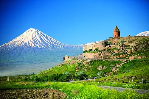 Little Ararat Mountain, Doğubayazıt District27 km NE
-
Hakim Tepesi Mountain, Doğubayazıt District18 km W
-
Bozburundağı Tepesi Mountain, Doğubayazıt District18 km NW
-
Mıhtepe Mountain, Doğubayazıt District23 km NE
-
Zīyarat T. Mountain, Doğubayazıt District21 km SE
Sources & licences
Data last updated: