Merkezefendi İlçesi
Located in Denizli Province, Turkey Coordinates: 37°48′22″ N 29°00′56″ E
- Population
- 262,825
- 262.8K
- Elevation
- 485 m
- above sea level
- Local time
- UTC+03:00
- Europe/Istanbul · UTC+03:00
- Places inside
- 32
- listed under Merkezefendi İlçesi
About Merkezefendi İlçesi
Merkezefendi İlçesi is a district. Location: Denizli Province, Turkey. Population: 262,825.
In comparison
- 6 sights and natural places within 10 km Gök Tepesi, Değermen Deresi
- Listed here: Neighbourhood: 14, Village: 11, Mountain: 4, City: 1
Places in Merkezefendi İlçesi
32 places-
Merkezefendi City280.3K
-
Aşağışamlı Village979
-
Altındere Village623
-
Yeşilyayla Village587
-
Kumkısık Village457
-
Bozburun Village288
-
Üzerlik Village233
-
Çeltikçi Village177
-
Barutçular Neighbourhood
-
Başkarcı Neighbourhood
-
Bereketli Neighbourhood
-
Çakıroluk Tepesi Mountain
-
Çakmak Neighbourhood
-
Denizli-Asagisamli transmitter Landmark
-
Denizli Bucağı Municipality
-
Eskihisar Village
-
Gök Tepesi Mountain
-
Göveçlik Village
-
Gümüşçay Neighbourhood
-
Hacıeyüplü Neighbourhood
-
Hallaçlar Neighbourhood
-
Hisarköy Neighbourhood
-
Kadılar Neighbourhood
-
Karahasanlı Neighbourhood
-
Kayaköy Neighbourhood
-
Şalap Tepesi Mountain
-
Salihağa Village
-
Sarhan Village
-
Şemikler Neighbourhood
-
Servergazi Neighbourhood
-
Şirinköy Neighbourhood
-
Tokluyatak Tepesi Mountain
Nearby attractions & nature
Everything nearby-
Değermen Deresi River, Denizli Province8.3 km SE
-
Karaaslanlı Deresi River, Denizli Province9.6 km N
-
Domuzyolu Deresi River, Denizli Province9.7 km SE
-
İsrail Boğazı Natural site, Denizli Province11 km SW
-
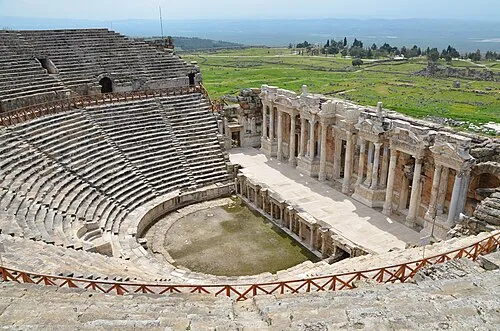 Hierapolis Historic site, Pamukkale İlçesi16 km NE
-
Laodikeia Historic site, Pamukkale İlçesi8.8 km NE
Sources & licences
Data last updated: