Yenidoğan
Located in Aralık İlçesi, Iğdır Province Coordinates: 39°46′34″ N 44°22′48″ E
- Population
- 367
- 367
- Elevation
- 1,724 m
- above sea level
- Local time
- UTC+03:00
- Europe/Istanbul · UTC+03:00
About Yenidoğan
Yenidoğan is a village. Location: Aralık İlçesi, Iğdır Province. Population: 367. Elevation: 1,724 m.
Yenidoğan (Armenian: Ակոռի, romanized: Akoři; Kurdish: Axurî; Russian: Ахури, Akhuri) is a village in eastern Turkey, on the northeastern slope of Mount Ararat, adjacent to the point where the borders of Turkey, Iran, and Armenia meet. Historically called Akori in Armenian, it was known in Turkey as Ahora until 1965. The village is a part of the Aralık District of Turkey's Iğdır Province, which largely corresponds to the historic region of Surmalu. Its population is 367 (2022).
Read more on Wikipedia Text: Wikipedia contributors · CC BY-SA 4.0 · shortened
In comparison
- No. 18 of 28 places in Aralık İlçesi by population
- Nearest larger town: Kulukent, 14 km N
- 5 sights and natural places within 10 km Tekaltıdağı Tepesi, Gömik
Nearby attractions & nature
Everything nearby-
Tekaltıdağı Tepesi Mountain, Aralık İlçesi5.8 km SE
-
Gömik Historic site, Aralık İlçesi6.1 km SE
-
Kopgel Mountain, Aralık İlçesi8.3 km SW
-
Kūh-e Ārārāt-e Bozorg Mountain, Aralık İlçesi9 km SW
-
Great Ararat Mountain, Aralık İlçesi11 km SW
-
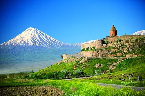 Little Ararat Mountain, Doğubayazıt District14 km S
Sources & licences
Data last updated: · 2 independent sources