Paşamandıra
Located in Beykoz, Istanbul Coordinates: 41°11′05″ N 29°14′58″ E
- Population
- 1,271
- 1.3K
- Elevation
- 19 m
- above sea level
- Local time
- UTC+03:00
- Europe/Istanbul · UTC+03:00
About Paşamandıra
Paşamandıra is a village. Location: Beykoz, Istanbul. Population: 1,271. Elevation: 19 m.
Paşamandıra is a neighborhood in the district of Beykoz, on the Anatolian side of Istanbul, Turkey. Its population is 1,373 (2026). It is bordered on the northeast by the Riva and Göllü neighborhoods, on the southeast by the Öğümce neighborhood, on the west by the Mahmutşevketpaşa neighborhood, and on the northwest by the Alibahadır neighborhood. It is divided by the Northern Marmara Motorway, which runs through the neighborhood southeast to northwest.
Read more on Wikipedia Text: Wikipedia contributors · CC BY-SA 4.0 · shortened
At a glance
- Area
- 12.1 km²
Source: Wikidata
In comparison
- No. 15 of 19 places in Beykoz by population
- Nearest larger town: Riva, 5 km NW
- 8 sights and natural places within 10 km Çayağzı Deresi, Alibahadır Deresi
Nearby attractions & nature
Everything nearby-
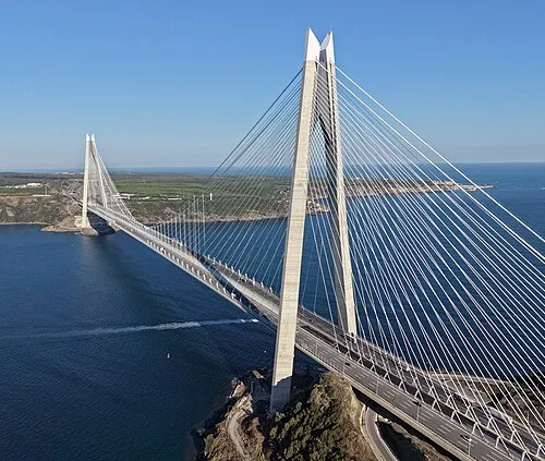 Yavuz Sultan Selim Bridge Landmark, Sarıyer12 km W
-
Çayağzı Deresi River, Istanbul5.4 km NW
-
Alibahadır Deresi River, Istanbul5.6 km NW
-
Eşek Adası Island, Istanbul5.8 km N
-
Açmalar Deresi River, Istanbul6.1 km NE
-
Dolap Deresi River, Istanbul6.5 km SW
Sources & licences
Data last updated: · 2 independent sources