Çarşamba
Located in Fatih, Istanbul Coordinates: 41°01′35″ N 28°56′54″ E
- Elevation
- 66 m
- above sea level
- Local time
- UTC+03:00
- Europe/Istanbul · UTC+03:00
About Çarşamba
Çarşamba is a neighbourhood. Location: Fatih, Istanbul.
Çarşamba (English: "Wednesday") is a small part of the Fatih district of Istanbul, Turkey, close to the Fatih Mosque. It is one of the most conservative areas of the city. According to the 17th-century Ottoman traveler Evliya Çelebi, the district takes its name from the town of Çarşamba on the Black Sea coast since, after the fall of Constantinople in 1453, this part of the city was repopulated with people from Çarşamba.
Read more on Wikipedia Text: Wikipedia contributors · CC BY-SA 4.0 · shortened
In comparison
- Nearest larger town: Balat, 0 km N
- 107 sights and natural places within 10 km Prodromos / Church of St. John Prodromos in Trullo / Hirami Ahmet Pasha Mosque / Hirâmi Ahmed Paşa Camii, Saint Mary of the Mongols
Climate of Çarşamba
Best months for sightseeing: May–October.
| Month | Jan | Feb | Mar | Apr | May | Jun | Jul | Aug | Sep | Oct | Nov | Dec |
|---|---|---|---|---|---|---|---|---|---|---|---|---|
| Average high (°C) | 9° | 9° | 11° | 17° | 21° | 26° | 28° | 28° | 25° | 20° | 15° | 11° |
| Average low (°C) | 3° | 3° | 4° | 8° | 12° | 16° | 19° | 19° | 16° | 12° | 8° | 5° |
| Precipitation (mm) | 95 | 64 | 64 | 47 | 38 | 31 | 25 | 35 | 42 | 75 | 89 | 113 |
Monthly averages for 1970–2000 at about 18 km resolution, adjusted for elevation. Highlighted months are mild and relatively dry. Source: WorldClim 2.1 (CC BY 4.0).
Airports nearest to Çarşamba
- İstanbul Airport (IST) Istanbul 33 km
- Istanbul Sabiha Gökçen International Airport (SAW) Pendik, Istanbul 34 km
- Tekirdağ Çorlu Airport (TEQ) Çorlu 87 km
Straight-line distance; airports with scheduled flights only. Source: OurAirports (public domain).
Nearby attractions & nature
Everything nearby-
Prodromos / Church of St. John Prodromos in Trullo / Hirami Ahmet Pasha Mosque / Hirâmi Ahmed Paşa Camii Attraction, Fatih0.3 km E
-
Saint Mary of the Mongols Attraction, Fatih0.4 km N
-
The Ecumenical Patriarchate Attraction, Fatih0.4 km NE
-
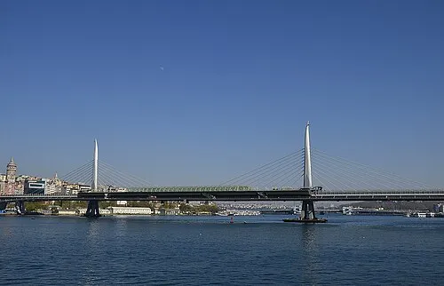 Golden Horn Metro Bridge Landmark, Beyoğlu1.6 km E
-
Laleli mosque Attraction, Fatih1.9 km S
-
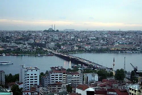 Atatürk Bridge Landmark, Turkey1.4 km E
Sources & licences
Data last updated: · 2 independent sources