Uskumruköy
Located in Sarıyer, Istanbul Coordinates: 41°13′13″ N 29°01′24″ E
- Population
- 9,864
- 9.9K
- Elevation
- 53 m
- above sea level
- Local time
- UTC+03:00
- Europe/Istanbul · UTC+03:00
About Uskumruköy
Uskumruköy is a town. Location: Sarıyer, Istanbul. Population: 9,864. Elevation: 53 m.
Uskumruköy (literally mackerel village) is a neighbourhood in the municipality and district of Sarıyer, Istanbul Province, Turkey. Its population is 9,864 (2022). It is situated to the north of Belgrad Forest which is one of the most popular excursion areas of Istanbul citizens. It is 8 km (5 mi) west of Sarıyer centre and a suburb of Greater Istanbul. Uskumruköy is an old village and the ruins of an observation tower around the village was probably built by Republic of Genoa in the Middle Ages.
Read more on Wikipedia Text: Wikipedia contributors · CC BY-SA 4.0 · shortened
At a glance
- Area
- 16.8 km²
Source: Wikidata
In comparison
- No. 7 of 14 places in Sarıyer by population
- Nearest larger town: Zekeriya, 3 km S
- 15 sights and natural places within 10 km Kartal Tepesi, Kısırkaya
Nearby attractions & nature
Everything nearby-
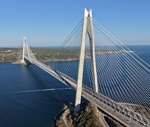 Yavuz Sultan Selim Bridge Landmark, Sarıyer7.6 km E
-
Kartal Tepesi Mountain, Sarıyer5 km W
-
Bosporus Powerline Crossing 3, Pylon West Landmark, Sarıyer6.2 km SE
-
Bosporus Powerline Crossing 2, Pylon West Landmark, Sarıyer6.2 km SE
-
Kısırkaya River, Istanbul5 km NW
-
Eski Bağlar River, Istanbul5.3 km SW
-
Arabacı Mandırası River, Istanbul5.3 km SW
-
Kısırka Village Beach, Istanbul5.5 km NW
Sources & licences
Data last updated: · 2 independent sources