Çıfıtkalesi Adası
Located in İzmir Province, Turkey Coordinates: 38°02′46″ N 26°51′19″ E
- Elevation
- 18 m
- above sea level
- Local time
- UTC+03:00
- Europe/Istanbul · UTC+03:00
About Çıfıtkalesi Adası
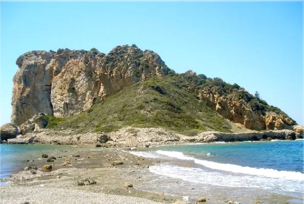
Çıfıtkalesi Adası is an island. Location: İzmir Province, Turkey.
Çıfıtkalesi Islet (literally "Jewish Castle Island") is an uninhabited Aegean islet in Turkey. The islet is administratively a part of Seferihisar ilçe (district) of İzmir Province. It is very close to mainland (Anatolia); the closest point to mainland is less than 100 metres (330 ft). The longest dimension of the islet is about 250 metres (820 ft). In antiquity the islet was connected to the mainland and was called Myonessus (Ancient Greek: Μυόννησος, meaning mouse island).
Read more on Wikipedia Text: Wikipedia contributors · CC BY-SA 4.0 · shortened
In comparison
- 5 sights and natural places within 10 km Bölme Adası, Doğanbey Adası
Nearest towns and villages
-
Cumhuriyet Village, Seferihisar District6.4 km NE
-
Doğanbey Village, Seferihisar District4.6 km N
-
Tepecik Village, Seferihisar District9.8 km N
-
Payamlı Village, Seferihisar District10 km NE
-
Karakoç Ilıcası Village, Seferihisar District6.6 km NE
-
Seferihisar City, Seferihisar District17 km N
Nearby attractions & nature
Everything nearby-
Bölme Adası Island, İzmir Province2 km SE
-
Doğanbey Adası Island, İzmir Province3.6 km SE
-
Kızılcadağı Tepesi Mountain, Seferihisar District7.6 km N
-
Palamo Island Island, İzmir Province9 km N
-
Doğanbey Limanı Natural site, İzmir Province9.8 km E
-
Kocaçay Deresi River, İzmir Province11 km NE
-
Sıçancık Deresi River, İzmir Province11 km NE
-
Çiçek Adası Island, İzmir Province14 km N
Sources & licences
Data last updated: · 2 independent sources