Kilis Province
Local name: Kilis ili
Located in Turkey Coordinates: 36°43′48″ N 37°08′24″ E
- Population
- 147,919
- 147.9K
- Elevation
- 693 m
- above sea level
- Local time
- UTC+03:00
- Europe/Istanbul · UTC+03:00
- Places inside
- 73
- listed under Kilis Province
About Kilis Province
Kilis Province is a region. Location: Turkey. Population: 147,919.
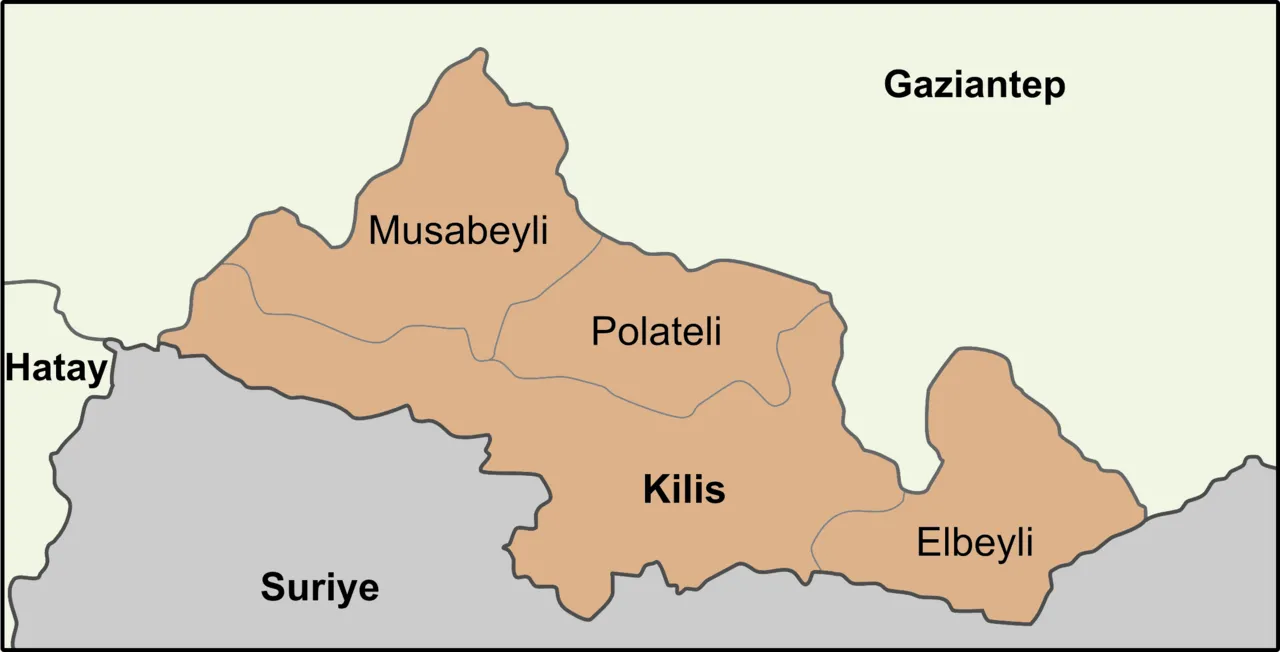
Kilis Province (Turkish: Kilis ili) is a province in southern Turkey, on the border with Syria. Its area is 1,412 km2, and its population is 147,919 (2022). The province was created in 1995 from the southern part of Gaziantep Province. The city of Kilis is home to over 75% of the inhabitants of the province; the other towns and villages are very small.
Read more on Wikipedia Text: Wikipedia contributors · CC BY-SA 4.0 · shortened
At a glance
- Area
- 1,412 km²
Source: Wikidata
In comparison
- 32 sights and natural places within 10 km Resülosman Dağı, Kalecik Tepesi
- Listed here: Natural site: 28, River: 28, Mountain: 5, District: 4
Places in Kilis Province
73 places-
Pancarlı Village
-
Polateli Bucağı Municipality
-
Ressey Pınarı Natural site
-
Sabunsuyu Dere River
-
Şakban Dere River
-
Sarıgol Kaynağı Natural site
-
Sinnep Deresi River
-
Sinnep Pınarı Natural site
-
Sinnep Suyu River
-
Südüklü kuyu Deresi River
-
Uzunlu Dere River
-
Yedi Pınar Natural site
-
Zaratta Deresi River
Largest cities and towns
Nature and heritage in Kilis Province
-
Yarımdağ Tepe Mountain, Polateli İlçesi
-
Hayberi Dağı Mountain, Polateli İlçesi
-
Gülbahar Tepe Mountain, Kilis Merkez
-
Bağıta Dağı Mountain, Elbeyli İlçesi
-
Acar Dağı Mountain, Kilis Merkez
-
Çangallıziyaret Tepesi Mountain, Elbeyli İlçesi
Other regions in Turkey
-
 Gaziantep Province Region, Turkey43 km NE
-
 Osmaniye Province Region, Turkey97 km NW
-
Hatay Province Region, Turkey84 km W
-
Kilis Merkez District, Kilis Province2.2 km SW
-
Polateli İlçesi District, Kilis Province12 km N
-
Musabeyli İlçesi District, Kilis Province25 km NW
Sources & licences
Data last updated: · 2 independent sources