Kırklareli Province
Local name: Kirklareli ili
Located in Turkey Coordinates: 41°40′00″ N 27°30′00″ E
- Population
- 379,031
- 379K
- Elevation
- 270 m
- above sea level
- Local time
- UTC+03:00
- Europe/Istanbul · UTC+03:00
- Places inside
- 105
- listed under Kırklareli Province
About Kırklareli Province
Kırklareli Province is a region. Location: Turkey. Population: 379,031.
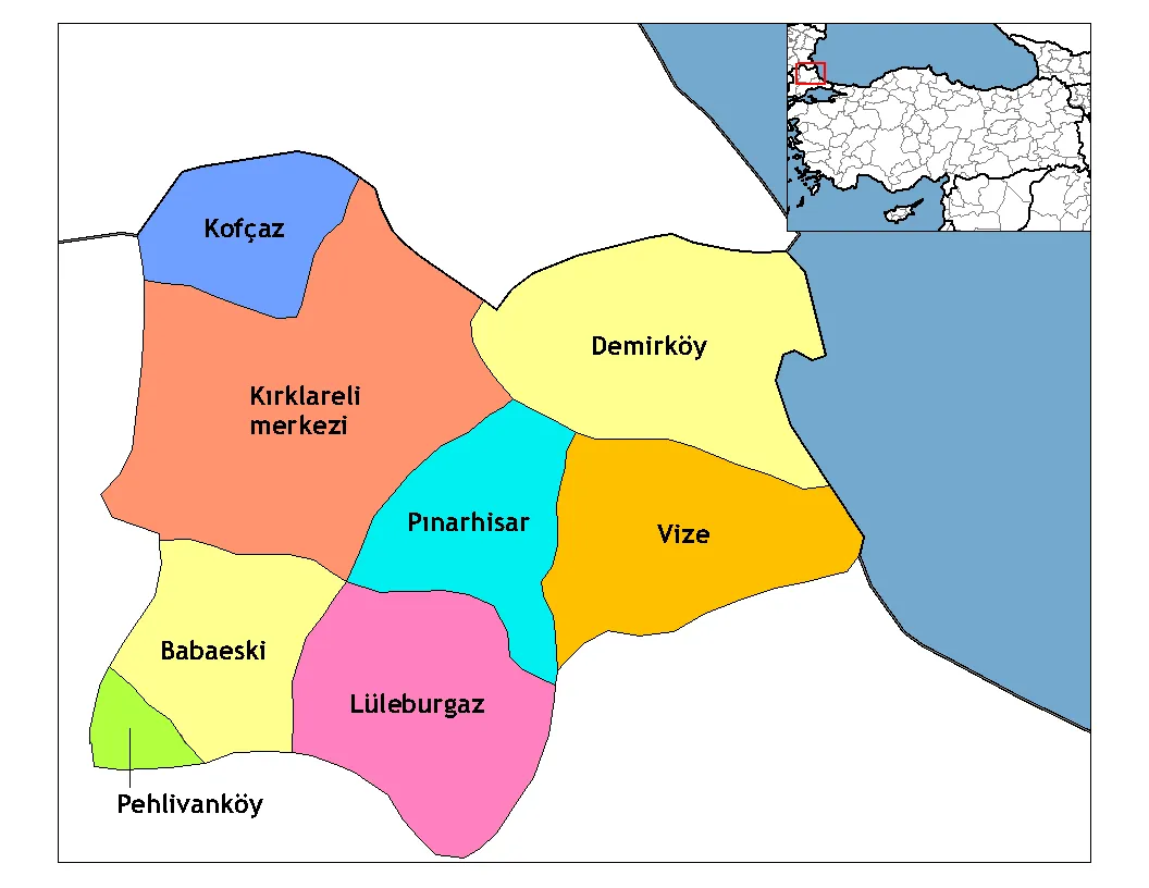
Kırklareli Province (Turkish: Kırklareli ili) is a province in northwestern Turkey on the west coast of the Black Sea. The province neighbours Bulgaria to the north along a 180-kilometre (110 mi) long border. It borders the province of Edirne to the west, the province of Tekirdağ to the south, and the province of Istanbul to the southeast. Kırklareli is the capital city of the province. Its area is 6,459 km2, and its population is 369,347 (2022).
Read more on Wikipedia Text: Wikipedia contributors · CC BY-SA 4.0 · shortened
At a glance
- Area
- 6,550 km²
Source: Wikidata
In comparison
- 3 sights and natural places within 10 km Kurt Deresi, Bağlar Tepesi
- Listed here: River: 73, Municipality: 16, District: 8, Lake: 4
Places in Kırklareli Province
105 places-
Lüleburgaz İlçesi District138.8K
-
Babaeski İlçesi District50K
-
Vize İlçesi District27.9K
-
Pınarhisar İlçesi District19K
-
Demirköy İlçesi District8.5K
-
Pehlivanköy İlçesi District4.1K
-
Kofçaz İlçesi District2.7K
-
Ahmetbey Deresi River
-
Akan Dere River
-
Akdere River
-
Aksu Deresi River
-
Babaeski Bucağı Municipality
-
Babaeski Deresi River
-
Bağlık Dere River
-
Bahçeköy Village
-
Balaban Deresi River
-
Beypınar Çeşmesi Natural site
-
Birinci Dere River
-
Bulanık Dere River
-
Büyük Dere River
-
Büyük Dere River
-
Büyük Dere River
-
Büyük Dere River
-
Büyükkarıştıran Bucaçğı Municipality
-
Çatal Deresi River
-
Çavdar Deresi River
-
Çavdar Deresi River
-
Çavuş Deresi River
-
Çilingier Deresi River
-
Çimenli Dere River
-
Değirmen Dere River
-
Demirköy Bucağı Municipality
-
Dereköy Bucaçğı Municipality
-
Dikenler Deresi River
-
Dolap Dere River
-
Dolhan Dere River
-
Efendi Dere River
-
Eğri Dere River
-
Emirali Deresi River
-
Erikleryurdu Deresi River
-
Fındıklı Dere River
-
Gökçesu Deresi River
-
Gürgen Dere River
-
Hamam Dere River
-
Hamam Deresi River
-
Hamam Deresi River
-
Hamam Gölü Lake
-
Havsa Deresi River
-
Höyük Deresi River
-
İğneada Bucaçğı Municipality
-
İnece Bucaçğı Municipality
-
İnece Deresi River
-
Karacaoğlan Bucaçğı Municipality
-
Kavak Dere River
-
Kavala Deresi River
-
Kaynarca Çeşmesi Natural site
-
Kaynarca Deresi River
-
Kaynarlı Dere River
-
Kazan Deresi River
-
Kirklareli District
Largest cities and towns
-
Kırklareli City, Kirklareli58.2K
-
Lüleburgaz City, Lüleburgaz İlçesi90.9K
-
Babaeski City, Babaeski İlçesi26.7K
-
Kıyıköy Village, Vize İlçesi2.4K
-
Pınarhisar City, Pınarhisar İlçesi11.2K
-
Üsküp Village, Kirklareli2.3K
-
Sakızköy Village, Lüleburgaz İlçesi1.3K
-
Vize City, Vize İlçesi11K
Nature and heritage in Kırklareli Province
-
Kocataş Tepesi Mountain, Kirklareli
-
Macora Kulesi Mountain, Demirköy İlçesi
-
Kartal Tepesi Mountain, Kirklareli
-
Çavuş Tepesi Mountain, Kofçaz İlçesi
-
Bekçi Tepesi Mountain, Kofçaz İlçesi
-
Büyükbezirgan Tepesi Mountain, Demirköy İlçesi
Other regions in Turkey
-
Tekirdağ Province Region, Turkey74 km S
-
 Edirne Province Region, Turkey84 km SW
-
Saray İlçesi District, Tekirdağ Province43 km SE
-
Kapaklı District, Tekirdağ Province54 km SE
-
Çorlu District, Tekirdağ Province64 km SE
-
Ergene District, Tekirdağ Province57 km SE
Sources & licences
Data last updated: · 2 independent sources