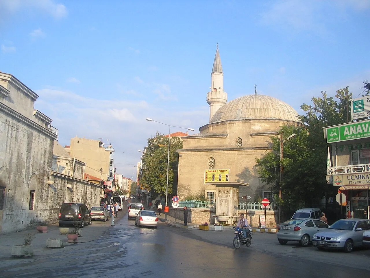
- Population
- 58,223
- 58.2K
- Elevation
- 215 m
- above sea level
- Local time
- UTC+03:00
- Europe/Istanbul · UTC+03:00
- Airports
- TEQ Tekirdağ Çorlu Airport88 km
- BOJ Burgas Airport96 km
About Kırklareli
Kırklareli is a city. Location: Kirklareli, Kırklareli Province. Population: 58,223. Elevation: 215 m.
Kırklareli (Turkish pronunciation: [kɯɾkˈɫaɾeli]) is a city in the European part of Turkey. It is the seat of Kırklareli Province and Kırklareli District. Its population is 85,493 (2022).
Source: Wikipedia · CC BY-SA 4.0
Photos of Kırklareli
-

Alicembasli · CC BY 4.0 -

Hamdigumus · CC0 -

Hamdigumus · CC0


Travel notes for Kırklareli
From Wikivoyage
Kırklareli is a city in Eastern Thrace, the northwestern part of Turkey, near the border with Bulgaria. In 2021 the population was estimated as 58,223. It's industrial and doesn't have much in the way of tourist sights, but as the provincial capital Kırklareli has many business travellers and is well supplied with hotels and other amenities.
Understand+
This area is close to the border and historically had many Bulgarians (who called it Lozengrad, Лозенград, "Vineyard Town") and Greeks (who called it Sarànta Ekklisiès, Σαράντα Εκκλησιές, "forty churches", rendered into Turkish as "Kırk Kilise"). It was fought over and had spells of occupation by both, the latest by the Bulgarians in 1912 and by Greece after 1918. The 1923 Treaty of Lausanne drew the present border and mandated population exchanges, so those others were deported while Turks from around Thessaloniki were re-settled across Turkish Thrace. It obviously no longer needed forty churches and the name mutated into Kırklareli, "Forties Place". That name had also been used from 1363 when 40 assault troops of Sultan Murad I died in taking the town: Thrace was the Ottoman power base for a century before they captured Constantinople.
The town became a provincial capital after independence. It's in the Istranca foothills and has developed industry but is far enough out to escape the metropolitan sprawl of Istanbul. The principal industries of the province are based on food, textiles, plastic and packaging, metal-working, casting, cement and glass.
Get in+
Kale Seyahat ("Castle Travel") buses run hourly from Istanbul Bayrampaşa, taking 3 hours 30 min via Saray and Vize, for an adult fare of 100 TL.
The 1 bus station is in town centre.
By road from Istanbul city follow O-3 / E80, and from IST airport follow O-7 till it joins O-3. Quickest is to stay on that until branching north on E87; a slower but shorter route is by D567 onto D020 through Saray and Vize.
From west Europe cross the border at Kapikule then head east on E80 to the junction with D020. But from the Bulgarian coast cross at Dereköy and follow E87 south.
Kırklareli lost its railway service in 1992. The nearest station is Edirne.
Source: Wikivoyage · CC BY-SA 4.0 · abridged
Population of Kırklareli over time
| 1970 | 27,431 | |
|---|---|---|
| 1980 | 36,296 | |
| 1990 | 43,017 | |
| 2000 | 53,221 | |
| 2008 | 61,880 | |
| 2015 | 73,517 | |
| 2018 | 79,093 | |
| 2020 | 79,884 |
Censuses and official estimates; source: Wikidata.
Climate of Kırklareli
Best months for sightseeingBest months for sightseeing: May, September.
This month · November
Outside the best season
Day 13° · Night 6° · Rain 73 mm
- Hottest month
- July (day 30°)
- Coldest month
- January (night 0°)
- Wettest month
- November (73 mm)
- Driest month
- August (25 mm)
Bars: average monthly low and high temperature. Below: precipitation. Monthly averages for 1970–2000 at about 18 km resolution, adjusted for elevation. Highlighted months are mild and relatively dry. Source: WorldClim 2.1 (CC BY 4.0).
Show values as a table
| Month | Jan | Feb | Mar | Apr | May | Jun | Jul | Aug | Sep | Oct | Nov | Dec |
|---|---|---|---|---|---|---|---|---|---|---|---|---|
| Average high (°C) | 7° | 8° | 12° | 18° | 23° | 28° | 30° | 30° | 26° | 19° | 13° | 9° |
| Average low (°C) | 0° | 1° | 3° | 7° | 11° | 15° | 17° | 17° | 14° | 9° | 6° | 2° |
| Precipitation (mm) | 61 | 53 | 54 | 51 | 50 | 49 | 26 | 25 | 30 | 51 | 73 | 73 |
How to get to Kırklareli
The nearest airport is Tekirdağ Çorlu Airport (TEQ), 88 km to the southeast as the crow flies. For international flights: Burgas Airport (BOJ) (96 km). The nearest large city is Edirne, 56 km to the west.
Airports
- Tekirdağ Çorlu Airport (TEQ) Çorlu 88 kmsoutheast
- Burgas Airport (BOJ) Burgas 96 kmnorth
- İstanbul Airport (IST) Istanbul 136 kmeast
Nearby large cities
- Edirne Population: 180K 56 kmwest
- Çorlu Population: 202.6K 80 kmsoutheast
- Tekirdağ Population: 122.3K 87 kmsouth
- Burgas Population: 210.6K 88 kmnorth
- Büyükçekmece Population: 163.1K 139 kmsoutheast
Straight-line distances; road distances are longer. Airport data: OurAirports.
Day trips from Kırklareli
Within 100 km: 74 historic and cultural sites, 124 natural sites, 194 lakes, rivers and coasts.
0–25 km31 places
- Yaprak Tepesi Mountain 20 kmE
- Tuzlakaya Tepesi Mountain 21 kmN
- Maraşal Tepesi Mountain 7 kmNW
- Kıtlık Tepe Mountain 24 kmN
25–60 km208 places
- Pedina Gölü Lake 60 kmE
- Koca Göl Lake 49 kmS
- Büyükkarakarlı Göleti Lake 52 kmS
- Sinit Gölü Lake 37 kmSW
60–100 km153 places
- Mert Gölü Lake 64 kmE
- Hamam Gölü Lake 62 kmE
- Sinekli Gölü Lake 98 kmSE
- Sakpınar Gölü Lake 64 kmE
Straight-line distances.
Kırklareli and similar cities
Side by side with cities of similar size in the same country: population, elevation and climate.
| Measure | Kırklareli | Patnos | Anamur | Reyhanlı |
|---|---|---|---|---|
| Population | 58.2K | 57.9K | 57.1K | 57K |
| Elevation | 215 m | 1,630 m | 28 m | 153 m |
| Summer day (hottest month) | 30° | 30° | 34° | 35° |
| Winter night (coldest month) | 0° | -11° | 7° | 5° |
| Annual rainfall | 596 mm | 522 mm | 691 mm | 634 mm |
| Best months | May, Sep | Jun, Sep | Apr–May, Nov | Apr, Nov |
| Distance | — | 1,352 km | 794 km | 1,011 km |
Climate values are 1970–2000 monthly averages; straight-line distance.
Nearby attractions & nature
Everything nearby-
Sırtgöl Tepesi Mountain, Kirklareli5.3 km SW
-
Maraşal Tepesi Mountain, Kirklareli7.2 km NW
-
Kocataş Tepesi Mountain, Kirklareli11 km NW
-
Demirkapu Tepesi Mountain, Kirklareli12 km N
-
Bağ Tepesi Mountain, Kirklareli20 km NW
-
Kayrak Tepesi Mountain, Kirklareli14 km W
-
Yal Tepe Mountain, Kirklareli24 km NE
-
Kabak Tepe Mountain, Kofçaz İlçesi20 km N
Sources & licences
Data last updated: · 2 independent sources