
- Population
- 1,742
- 1.7K
- Elevation
- 9 m
- above sea level
- Local time
- UTC+03:00
- Europe/Istanbul · UTC+03:00
- Airports
- COV Çukurova International Airport96 km
- ECN Ercan International Airport156 km
About Kızkalesi
Kızkalesi is a village. Location: Erdemli İlçesi, Mersin Province. Population: 1,742. Elevation: 9 m.
Kızkalesi (English: Maiden's castle) is a neighbourhood in the municipality and district of Erdemli, Mersin Province, Turkey. Its population is 1,781 (2022). Before the 2013 reorganisation, it was a town (belde). The town, known in Antiquity as Corycus or Korykos (Greek: Κώρυκος), is named after the ancient castle built on a small island just facing the town.
Source: Wikipedia · CC BY-SA 4.0
Photos of Kızkalesi
-

Dosseman · CC BY-SA 4.0 -

Dosseman · CC BY-SA 4.0 -

YG01 · CC BY 4.0 -

Seyfettin33 · CC BY-SA 4.0 -

Wikimedia Commons · Public domain


Climate of Kızkalesi
Best months for sightseeingBest months for sightseeing: April–May, November.
This month · November
A good month to visit
Day 22° · Night 12° · Rain 80 mm
- Hottest month
- August (day 33°)
- Coldest month
- January (night 7°)
- Wettest month
- December (143 mm)
- Driest month
- August (2 mm)
Bars: average monthly low and high temperature. Below: precipitation. Monthly averages for 1970–2000 at about 18 km resolution, adjusted for elevation. Highlighted months are mild and relatively dry. Source: WorldClim 2.1 (CC BY 4.0).
Show values as a table
| Month | Jan | Feb | Mar | Apr | May | Jun | Jul | Aug | Sep | Oct | Nov | Dec |
|---|---|---|---|---|---|---|---|---|---|---|---|---|
| Average high (°C) | 15° | 16° | 19° | 23° | 27° | 30° | 33° | 33° | 32° | 28° | 22° | 16° |
| Average low (°C) | 7° | 7° | 9° | 13° | 17° | 21° | 24° | 24° | 21° | 17° | 12° | 8° |
| Precipitation (mm) | 126 | 94 | 68 | 37 | 27 | 11 | 7 | 2 | 8 | 47 | 80 | 143 |
How to get to Kızkalesi
The nearest airport is Çukurova International Airport (COV), 96 km to the northeast as the crow flies. The nearest large city is Silifke, 21 km to the southwest.
Airports
- Çukurova International Airport (COV) Tarsus 96 kmnortheast
- Ercan International Airport (ECN) Tymbou (Kirklar) 156 kmsouth
- Gazipaşa-Alanya Airport (GZP) Gazipaşa 167 kmwest
Nearby large cities
- Silifke Population: 132.7K 21 kmsouthwest
- Mersin Population: 537.8K 59 kmnortheast
- Tarsus Population: 350.7K 84 kmnortheast
- Karaman Population: 175.4K 115 kmnorthwest
- Heraclea Population: 156.3K 117 kmnorth
Straight-line distances; road distances are longer. Airport data: OurAirports.
Day trips from Kızkalesi
Within 100 km: 63 historic and cultural sites, 689 natural sites, 149 lakes, rivers and coasts.
0–25 km27 places
- Paradeniz Gölü Lake 23 kmSW
- Ak Göl Lake 25 kmSW
- Sandal Dağı Mountain 16 kmN
- Çamlı Tepe Mountain 17 kmW
25–60 km190 places
- Ovacık Adası Island 53 kmSW
- Dana Adası Island 45 kmSW
- Boğsak Adası Island 36 kmSW
- Ziyaret Tepesi Mountain 51 kmNW
60–100 km684 places
- Nisídes Kordýlia Island 94 kmS
- Nisída Gláros Island 93 kmS
- Nisída Lefkónisos Island 94 kmS
- Nisídes Skaloúdia Island 100 kmS
Straight-line distances.
Nearby attractions & nature
Everything nearby-
Karayağdı Deresi River, Mersin Province0.1 km NW
-
Kız Kalesi Historic site, Mersin Province0.8 km SE
-
Akkum Limanı Natural site, Mersin Province0.8 km SW
-
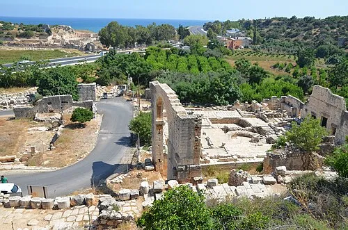 Elaiussa Sebaste Historic site, Erdemli İlçesi3.7 km NE
-
Küçük Kale Historic site, Erdemli İlçesi2.9 km N
-
Karaçay Deresi River, Mersin Province3.1 km NE
Sources & licences
Data last updated: · 2 independent sources