Alay
Located in Nigde, Niğde Province Coordinates: 38°15′23″ N 34°42′10″ E
- Elevation
- 1,304 m
- above sea level
- Local time
- UTC+03:00
- Europe/Istanbul · UTC+03:00
About Alay
Alay is a village. Location: Nigde, Niğde Province. Elevation: 1,304 m.
Alay is a town (belde) in the Niğde District, Niğde Province, Turkey. Its population is 3,038 (2022). It is situated 42 kilometres (26 mi) north of Niğde. The town may be very old. According to Mayor's page it was named after İsmail Bahri Mahmut, a commander of a regiment (Turkish: Alay). The settlement was declared a seat of township in 1988. The main crops of the town are potato and wheat.
Read more on Wikipedia Text: Wikipedia contributors · CC BY-SA 4.0 · shortened
In comparison
Nearby attractions & nature
Everything nearby-
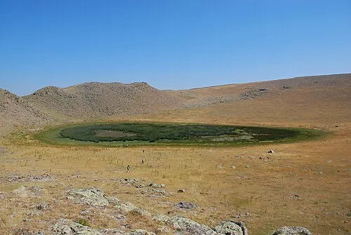 Göllü Dağ Mountain, Nigde12 km W
-
Uluyol Sarnıcı Lake, Niğde Province6.8 km W
-
Kara Tepe Mountain, Nigde11 km SE
-
Gellek Tepesi Mountain, Nigde20 km S
-
Tapır Tepesi Mountain, Nigde11 km NE
-
Boz Tepe Mountain, Çiftlik District12 km W
Sources & licences
Data last updated: · 2 independent sources