- Elevation
- 49 m
- above sea level
- Local time
- UTC+03:00
- Europe/Istanbul · UTC+03:00
- Airports
- KCM Kahramanmaraş Airport86 km
- COV Çukurova International Airport96 km
About Yalnızdut
Yalnızdut is a village. Location: Kadirli İlçesi, Osmaniye Province. Elevation: 49 m. The best months to visit are April, November. The nearest airport is Kahramanmaraş Airport (86 km). Nearby sights include Savrun Çayı and Gökçe Dağ.
Climate of Yalnızdut
Best months for sightseeingBest months for sightseeing: April, November.
This month · November
A good month to visit
Day 22° · Night 11° · Rain 74 mm
- Hottest month
- August (day 35°)
- Coldest month
- January (night 6°)
- Wettest month
- December (124 mm)
- Driest month
- July (13 mm)
Bars: average monthly low and high temperature. Below: precipitation. Monthly averages for 1970–2000 at about 18 km resolution, adjusted for elevation. Highlighted months are mild and relatively dry. Source: WorldClim 2.1 (CC BY 4.0).
Show values as a table
| Month | Jan | Feb | Mar | Apr | May | Jun | Jul | Aug | Sep | Oct | Nov | Dec |
|---|---|---|---|---|---|---|---|---|---|---|---|---|
| Average high (°C) | 15° | 16° | 19° | 24° | 28° | 32° | 35° | 35° | 34° | 29° | 22° | 16° |
| Average low (°C) | 6° | 7° | 9° | 13° | 16° | 20° | 23° | 24° | 21° | 16° | 11° | 7° |
| Precipitation (mm) | 110 | 95 | 96 | 85 | 66 | 32 | 13 | 14 | 24 | 64 | 74 | 124 |
How to get to Yalnızdut
The nearest airport is Kahramanmaraş Airport (KCM), 86 km to the east as the crow flies. For international flights: Çukurova International Airport (COV) (96 km). The nearest large city is Osmaniye, 29 km to the southeast.
Airports
- Kahramanmaraş Airport (KCM) Kahramanmaraş 86 kmeast
- Çukurova International Airport (COV) Tarsus 96 kmsouthwest
- Hatay Airport (HTY) Antakya 104 kmsouth
Nearby large cities
- Osmaniye Population: 202.8K 29 kmsoutheast
- Adana Population: 1.8M 71 kmsouthwest
- İskenderun Population: 251.7K 77 kmsouth
- Kahramanmaraş Population: 385K 86 kmnortheast
- Arsuz Population: 109.6K 97 kmsouth
Straight-line distances; road distances are longer. Airport data: OurAirports.
Day trips from Yalnızdut
Within 100 km: 36 historic and cultural sites, 467 natural sites, 258 lakes, rivers and coasts.
0–25 km27 places
- Karatepe Aslantaşı Milli Parkı Natural site 19 kmE
- Kara Tepe Mountain 16 kmE
- Gökçe Dağ Mountain 9 kmSE
- Domuzlu Tepe Mountain 15 kmNE
25–60 km213 places
- Yağızlar Göleti Lake 45 kmW
- Arıklıkaş Göleti Lake 44 kmE
- Fevzipaşa Gölü Lake 55 kmE
- Ziyaret Tepesi Mountain 27 kmSE
60–100 km521 places
- Küçük Ada Island 96 kmSW
- Nergizi Adasi Island 88 kmSW
- Ömer Gölü Island 70 kmSW
- Yapı Gölü Lake 75 kmSW
Straight-line distances.
Nearby attractions & nature
Everything nearby-
Savrun Çayı River, Osmaniye Province4.1 km SW
-
Gökçe Dağ Mountain, Osmaniye9.2 km SE
-
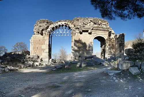 Anazarbus Historic site, Kozan12 km W
-
Kara Tepe Mountain, Kadirli İlçesi16 km E
-
Anavarza Tepesi Mountain, Ceyhan13 km W
-
Andvorza Harabesi Historic site, Kozan14 km W
Sources & licences
Data last updated: