- Population
- 202,837
- 202.8K
- Elevation
- 128 m
- above sea level
- Local time
- UTC+03:00
- Europe/Istanbul · UTC+03:00
- Airports
- HTY Hatay Airport79 km
- KCM Kahramanmaraş Airport81 km
About Osmaniye
Osmaniye is a city. Location: Osmaniye, Osmaniye Province. Population: 202,837. Elevation: 128 m.
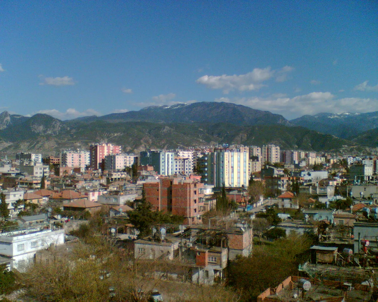
Osmaniye (pronounced [osˈmaːnije]) is a city on the eastern edge of the Çukurova plain in southern Turkey. It is the seat of Osmaniye Province and Osmaniye District. Its population is 252,186 (2022). Backed by the foothills of the Nur Mountains, Osmaniye lay on one of the old Silk Roads and was always a place of strategic importance since it straddled the main route between Anatolia and the Middle East.
Source: Wikipedia · CC BY-SA 4.0
Photos of Osmaniye
-

Fatih Renkligil · CC BY-SA 4.0 -

Fatih Renkligil · CC BY-SA 4.0 -

Fatih Renkligil · CC BY-SA 4.0 -

Fatih Renkligil · CC BY-SA 4.0 -

Fatih Renkligil · CC BY-SA 4.0


Travel notes for Osmaniye
From Wikivoyage
Osmaniye is a city in the Cilician Plains of Turkey, with a population of 252,000 in 2022. The city has few visitor attractions but it serves as a good base to explore outlying sites in the countryside.
Understand+
Osmaniye is in the southeast corner of the Cilician Plains, at the foot of the Nur Mountains. In the 12th century BC, after the collapse of the Hittite Empire, the area came under the rule of several polities collectively named "Neo-Hittites". In the Middle Ages, it was the seat of the Armenian Kingdom of Cilicia, allies of the Crusaders, who established numerous castles. Turkish nomads arrived in the 11th century, and because the summers here are so hot and mosquito-ridden they moved seasonally between the mountains and plains. A market town grew hereabouts, named Kınık after one of the nomadic tribes.
In the 1860s the American Civil War disrupted the global supply of cotton. The Cilician Plains were ideal for growing cotton but lacked a workforce, so willy-nilly the nomads were forced into a settled agricultural lifestyle. As a bonus, this also curbed their incessant rebellions. Kınık grew and was renamed Osmaniye, lest it slip anyone's mind which dynasty ruled Turkey. Since 1996 the city has been capital of a large province.
Irrigation projects further east in Turkey drew cotton production away, so it's no longer as important for this region, which has switched to other crops such as peanuts and olives.
Get in+
By plane:
The most convenient airport is Çukurova (COV IATA) 130 km west, with frequent flights from Istanbul (both IST and SAW), and daily from Ankara, Izmir, other Turkish cities and Ercan in Northern Cyprus. In 2024 COV replaced Adana airport, which has closed.
Others are Kahramanmaraş (KCM IATA) 112 km northeast, Gaziantep (GZT IATA) 160 km east, and Hatay (HTY IATA) 116 km south.
By train:
All trains are suspended because of major engineering works in southeast Turkey.
A partial re-opening is expected in 2026 when the line to Adana, Tarsus and Mersin is rebuilt, with a spur to Çukurova airport. The larger project is a high-speed railway between Adana and Gaziantep: don't hold your breath.
Osmaniye railway station (1 km north of city centre) is therefore a very quiet place.
By bus:
Five buses a day are direct from Istanbul, taking 13-15 hours via Gebze, Izmit, Adapazari and Adana, or via Ankara. They continue to Gaziantep, another 90 min. From Ankara is 8 eight hours, with six per day.
Bus lines are Metro Turizm and Flix Bus. From places within 100 km or so such as Adana, İskenderun and Gaziantep, look for a dolmuş or shared taxi.
1 Otogar is the inter-city bus station, 4 km north of downtown by the O-52 junction. Just because it's new, don't expect any facilities to be clean or functional. You need a dolmuş to get downtown: this may be included in your fare, enquire when booking.
By road:
From Ankara take O-21 toll motorway south then O-52 / E90 east. This bypasses Osmaniye to the north, exit onto D400.
Highway D400 hugs the Mediterranean coast to Adana then strikes inland to Osmaniye, Gaziantep, Şanlıurfa and the borders with Syria, Iraq and Iran. It nowadays bypasses Osmaniye to the south while its old route traverses the city as Musa Şahin Blv.
Source: Wikivoyage · CC BY-SA 4.0 · abridged
Places bordering Osmaniye
- Toprakkale
Climate of Osmaniye
Best months for sightseeingBest months for sightseeing: April, November.
This month · November
A good month to visit
Day 21° · Night 11° · Rain 81 mm
- Hottest month
- August (day 34°)
- Coldest month
- January (night 5°)
- Wettest month
- December (133 mm)
- Driest month
- July (11 mm)
Bars: average monthly low and high temperature. Below: precipitation. Monthly averages for 1970–2000 at about 18 km resolution, adjusted for elevation. Highlighted months are mild and relatively dry. Source: WorldClim 2.1 (CC BY 4.0).
Show values as a table
| Month | Jan | Feb | Mar | Apr | May | Jun | Jul | Aug | Sep | Oct | Nov | Dec |
|---|---|---|---|---|---|---|---|---|---|---|---|---|
| Average high (°C) | 13° | 15° | 18° | 23° | 27° | 31° | 34° | 34° | 33° | 28° | 21° | 15° |
| Average low (°C) | 5° | 6° | 9° | 13° | 16° | 20° | 23° | 23° | 21° | 16° | 11° | 7° |
| Precipitation (mm) | 120 | 107 | 104 | 87 | 62 | 26 | 11 | 13 | 25 | 65 | 81 | 133 |
How to get to Osmaniye
The nearest airport is Hatay Airport (HTY), 79 km to the south as the crow flies. For international flights: Çukurova International Airport (COV) (107 km). The nearest large city is İskenderun, 54 km to the south.
Airports
- Hatay Airport (HTY) Antakya 79 kmsouth
- Kahramanmaraş Airport (KCM) Kahramanmaraş 81 kmnortheast
- Çukurova International Airport (COV) Tarsus 107 kmwest
Nearby large cities
- İskenderun Population: 251.7K 54 kmsouth
- Arsuz Population: 109.6K 80 kmsouthwest
- Adana Population: 1.8M 83 kmwest
- Kahramanmaraş Population: 385K 83 kmnortheast
- Kilis Population: 111.6K 87 kmsoutheast
Straight-line distances; road distances are longer. Airport data: OurAirports.
Day trips from Osmaniye
Within 100 km: 50 historic and cultural sites, 539 natural sites, 267 lakes, rivers and coasts.
0–25 km81 places
- Karatepe Aslantaşı Milli Parkı Natural site 25 kmN
- Ziyaret Tepesi Mountain 12 kmNE
- Kösür Dağı Mountain 12 kmE
- Kara Tepe Mountain 21 kmN
25–60 km346 places
- Örmeli Göl Lake 44 kmE
- Arıklıkaş Göleti Lake 26 kmE
- Kara Göl Lake 45 kmE
- Fevzipaşa Gölü Lake 33 kmE
60–100 km429 places
- Tell Atchana Historic site 94 kmS
- Küçük Ada Island 93 kmSW
- Nergizi Adasi Island 84 kmSW
- Ömer Gölü Island 66 kmSW
Straight-line distances.
Osmaniye and similar cities
Side by side with cities of similar size in the same country: population, elevation and climate.
| Measure | Osmaniye | Çorlu | Arnavutköy | İzmit |
|---|---|---|---|---|
| Population | 202.8K | 202.6K | 198.2K | 196.6K |
| Elevation | 128 m | 161 m | 147 m | 19 m |
| Summer day (hottest month) | 34° | 28° | 27° | 29° |
| Winter night (coldest month) | 5° | 1° | 2° | 3° |
| Annual rainfall | 834 mm | 594 mm | 711 mm | 753 mm |
| Best months | Apr, Nov | May–Oct | May–Sep | May, Sep–Oct |
| Distance | — | 859 km | 793 km | 684 km |
Climate values are 1970–2000 monthly averages; straight-line distance.
Nearby attractions & nature
Everything nearby-
Bahadır Tepe Mountain, Osmaniye5.9 km W
-
Karakaya Tepesi Mountain, Osmaniye9.7 km SE
-
Yarpuz Çayı River, Osmaniye Province5.9 km N
-
Kelibik Tepesi Mountain, Osmaniye14 km SE
-
Haçbeli Tepesi Mountain, Osmaniye11 km SE
-
Topçam Tepesi Mountain, Osmaniye15 km SE
-
Kösür Dağı Mountain, Osmaniye12 km E
-
Ziyaret Tepesi Mountain, Osmaniye12 km NE
Sources & licences
Data last updated: · 2 independent sources