Sakarya Province
Local name: Sakarya ili
Located in Turkey Coordinates: 40°45′00″ N 30°35′00″ E
- Population
- 1,080,080
- 1.1M
- Elevation
- 28 m
- above sea level
- Local time
- UTC+03:00
- Europe/Istanbul · UTC+03:00
- Places inside
- 58
- listed under Sakarya Province
About Sakarya Province
Sakarya Province is a region. Location: Turkey. Population: 1,080,080.
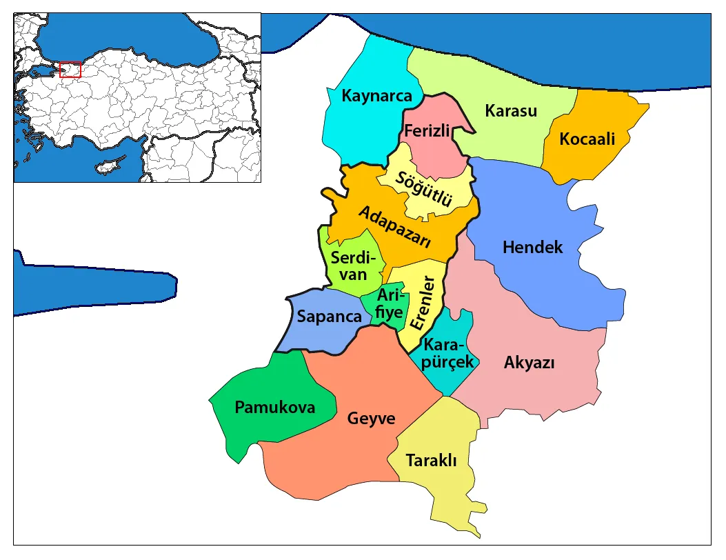
Sakarya (Turkish: Sakarya ili) is a province and metropolitan municipality in Turkey, located on the coast of the Black Sea. Its area is 4,824 km2 (1,863 sq mi), and its population is 1,110,735 (2024). The Sakarya River creates a webbing of estuaries in the province, which is in the Marmara Region. The adjacent provinces are Kocaeli to the west, Bilecik to the south, Bolu to the southeast and Düzce to the east. The capital of Sakarya is Adapazarı.
Read more on Wikipedia Text: Wikipedia contributors · CC BY-SA 4.0 · shortened
At a glance
- Area
- 4,878 km²
Source: Wikidata
In comparison
- 2 sights and natural places within 10 km Kanlıçay Deresi, Gücücek Deresi
- Listed here: River: 20, District: 16, Municipality: 16, Lake: 4
Places in Sakarya Province
58 places-
Adapazarı District259.5K
-
Serdivan District105.8K
-
Akyazı İlçesi District84.3K
-
Erenler District78.1K
-
Hendek İlçesi District76.1K
-
Karasu İlçesi District55.3K
-
Geyve İlçesi District48.2K
-
Sapanca İlçesi District39.1K
-
Arifiye District38.9K
-
Pamukova İlçesi District27.8K
-
Ferizli İlçesi District24.6K
-
Kaynarca İlçesi District23.4K
-
Kocaali İlçesi District22.7K
-
Söğütlü İlçesi District14.1K
-
Karapürçek İlçesi District12.4K
-
Taraklı İlçesi District7.1K
-
Adapazarı Bucağı Municipality
-
Akboğaz Pınarı Natural site
-
Akçay Deresi River
-
Akgöl Lake
-
Ak Göl Lake
-
Aksu Deresi River
-
Akyazı Bucağı Municipality
-
Arabacılar Deresi River
-
Bikçi Deresi River
-
Bıçkı Dere River
-
Çarksuyu Çayı River
-
Çin Deresi River
-
Doğançay Bucağı Municipality
-
Dokurcun Bucağı Municipality
-
Ferizli Bucağı Municipality
-
Geyve Bucağı Municipality
-
Gücücek Deresi River
-
Hendek Bucağı Municipality
-
Hisar Deresi River
-
İkisu Deresia River
-
Kancalar Deresi River
-
Kanlıçay Deresi River
-
Karacasu River
-
Karadere Bucağı Municipality
-
Karapürçek Bucağı Municipality
-
Kayaboğazı Deresi River
-
Kaynarca Bucağı Municipality
-
Kazımpaşa Bucağı Municipality
-
Kocaali Bucağı Municipality
-
Kunduz Deresi River
-
Kurtköy Deresi River
-
Mudurnu Çayı River
-
Ortaköy Bucağı Municipality
-
Ortapınar Çeşmesi Natural site
-
Pamukova Bucağı Municipality
-
Poyrazlar Gölü Lake
-
Sapanca Bucağı Municipality
-
Sarıcaarı Deresi River
-
Sazcı Deresi River
-
Sondere River
-
Taraklı Bucağı Municipality
-
Taşkısı Gölü Lake
Largest cities and towns
Nature and heritage in Sakarya Province
-
Güllük Tepesi Mountain, Kocaali İlçesi
-
Kel Tepe Mountain, Hendek İlçesi
-
Dikmen Tepesi Mountain, Hendek İlçesi
-
Demirli Dağı Mountain, Karasu İlçesi
-
Cumhuriyet Tepesi Mountain, Hendek İlçesi
-
Potoğlu Deresi Mountain, Karasu İlçesi
Other regions in Turkey
-
Kocaeli Province Region, Turkey59 km W
-
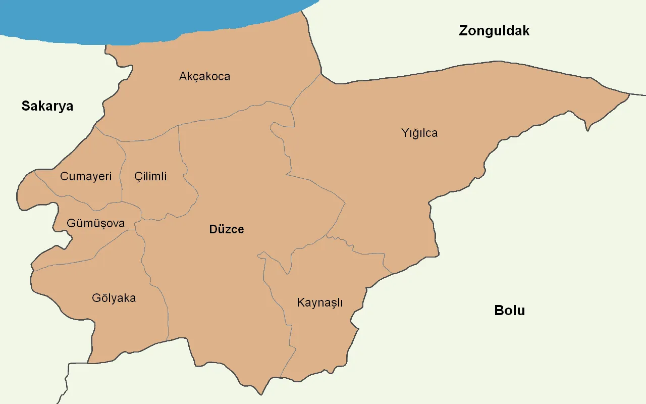 Düzce Region, Turkey50 km E
-
Gölyaka District District, Düzce36 km E
-
Kartepe District, Kocaeli Province47 km W
Sources & licences
Data last updated: · 2 independent sources